Property Record
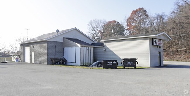
3530 Pittsburgh Rd, Perryopolis, PA 15473


NEARBY LISTINGS FOR SALE OR LEASE
Property Detail
3530 Pittsburgh Rd
28-01-0006
1.1346 AC SERV STA,JEWELRY STORE
Storebuilding
Fayette
X
Pennsylvania
42051C0157E
1.14 AC
2025
Fayette County
2025
Pittsburgh
260200
Pittsburgh, PA
2,649 SF
DEMOGRAPHICS near 3530 Pittsburgh Rd
1 mile
3 mile
5 mile
2024 Total Population
1,468
4,273
13,022
2029 Population
1,387
4,072
12,662
Pop Growth 2024-2029
(5.52%)
(4.70%)
(2.76%)
Average Age
46
46
45
2024 Total Households
649
1,834
5,557
HH Growth 2024-2029
(5.70%)
(4.85%)
(2.95%)
Median Household Inc
$47,272
$55,578
$62,565
Avg Household Size
2.30
2.30
2.30
2024 Avg HH Vehicles
2.00
2.00
2.00
Median Home Value
$175,132
$172,084
$162,207
Median Year Built
1955
1958
1959
Nearby Places
Map Layers
Map Styles
 Street
 Aerial
Transit
 Traffic
 Biking
Places
Listings with unknown addresses are not visible on the map
- Restaurants
- Banks
- Shops
- Fitness
- Groceries
PUBLIC TRANSPORTATION
AIRPORT
Arnold Palmer Regional
Drive
Walk
Distance
Arnold Palmer Regional
54 min
31.1 mi
Pittsburgh International
Drive
Walk
Distance
Pittsburgh International
74 min
45.4 mi
Nearby Properties
Address
Land Use
TOTAL SIZE
Lot Size
Zoning
Address
Land Use
TOTAL SIZE
Lot Size
Zoning
Address
Land Use
TOTAL SIZE
Lot Size
Zoning
13.34 AC
Address
Land Use
TOTAL SIZE
Lot Size
Zoning
7,962 SF
2.11 AC
Address
Land Use
TOTAL SIZE
Lot Size
Zoning
Address
Land Use
TOTAL SIZE
Lot Size
Zoning
Address
Land Use
TOTAL SIZE
Lot Size
Zoning
Address
Land Use
TOTAL SIZE
Lot Size
Zoning
9,787 SF
1.14 AC
Address
Land Use
TOTAL SIZE
Lot Size
Zoning
25.77 AC
Address
Land Use
TOTAL SIZE
Lot Size
Zoning
960 SF
12.14 AC
Address
Land Use
TOTAL SIZE
Lot Size
Zoning
14,110 SF
8.29 AC
Address
Land Use
TOTAL SIZE
Lot Size
Zoning
5,094 SF
2.31 AC
Address
Land Use
TOTAL SIZE
Lot Size
Zoning
1,260 SF
609.71 AC
Address
Land Use
TOTAL SIZE
Lot Size
Zoning
2,448 SF
249.47 AC
Address
Land Use
TOTAL SIZE
Lot Size
Zoning
1.89 AC
Address
Land Use
TOTAL SIZE
Lot Size
Zoning
Address
Land Use
TOTAL SIZE
Lot Size
Zoning
Address
Land Use
TOTAL SIZE
Lot Size
Zoning
0.98 AC
Address
Land Use
TOTAL SIZE
Lot Size
Zoning
3,386 SF
21.12 AC
Address
Land Use
TOTAL SIZE
Lot Size
Zoning
2,670 SF
8.13 AC
Address
Land Use
TOTAL SIZE
Lot Size
Zoning
2,244 SF
2.73 AC
Address
Land Use
TOTAL SIZE
Lot Size
Zoning
14,636 SF
0.78 AC
Address
Land Use
TOTAL SIZE
Lot Size
Zoning
2,454 SF
58.92 AC
Address
Land Use
TOTAL SIZE
Lot Size
Zoning
2,280 SF
16.03 AC
Address
Land Use
TOTAL SIZE
Lot Size
Zoning
20,800 SF
16.15 AC
Address
Land Use
TOTAL SIZE
Lot Size
Zoning
Address
Land Use
TOTAL SIZE
Lot Size
Zoning
3,845 SF
6.74 AC
Address
Land Use
TOTAL SIZE
Lot Size
Zoning
Address
Land Use
TOTAL SIZE
Lot Size
Zoning
7,878 SF
1.13 AC
Address
Land Use
TOTAL SIZE
Lot Size
Zoning
2,822 SF
2.20 AC
Address
Land Use
TOTAL SIZE
Lot Size
Zoning
1,032 SF
21.48 AC
The World's #1 Commercial Real Estate Marketplace
Connect with us
© 2026 CoStar Group
The information above has been obtained from sources believed reliable. While we do not doubt its accuracy we have not verified it and make no guarantee, warranty or representation about it. It is your responsibility to independently confirm its accuracy and completeness. Any projections, opinions, assumptions, or estimates used are for example only and do not represent the current or future performance of the property. The value of this transaction to you depends on tax and other factors which should be evaluated by your tax, financial, and legal advisors. You and your advisors should conduct a careful, independent investigation of the property to determine to your satisfaction the suitability of the property for your needs.