Property Record
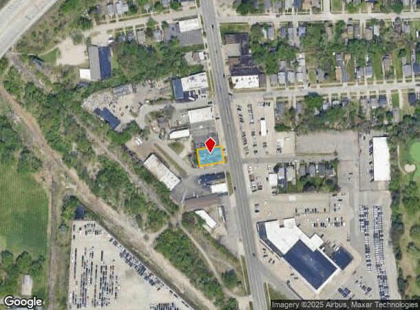
3530 S Saginaw St, Flint, MI 48503

NEARBY LISTINGS FOR SALE OR LEASE
Property Detail
3530 S Saginaw St
41-19-477-005
Pickwick Place
Commercialnec
PLAT OF PICKWICK PLACE LOTS 24 THRU 26 INCL; ALSO PART OF LOT 27 DESC AS BEG AT SE COR OF SD LOT 27; TH WLY ALG S LINE OF SD
X
Genesee
26049C0306D
Michigan
2024
0.21 AC
2025
Flint
003800
Detroit
6,515 SF
Flint, MI
DEMOGRAPHICS near 3530 S Saginaw St
1 Mile
3 Mile
5 Mile
2024 Total Population
10,590
67,214
147,940
2029 Population
10,616
66,884
148,171
Pop Growth 2024-2029
+ 0.25%
(0.49%)
+ 0.16%
Average Age
37
38
39
2024 Total Households
4,424
28,250
62,047
HH Growth 2024-2029
+ 0.20%
(0.52%)
+ 0.08%
Median Household Inc
$33,684
$37,248
$41,013
Avg Household Size
2.30
2.20
2.30
2024 Avg HH Vehicles
1.00
1.00
1.00
Median Home Value
$60,306
$76,558
$88,196
Median Year Built
1953
1958
1961
Nearby Places
Map Layers
Map Styles
 Street
 Aerial
- Restaurants
- Banks
- Shops
- Fitness
- Groceries
PUBLIC TRANSPORTATION
COMMUTER RAIL
Flint Amtrak Station (Blue Water - Amtrak)
DRIVE
WALK
Distance
Flint Amtrak Station (Blue Water - Amtrak)
7 min
3.3 mi
AIRPORT
Bishop International
DRIVE
WALK
Distance
Bishop International
22 min
9.5 mi
Freight Ports
Port of Toledo
DRIVE
WALK
Distance
Port of Toledo
136 min
113.8 mi
Nearby Properties
Address
Land Use
TOTAL SIZE
Lot Size
Zoning
Address
Land Use
TOTAL SIZE
Lot Size
Zoning
381,509 SF
371.45 AC
PC
Address
Land Use
TOTAL SIZE
Lot Size
Zoning
Address
Land Use
TOTAL SIZE
Lot Size
Zoning
911,140 SF
Address
Land Use
TOTAL SIZE
Lot Size
Zoning
130,291 SF
Address
Land Use
TOTAL SIZE
Lot Size
Zoning
227,755 SF
32.27 AC
C-2
Address
Land Use
TOTAL SIZE
Lot Size
Zoning
112,232 SF
196 AC
Address
Land Use
TOTAL SIZE
Lot Size
Zoning
354,079 SF
48.41 AC
C-4
Address
Land Use
TOTAL SIZE
Lot Size
Zoning
144,896 SF
0.23 AC
DC
Address
Land Use
TOTAL SIZE
Lot Size
Zoning
115,556 SF
2.50 AC
DE
Address
Land Use
TOTAL SIZE
Lot Size
Zoning
100,000 SF
Address
Land Use
TOTAL SIZE
Lot Size
Zoning
60,613 SF
12.91 AC
RO
Address
Land Use
TOTAL SIZE
Lot Size
Zoning
100,750 SF
Address
Land Use
TOTAL SIZE
Lot Size
Zoning
68,571 SF
0.81 AC
DC
Address
Land Use
TOTAL SIZE
Lot Size
Zoning
246,759 SF
19.03 AC
CC
Address
Land Use
TOTAL SIZE
Lot Size
Zoning
24.38 AC
RM
Address
Land Use
TOTAL SIZE
Lot Size
Zoning
49,582 SF
25.15 AC
HRM
Address
Land Use
TOTAL SIZE
Lot Size
Zoning
364,289 SF
24.80 AC
GN-1
Address
Land Use
TOTAL SIZE
Lot Size
Zoning
236,340 SF
25.17 AC
CE
Address
Land Use
TOTAL SIZE
Lot Size
Zoning
11.22 AC
RM
Address
Land Use
TOTAL SIZE
Lot Size
Zoning
10,212 SF
2.60 AC
UC
Address
Land Use
TOTAL SIZE
Lot Size
Zoning
94,280 SF
48.79 AC
Address
Land Use
TOTAL SIZE
Lot Size
Zoning
2,321 SF
18.59 AC
M-1
Address
Land Use
TOTAL SIZE
Lot Size
Zoning
2,829 SF
75.78 AC
RMH
Address
Land Use
TOTAL SIZE
Lot Size
Zoning
85,697 SF
0.30 AC
DC
Address
Land Use
TOTAL SIZE
Lot Size
Zoning
25,496 SF
5.33 AC
Address
Land Use
TOTAL SIZE
Lot Size
Zoning
79,828 SF
6.48 AC
Address
Land Use
TOTAL SIZE
Lot Size
Zoning
123,170 SF
3.41 AC
DE
Address
Land Use
TOTAL SIZE
Lot Size
Zoning
62.08 AC
MHP
Address
Land Use
TOTAL SIZE
Lot Size
Zoning
65,488 SF
0.30 AC
DC
Address
Land Use
TOTAL SIZE
Lot Size
Zoning
320,622 SF
14.93 AC
M-2
The World's #1 Commercial Real Estate Marketplace
Connect with us
© 2025 CoStar Group
The information above has been obtained from sources believed reliable. While we do not doubt its accuracy we have not verified it and make no guarantee, warranty or representation about it. It is your responsibility to independently confirm its accuracy and completeness. Any projections, opinions, assumptions, or estimates used are for example only and do not represent the current or future performance of the property. The value of this transaction to you depends on tax and other factors which should be evaluated by your tax, financial, and legal advisors. You and your advisors should conduct a careful, independent investigation of the property to determine to your satisfaction the suitability of the property for your needs.