Property Record
3534 Us Highway 87, Port Lavaca, TX 77979
NEARBY LISTINGS FOR SALE OR LEASE
-
-
-
No Photo
-
View all Port Lavaca listings for sale on LoopNet.com
Property Detail
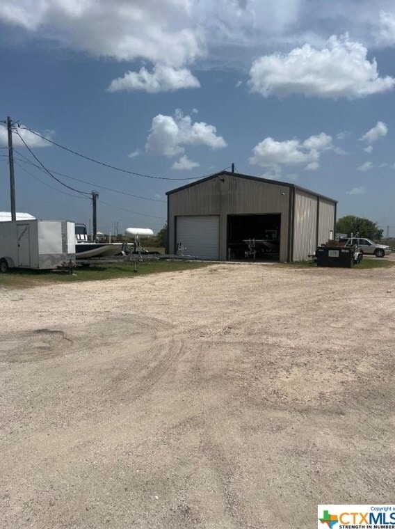
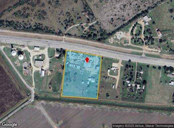
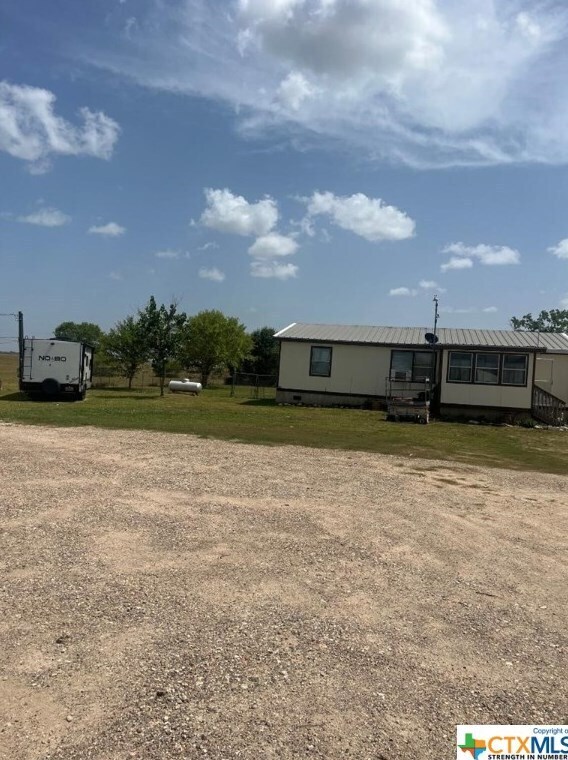
3534 Us Highway 87
14175
Westerlund S/D
Commercialnec
A0038 YSIDRO BENAVIDES, TRACT PT 20 WESTERLUND S/D, ACRES 5.46, 24X44 FLEETWOOD - GLENBROOK
X
Calhoun
48057C0185E
Texas
2025
5.46 AC
2025
Texas South Area
000401
Other Market Areas
7,384 SF
Port Lavaca, TX
DEMOGRAPHICS near 3534 Us Highway 87
1 Mile
3 Mile
5 Mile
2024 Total Population
264
11,748
14,448
2029 Population
256
11,549
14,185
Pop Growth 2024-2029
(3.03%)
(1.69%)
(1.82%)
Average Age
41
39
40
2024 Total Households
99
4,298
5,236
HH Growth 2024-2029
(2.02%)
(1.68%)
(1.81%)
Median Household Inc
$75,781
$55,978
$61,357
Avg Household Size
2.60
2.70
2.70
2024 Avg HH Vehicles
2.00
2.00
2.00
Median Home Value
$148,684
$126,253
$137,656
Median Year Built
1986
1970
1974
Nearby Places
Map Layers
Map Styles
 Street
 Aerial
- Restaurants
- Banks
- Shops
- Fitness
- Groceries
Nearby Properties
Address
Land Use
TOTAL SIZE
Lot Size
Zoning
Address
Land Use
TOTAL SIZE
Lot Size
Zoning
253,184 SF
50 AC
Address
Land Use
TOTAL SIZE
Lot Size
Zoning
93,017 SF
2.56 AC
Address
Land Use
TOTAL SIZE
Lot Size
Zoning
68,115 SF
12.89 AC
Address
Land Use
TOTAL SIZE
Lot Size
Zoning
155,202 SF
19.21 AC
Address
Land Use
TOTAL SIZE
Lot Size
Zoning
52,320 SF
1.72 AC
Address
Land Use
TOTAL SIZE
Lot Size
Zoning
35,055 SF
1.29 AC
Address
Land Use
TOTAL SIZE
Lot Size
Zoning
42,848 SF
10.79 AC
Address
Land Use
TOTAL SIZE
Lot Size
Zoning
31,564 SF
8.17 AC
Address
Land Use
TOTAL SIZE
Lot Size
Zoning
47,675 SF
12.04 AC
Address
Land Use
TOTAL SIZE
Lot Size
Zoning
44,571 SF
4.49 AC
Address
Land Use
TOTAL SIZE
Lot Size
Zoning
59,364 SF
5.70 AC
Address
Land Use
TOTAL SIZE
Lot Size
Zoning
55,070 SF
12.79 AC
Address
Land Use
TOTAL SIZE
Lot Size
Zoning
103,451 SF
10 AC
Address
Land Use
TOTAL SIZE
Lot Size
Zoning
46,204 SF
6.82 AC
Address
Land Use
TOTAL SIZE
Lot Size
Zoning
256,010 SF
18.83 AC
Address
Land Use
TOTAL SIZE
Lot Size
Zoning
114,420 SF
6 AC
Address
Land Use
TOTAL SIZE
Lot Size
Zoning
15,240 SF
10 AC
Address
Land Use
TOTAL SIZE
Lot Size
Zoning
31.63 AC
Address
Land Use
TOTAL SIZE
Lot Size
Zoning
36,204 SF
9.76 AC
Address
Land Use
TOTAL SIZE
Lot Size
Zoning
36,372 SF
7.21 AC
Address
Land Use
TOTAL SIZE
Lot Size
Zoning
123,240 SF
12.81 AC
Address
Land Use
TOTAL SIZE
Lot Size
Zoning
12,000 SF
1.07 AC
Address
Land Use
TOTAL SIZE
Lot Size
Zoning
75,889 SF
6.43 AC
Address
Land Use
TOTAL SIZE
Lot Size
Zoning
30,007 SF
1.72 AC
Address
Land Use
TOTAL SIZE
Lot Size
Zoning
22,500 SF
5 AC
Address
Land Use
TOTAL SIZE
Lot Size
Zoning
21,660 SF
3.37 AC
Address
Land Use
TOTAL SIZE
Lot Size
Zoning
42,750 SF
2.30 AC
Address
Land Use
TOTAL SIZE
Lot Size
Zoning
60,480 SF
4.85 AC
Address
Land Use
TOTAL SIZE
Lot Size
Zoning
20,320 SF
4 AC
Address
Land Use
TOTAL SIZE
Lot Size
Zoning
15,375 SF
4.07 AC
The World's #1 Commercial Real Estate Marketplace
Connect with us
© 2026 CoStar Group
The information above has been obtained from sources believed reliable. While we do not doubt its accuracy we have not verified it and make no guarantee, warranty or representation about it. It is your responsibility to independently confirm its accuracy and completeness. Any projections, opinions, assumptions, or estimates used are for example only and do not represent the current or future performance of the property. The value of this transaction to you depends on tax and other factors which should be evaluated by your tax, financial, and legal advisors. You and your advisors should conduct a careful, independent investigation of the property to determine to your satisfaction the suitability of the property for your needs.