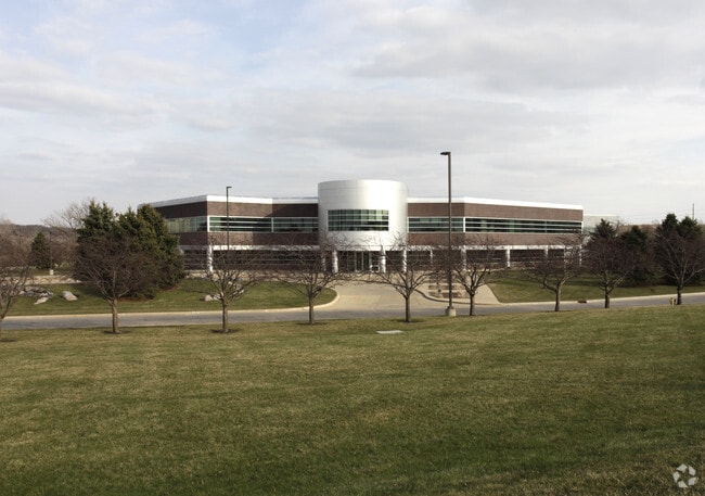
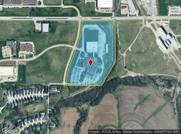
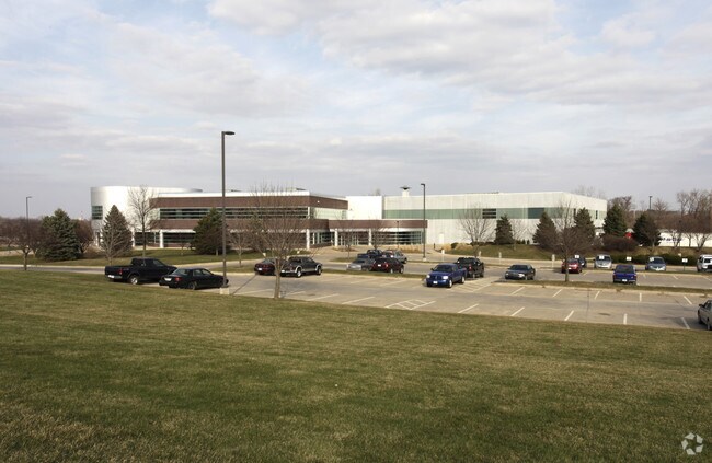
Property Record
3535 Sw 56Th St, Des Moines, IA 50321
NEARBY LISTINGS FOR SALE OR LEASE
Property Detail
3535 Sw 56Th St
Des Moines-West Des Moines, IA
Airport Commerce Park West Pl2
010/00006-035-001
LOTS 15 & 16 AIRPORT COMMERCE PARK WEST PLAT 2
Lightindustrial
Polk
X
Iowa
19153C0340F
15,16
2024
22.29 AC
2025
South
004004
Des Moines
149,564 SF
DEMOGRAPHICS near 3535 Sw 56Th St
1 Mile
3 Mile
5 Mile
2024 Total Population
3,069
37,216
176,766
2029 Population
3,254
38,769
184,526
Pop Growth 2024-2029
+ 6.03%
+ 4.17%
+ 4.39%
Average Age
36
41
38
2024 Total Households
1,283
16,896
77,180
HH Growth 2024-2029
+ 6.16%
+ 4.26%
+ 4.60%
Median Household Inc
$72,937
$70,989
$64,314
Avg Household Size
2.30
2.10
2.20
2024 Avg HH Vehicles
2.00
2.00
2.00
Median Home Value
$269,256
$255,801
$197,795
Median Year Built
1992
1968
1970
Nearby Places
Map Layers
Map Styles
 Street
 Aerial
- Restaurants
- Banks
- Shops
- Fitness
- Groceries
PUBLIC TRANSPORTATION
AIRPORT
Des Moines International
DRIVE
WALK
Distance
Des Moines International
7 min
2.7 mi
Nearby Properties
Address
Land Use
TOTAL SIZE
Lot Size
Zoning
Address
Land Use
TOTAL SIZE
Lot Size
Zoning
351,427 SF
57.41 AC
Address
Land Use
TOTAL SIZE
Lot Size
Zoning
496,782 SF
59.32 AC
Address
Land Use
TOTAL SIZE
Lot Size
Zoning
283,760 SF
27.19 AC
Address
Land Use
TOTAL SIZE
Lot Size
Zoning
283,760 SF
14.96 AC
Address
Land Use
TOTAL SIZE
Lot Size
Zoning
227,640 SF
19.48 AC
Address
Land Use
TOTAL SIZE
Lot Size
Zoning
594,010 SF
24.40 AC
R1-80
Address
Land Use
TOTAL SIZE
Lot Size
Zoning
289,527 SF
11.23 AC
PUD
Address
Land Use
TOTAL SIZE
Lot Size
Zoning
397,938 SF
27.97 AC
PUD
Address
Land Use
TOTAL SIZE
Lot Size
Zoning
302,800 SF
20.85 AC
Address
Land Use
TOTAL SIZE
Lot Size
Zoning
444,073 SF
28.05 AC
RH
Address
Land Use
TOTAL SIZE
Lot Size
Zoning
203,710 SF
26.88 AC
Address
Land Use
TOTAL SIZE
Lot Size
Zoning
298,716 SF
18.90 AC
PUD
Address
Land Use
TOTAL SIZE
Lot Size
Zoning
150,640 SF
2.46 AC
PUD
Address
Land Use
TOTAL SIZE
Lot Size
Zoning
235,620 SF
13.18 AC
RH
Address
Land Use
TOTAL SIZE
Lot Size
Zoning
526,295 SF
26.06 AC
M-1
Address
Land Use
TOTAL SIZE
Lot Size
Zoning
298,528 SF
3.79 AC
R-4
Address
Land Use
TOTAL SIZE
Lot Size
Zoning
122,676 SF
1.16 AC
Address
Land Use
TOTAL SIZE
Lot Size
Zoning
192,222 SF
9.27 AC
Address
Land Use
TOTAL SIZE
Lot Size
Zoning
189,506 SF
11.78 AC
PUD HD
Address
Land Use
TOTAL SIZE
Lot Size
Zoning
168,556 SF
10.92 AC
RH
Address
Land Use
TOTAL SIZE
Lot Size
Zoning
161,788 SF
9.41 AC
PBP
Address
Land Use
TOTAL SIZE
Lot Size
Zoning
61,320 SF
8.13 AC
Address
Land Use
TOTAL SIZE
Lot Size
Zoning
260,420 SF
18.17 AC
R-3
Address
Land Use
TOTAL SIZE
Lot Size
Zoning
264,656 SF
9.38 AC
RH
Address
Land Use
TOTAL SIZE
Lot Size
Zoning
96,860 SF
7.98 AC
R-1
Address
Land Use
TOTAL SIZE
Lot Size
Zoning
658,855 SF
47.73 AC
M-1
Address
Land Use
TOTAL SIZE
Lot Size
Zoning
75,075 SF
6.09 AC
PUD
Address
Land Use
TOTAL SIZE
Lot Size
Zoning
191,668 SF
8.27 AC
R-6
Address
Land Use
TOTAL SIZE
Lot Size
Zoning
78,390 SF
3.04 AC
R1-80
The World's #1 Commercial Real Estate Marketplace
Connect with us
© 2025 CoStar Group
The information above has been obtained from sources believed reliable. While we do not doubt its accuracy we have not verified it and make no guarantee, warranty or representation about it. It is your responsibility to independently confirm its accuracy and completeness. Any projections, opinions, assumptions, or estimates used are for example only and do not represent the current or future performance of the property. The value of this transaction to you depends on tax and other factors which should be evaluated by your tax, financial, and legal advisors. You and your advisors should conduct a careful, independent investigation of the property to determine to your satisfaction the suitability of the property for your needs.