Property Record
3535 W Pipkin Rd, Lakeland, FL 33811


NEARBY LISTINGS FOR SALE OR LEASE
Property Detail
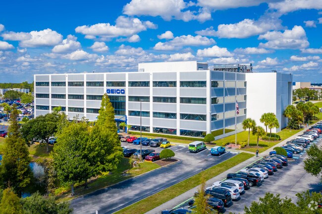
3535 W Pipkin Rd
23-29-09-000000-014020
Forest Brook (Secs 9 10 And 15)
Financialbuilding
COMM AT SW COR OF N1/2 OF SEC 9 RUN E 1706.84 FT N 50 FT TO N R/W LINE OF MEDULLA RD & POB CONT N 764.87 FT E 1804.12 FT S 230.76 FT W 388 FT S 540 FT TO N R/W LINE OF MEDULLA RD W 1415 FT TO POB LESS COMM SW COR OF NE1/4 OF SEC RUN N89-47-47E 462.64
A
Polk
12105C0460G
Florida
2024
26.74 AC
2025
Polk County
011902
Tampa/St Petersburg
296,264 SF
Lakeland-Winter Haven, FL
DEMOGRAPHICS near 3535 W Pipkin Rd
1 Mile
3 Mile
5 Mile
2024 Total Population
1,885
28,574
104,299
2029 Population
2,232
33,894
123,499
Pop Growth 2024-2029
+ 18.41%
+ 18.62%
+ 18.41%
Average Age
40
39
40
2024 Total Households
665
10,873
40,467
HH Growth 2024-2029
+ 18.35%
+ 18.54%
+ 18.56%
Median Household Inc
$85,911
$73,625
$65,436
Avg Household Size
2.80
2.60
2.50
2024 Avg HH Vehicles
2.00
2.00
2.00
Median Home Value
$295,495
$249,793
$232,128
Median Year Built
1990
1993
1986
Nearby Places
Map Layers
Map Styles
 Street
 Aerial
- Restaurants
- Banks
- Shops
- Fitness
- Groceries
PUBLIC TRANSPORTATION
COMMUTER RAIL
DRIVE
WALK
Distance
18 min
8.1 mi
AIRPORT
Tampa International
DRIVE
WALK
Distance
Tampa International
57 min
40.9 mi
Freight Ports
Port of Tampa Bay
DRIVE
WALK
Distance
Port of Tampa Bay
50 min
35.2 mi
Nearby Properties
Address
Land Use
TOTAL SIZE
Lot Size
Zoning
Address
Land Use
TOTAL SIZE
Lot Size
Zoning
518,028 SF
195.69 AC
Address
Land Use
TOTAL SIZE
Lot Size
Zoning
805,336 SF
52.50 AC
I
Address
Land Use
TOTAL SIZE
Lot Size
Zoning
595,473 SF
47.29 AC
Address
Land Use
TOTAL SIZE
Lot Size
Zoning
315,901 SF
20.55 AC
Address
Land Use
TOTAL SIZE
Lot Size
Zoning
882,663 SF
133.57 AC
PUD
Address
Land Use
TOTAL SIZE
Lot Size
Zoning
508,310 SF
37.85 AC
M-1A
Address
Land Use
TOTAL SIZE
Lot Size
Zoning
417,890 SF
14.59 AC
Address
Land Use
TOTAL SIZE
Lot Size
Zoning
492,859 SF
135.58 AC
Address
Land Use
TOTAL SIZE
Lot Size
Zoning
363,147 SF
76.15 AC
Address
Land Use
TOTAL SIZE
Lot Size
Zoning
328,863 SF
38.87 AC
M-1A
Address
Land Use
TOTAL SIZE
Lot Size
Zoning
300,411 SF
18.77 AC
I
Address
Land Use
TOTAL SIZE
Lot Size
Zoning
432,087 SF
626.03 AC
PUD
Address
Land Use
TOTAL SIZE
Lot Size
Zoning
333,560 SF
44.88 AC
IND
Address
Land Use
TOTAL SIZE
Lot Size
Zoning
221,500 SF
19.54 AC
XX
Address
Land Use
TOTAL SIZE
Lot Size
Zoning
200,200 SF
17.40 AC
XX
Address
Land Use
TOTAL SIZE
Lot Size
Zoning
76,250 SF
5.25 AC
Address
Land Use
TOTAL SIZE
Lot Size
Zoning
215,280 SF
19.73 AC
R2
Address
Land Use
TOTAL SIZE
Lot Size
Zoning
144,648 SF
8.84 AC
I
Address
Land Use
TOTAL SIZE
Lot Size
Zoning
112,538 SF
23.44 AC
Address
Land Use
TOTAL SIZE
Lot Size
Zoning
139,062 SF
9.17 AC
I
Address
Land Use
TOTAL SIZE
Lot Size
Zoning
170,844 SF
200.53 AC
PUD
Address
Land Use
TOTAL SIZE
Lot Size
Zoning
156,240 SF
12.18 AC
RE2
Address
Land Use
TOTAL SIZE
Lot Size
Zoning
278,400 SF
22.83 AC
XX
Address
Land Use
TOTAL SIZE
Lot Size
Zoning
101,103 SF
13.87 AC
Address
Land Use
TOTAL SIZE
Lot Size
Zoning
216,358 SF
135.58 AC
Address
Land Use
TOTAL SIZE
Lot Size
Zoning
77,232 SF
0.46 AC
Address
Land Use
TOTAL SIZE
Lot Size
Zoning
70,604 SF
7.79 AC
Address
Land Use
TOTAL SIZE
Lot Size
Zoning
145,672 SF
16 AC
Address
Land Use
TOTAL SIZE
Lot Size
Zoning
63,917 SF
3.85 AC
The World's #1 Commercial Real Estate Marketplace
Connect with us
© 2025 CoStar Group
The information above has been obtained from sources believed reliable. While we do not doubt its accuracy we have not verified it and make no guarantee, warranty or representation about it. It is your responsibility to independently confirm its accuracy and completeness. Any projections, opinions, assumptions, or estimates used are for example only and do not represent the current or future performance of the property. The value of this transaction to you depends on tax and other factors which should be evaluated by your tax, financial, and legal advisors. You and your advisors should conduct a careful, independent investigation of the property to determine to your satisfaction the suitability of the property for your needs.