Property Record
3539 22Nd Ave Nw, Rochester, MN 55901

NEARBY LISTINGS FOR SALE OR LEASE
Property Detail
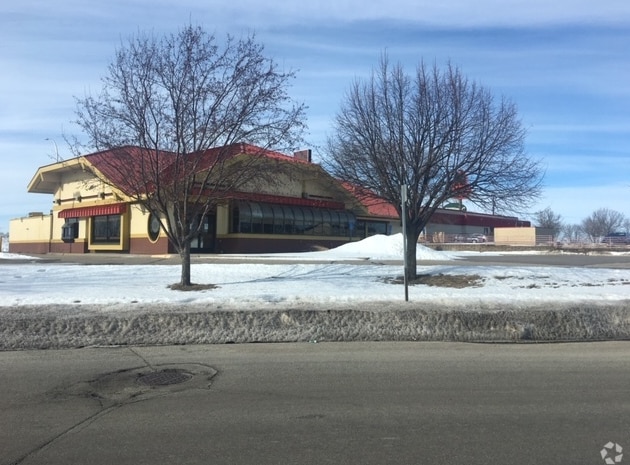
3539 22Nd Ave Nw
Rochester, MN
Rolling Greens 5Th
74.22.23.067470
SECT-22 TWP-107 RANGE-014 ROLLING GREENS 5TH LOT-004 BLOCK-001 LOT 4 BLK 1 LESS TH PT SHOWN AS PARCEL 440G ON MN DOT R-O-W PL
Bartavern
Olmsted
X
Minnesota
27109C0161F
4
2025
0.80 AC
2024
Rochester
001501
Other Market Areas
5,310 SF
DEMOGRAPHICS near 3539 22Nd Ave Nw
1 Mile
3 Mile
5 Mile
2024 Total Population
12,538
68,746
111,223
2029 Population
12,732
70,251
114,197
Pop Growth 2024-2029
+ 1.55%
+ 2.19%
+ 2.67%
Average Age
37
39
39
2024 Total Households
5,223
28,491
46,021
HH Growth 2024-2029
+ 1.53%
+ 2.14%
+ 2.70%
Median Household Inc
$63,725
$82,245
$79,820
Avg Household Size
2.20
2.30
2.30
2024 Avg HH Vehicles
2.00
2.00
2.00
Median Home Value
$228,092
$271,253
$279,299
Median Year Built
1979
1986
1986
Nearby Places
Map Layers
Map Styles
 Street
 Aerial
- Restaurants
- Banks
- Shops
- Fitness
- Groceries
PUBLIC TRANSPORTATION
AIRPORT
Rochester International
DRIVE
WALK
Distance
Rochester International
16 min
12.1 mi
Freight Ports
Port Milwaukee
DRIVE
WALK
Distance
Port Milwaukee
310 min
281.5 mi
SALE & LEASE HISTORY
LISTING DATE
SALE/LEASE

Feb 11, 2020
For Sale
Nearby Properties
Address
Land Use
TOTAL SIZE
Lot Size
Zoning
Address
Land Use
TOTAL SIZE
Lot Size
Zoning
Address
Land Use
TOTAL SIZE
Lot Size
Zoning
2,238,362 SF
2.06 AC
Address
Land Use
TOTAL SIZE
Lot Size
Zoning
1,232,028 SF
2.03 AC
Address
Land Use
TOTAL SIZE
Lot Size
Zoning
2.77 AC
Address
Land Use
TOTAL SIZE
Lot Size
Zoning
791,669 SF
2.15 AC
Address
Land Use
TOTAL SIZE
Lot Size
Zoning
271,310 SF
27.90 AC
Address
Land Use
TOTAL SIZE
Lot Size
Zoning
4,612 SF
21.16 AC
Address
Land Use
TOTAL SIZE
Lot Size
Zoning
6,082 SF
31.75 AC
Address
Land Use
TOTAL SIZE
Lot Size
Zoning
960 SF
38.12 AC
Address
Land Use
TOTAL SIZE
Lot Size
Zoning
0.88 AC
Address
Land Use
TOTAL SIZE
Lot Size
Zoning
13,946 SF
34.10 AC
Address
Land Use
TOTAL SIZE
Lot Size
Zoning
309,127 SF
0.67 AC
Address
Land Use
TOTAL SIZE
Lot Size
Zoning
175,078 SF
1.98 AC
Address
Land Use
TOTAL SIZE
Lot Size
Zoning
236,769 SF
33.30 AC
Address
Land Use
TOTAL SIZE
Lot Size
Zoning
12,016 SF
20.31 AC
Address
Land Use
TOTAL SIZE
Lot Size
Zoning
2,420 SF
10.37 AC
Address
Land Use
TOTAL SIZE
Lot Size
Zoning
195,039 SF
8.25 AC
Address
Land Use
TOTAL SIZE
Lot Size
Zoning
53.73 AC
Address
Land Use
TOTAL SIZE
Lot Size
Zoning
167.09 AC
Address
Land Use
TOTAL SIZE
Lot Size
Zoning
4.63 AC
Address
Land Use
TOTAL SIZE
Lot Size
Zoning
250,864 SF
4.43 AC
Address
Land Use
TOTAL SIZE
Lot Size
Zoning
6,780 SF
1.16 AC
Address
Land Use
TOTAL SIZE
Lot Size
Zoning
136,031 SF
35.28 AC
Address
Land Use
TOTAL SIZE
Lot Size
Zoning
170,843 SF
13.66 AC
Address
Land Use
TOTAL SIZE
Lot Size
Zoning
199,348 SF
2.89 AC
Address
Land Use
TOTAL SIZE
Lot Size
Zoning
2,300 SF
6.38 AC
Address
Land Use
TOTAL SIZE
Lot Size
Zoning
7,463 SF
0.68 AC
Address
Land Use
TOTAL SIZE
Lot Size
Zoning
3,024 SF
4.93 AC
Address
Land Use
TOTAL SIZE
Lot Size
Zoning
3,915 SF
12.56 AC
Address
Land Use
TOTAL SIZE
Lot Size
Zoning
10,920 SF
38.88 AC
The World's #1 Commercial Real Estate Marketplace
Connect with us
© 2026 CoStar Group
The information above has been obtained from sources believed reliable. While we do not doubt its accuracy we have not verified it and make no guarantee, warranty or representation about it. It is your responsibility to independently confirm its accuracy and completeness. Any projections, opinions, assumptions, or estimates used are for example only and do not represent the current or future performance of the property. The value of this transaction to you depends on tax and other factors which should be evaluated by your tax, financial, and legal advisors. You and your advisors should conduct a careful, independent investigation of the property to determine to your satisfaction the suitability of the property for your needs.