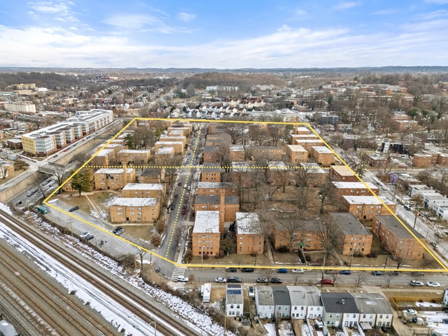
Property Record
3539 A St Se, Washington, DC 20019
NEARBY LISTINGS FOR SALE OR LEASE
Property Detail
3539 A St Se
Washington-Arlington-Alexandria, DC-VA-MD-WV
Fort Dupont Park
5411-0802
SQUARE 5412 LOT 0801 NBHD: FORT DUPONT PARK
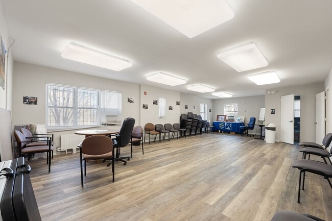
Apartment
District of Columbia
X
District of Columbia
1100010039C
801
2025
3.67 AC
2025
Greenway
007708
Washington, DC
12,960 SF
DEMOGRAPHICS near 3539 A St Se
1 Mile
3 Mile
5 Mile
2024 Total Population
19,669
248,090
630,255
2029 Population
17,936
233,044
592,380
Pop Growth 2024-2029
(8.81%)
(6.06%)
(6.01%)
Average Age
39
38
38
2024 Total Households
8,600
108,634
274,957
HH Growth 2024-2029
(9.85%)
(6.56%)
(6.79%)
Median Household Inc
$46,394
$77,303
$80,868
Avg Household Size
2.20
2.10
2.20
2024 Avg HH Vehicles
1.00
1.00
1.00
Median Home Value
$405,870
$476,838
$450,480
Median Year Built
1957
1962
1965
Nearby Places
Map Layers
Map Styles
 Street
 Aerial
- Restaurants
- Banks
- Shops
- Fitness
- Groceries
PUBLIC TRANSPORTATION
TRANSIT/SUBWAY
Minnesota Avenue (Orange Line - Washington Metropolitan Area Transit Authority Metrorail (Metrorail))
DRIVE
WALK
Distance
Minnesota Avenue (Orange Line - Washington Metropolitan Area Transit Authority Metrorail (Metrorail))
3 min
18 min
0.9 mi
Benning Road (Blue Line - Washington Metropolitan Area Transit Authority Metrorail (Metrorail), Silver Line - Washington Metropolitan Area Transit Authority Metrorail (Metrorail))
DRIVE
WALK
Distance
Benning Road (Blue Line - Washington Metropolitan Area Transit Authority Metrorail (Metrorail), Silver Line - Washington Metropolitan Area Transit Authority Metrorail (Metrorail))
2 min
20 min
1.1 mi
COMMUTER RAIL
Lead (Fredericksburg Line - Virginia Railway Express, Manassas Line - Virginia Railway Express)
DRIVE
WALK
Distance
Lead (Fredericksburg Line - Virginia Railway Express, Manassas Line - Virginia Railway Express)
6 min
3.7 mi
Union Station (Brunswick Line - Maryland Area Regional Commuter Trains (The MARC), Camden Line - Maryland Area Regional Commuter Trains (The MARC), Fredericksburg Line - Maryland Area Regional Commuter Trains (The MARC), Manassas Line - Maryland Area Regional Commuter Trains (The MARC), Penn Line - Maryland Area Regional Commuter Trains (The MARC), Red Line - Maryland Area Regional Commuter Trains (The MARC))
DRIVE
WALK
Distance
Union Station (Brunswick Line - Maryland Area Regional Commuter Trains (The MARC), Camden Line - Maryland Area Regional Commuter Trains (The MARC), Fredericksburg Line - Maryland Area Regional Commuter Trains (The MARC), Manassas Line - Maryland Area Regional Commuter Trains (The MARC), Penn Line - Maryland Area Regional Commuter Trains (The MARC), Red Line - Maryland Area Regional Commuter Trains (The MARC))
7 min
3.9 mi
AIRPORT
Ronald Reagan Washington Ntl
DRIVE
WALK
Distance
Ronald Reagan Washington Ntl
17 min
8.5 mi
Baltimore/Washington International Thurgood Marshall
DRIVE
WALK
Distance
Baltimore/Washington International Thurgood Marshall
42 min
28.5 mi
Washington Dulles International
DRIVE
WALK
Distance
Washington Dulles International
52 min
32.6 mi
Freight Ports
Port of Baltimore
DRIVE
WALK
Distance
Port of Baltimore
52 min
35.0 mi
SALE & LEASE HISTORY
LISTING DATE
SALE/LEASE

Feb 04, 2025
For Sale
Nearby Properties
Address
Land Use
TOTAL SIZE
Lot Size
Zoning
Address
Land Use
TOTAL SIZE
Lot Size
Zoning
58,289 SF
418.97 AC
MU-4;PDR-1
Address
Land Use
TOTAL SIZE
Lot Size
Zoning
2,369,428 SF
7.93 AC
MU-10;SEFC
Address
Land Use
TOTAL SIZE
Lot Size
Zoning
1,043,058 SF
4.03 AC
UNZONED
Address
Land Use
TOTAL SIZE
Lot Size
Zoning
185,826 SF
9.40 AC
UNZONED
Address
Land Use
TOTAL SIZE
Lot Size
Zoning
2,058,692 SF
4.77 AC
UNZONED
Address
Land Use
TOTAL SIZE
Lot Size
Zoning
607,735 SF
8.94 AC
PDR-3;UNZO
Address
Land Use
TOTAL SIZE
Lot Size
Zoning
2,542,436 SF
6.39 AC
MU-2;MU-4;
Address
Land Use
TOTAL SIZE
Lot Size
Zoning
1,642,951 SF
95.12 AC
RF-1
Address
Land Use
TOTAL SIZE
Lot Size
Zoning
730,233 SF
4.78 AC
UNZONED
Address
Land Use
TOTAL SIZE
Lot Size
Zoning
7.41 AC
UNZONED
Address
Land Use
TOTAL SIZE
Lot Size
Zoning
930,547 SF
1.90 AC
D-5
Address
Land Use
TOTAL SIZE
Lot Size
Zoning
1,323,000 SF
3.36 AC
RA-2
Address
Land Use
TOTAL SIZE
Lot Size
Zoning
21.28 AC
GOV
Address
Land Use
TOTAL SIZE
Lot Size
Zoning
589,000 SF
1.39 AC
D-5
Address
Land Use
TOTAL SIZE
Lot Size
Zoning
5.53 AC
UNZONED
Address
Land Use
TOTAL SIZE
Lot Size
Zoning
169.85 AC
R-2;RA-1;U
Address
Land Use
TOTAL SIZE
Lot Size
Zoning
812,092 SF
10.19 AC
UNZONED
Address
Land Use
TOTAL SIZE
Lot Size
Zoning
726,490 SF
3.84 AC
RA-2
Address
Land Use
TOTAL SIZE
Lot Size
Zoning
572,916 SF
1.26 AC
UNZONED
Address
Land Use
TOTAL SIZE
Lot Size
Zoning
2,131,229 SF
144.34 AC
AG
Address
Land Use
TOTAL SIZE
Lot Size
Zoning
1,059,397 SF
2.51 AC
PDR-3;USN
Address
Land Use
TOTAL SIZE
Lot Size
Zoning
30,000 SF
819.17 AC
PDR-1;RA-1
Address
Land Use
TOTAL SIZE
Lot Size
Zoning
273,650 SF
6.31 AC
PDR-1
Address
Land Use
TOTAL SIZE
Lot Size
Zoning
589,680 SF
3.11 AC
D-5
Address
Land Use
TOTAL SIZE
Lot Size
Zoning
538,974 SF
1.26 AC
PDR-3
Address
Land Use
TOTAL SIZE
Lot Size
Zoning
503,872 SF
1.24 AC
D-5
Address
Land Use
TOTAL SIZE
Lot Size
Zoning
755,499 SF
1.75 AC
PDR-3;USN
Address
Land Use
TOTAL SIZE
Lot Size
Zoning
280,000 SF
D-5
Address
Land Use
TOTAL SIZE
Lot Size
Zoning
3.37 AC
D-3;UNZONE
Address
Land Use
TOTAL SIZE
Lot Size
Zoning
400,000 SF
1.05 AC
D-5
The World's #1 Commercial Real Estate Marketplace
Connect with us
© 2025 CoStar Group
The information above has been obtained from sources believed reliable. While we do not doubt its accuracy we have not verified it and make no guarantee, warranty or representation about it. It is your responsibility to independently confirm its accuracy and completeness. Any projections, opinions, assumptions, or estimates used are for example only and do not represent the current or future performance of the property. The value of this transaction to you depends on tax and other factors which should be evaluated by your tax, financial, and legal advisors. You and your advisors should conduct a careful, independent investigation of the property to determine to your satisfaction the suitability of the property for your needs.