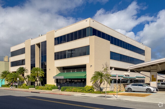
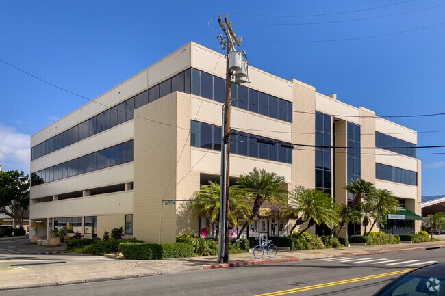
Property Record
354 Uluniu St, Kailua, HI 96734
NEARBY LISTINGS FOR SALE OR LEASE
-
-
View all Kailua listings for lease on LoopNet.com
Property Detail
354 Uluniu St
1-4-3-052-023-0000
Kailua Coconut Grove 03 Map 39
Commercialnec
Honolulu
X
Hawaii
15003C0290H
333-a
2024
0.68 AC
2025
Windward
010905
Hawaii
52,112 SF
Urban Honolulu, HI
DEMOGRAPHICS near 354 Uluniu St
1 Mile
3 Mile
5 Mile
2024 Total Population
17,673
47,554
94,082
2029 Population
17,289
45,800
90,859
Pop Growth 2024-2029
(2.17%)
(3.69%)
(3.43%)
Average Age
42
43
41
2024 Total Households
6,190
15,558
28,731
HH Growth 2024-2029
(3.04%)
(4.68%)
(4.35%)
Median Household Inc
$118,809
$138,170
$120,332
Avg Household Size
2.70
2.80
2.90
2024 Avg HH Vehicles
2.00
2.00
2.00
Median Home Value
$1,011,458
$1,056,355
$962,023
Median Year Built
1965
1966
1970
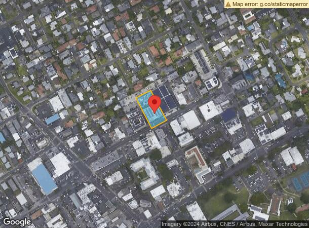
Nearby Places
Map Layers
Map Styles
 Street
 Aerial
- Restaurants
- Banks
- Shops
- Fitness
- Groceries
PUBLIC TRANSPORTATION
AIRPORT
Daniel K Inouye International
DRIVE
WALK
Distance
Daniel K Inouye International
31 min
16.4 mi
Freight Ports
Honolulu Harbor, Oahu
DRIVE
WALK
Distance
Honolulu Harbor, Oahu
33 min
15.5 mi
SALE & LEASE HISTORY
LISTING DATE
SALE/LEASE

Sep 25, 2016
For Lease
Nov 15, 2018
For Lease
Jan 11, 2018
For Lease
Dec 09, 2016
For Lease
Aug 16, 2024
For Lease
Apr 08, 2019
For Lease
Apr 08, 2019
For Lease
Nearby Properties
Address
Land Use
TOTAL SIZE
Lot Size
Zoning
Address
Land Use
TOTAL SIZE
Lot Size
Zoning
130,311 SF
7.05 AC
B-2
Address
Land Use
TOTAL SIZE
Lot Size
Zoning
325,894 SF
22.26 AC
I-2
Address
Land Use
TOTAL SIZE
Lot Size
Zoning
226,160 SF
9.90 AC
R-5
Address
Land Use
TOTAL SIZE
Lot Size
Zoning
137,288 SF
16.12 AC
A-2
Address
Land Use
TOTAL SIZE
Lot Size
Zoning
56.87 AC
P-2
Address
Land Use
TOTAL SIZE
Lot Size
Zoning
75,635 SF
7.21 AC
B-1
Address
Land Use
TOTAL SIZE
Lot Size
Zoning
54,244 SF
3.38 AC
B-2
Address
Land Use
TOTAL SIZE
Lot Size
Zoning
120,970 SF
2.43 AC
B-2
Address
Land Use
TOTAL SIZE
Lot Size
Zoning
55,645 SF
3.10 AC
B-2
Address
Land Use
TOTAL SIZE
Lot Size
Zoning
397,566 SF
3.09 AC
B-1
Address
Land Use
TOTAL SIZE
Lot Size
Zoning
70,952 SF
2.31 AC
B-2
Address
Land Use
TOTAL SIZE
Lot Size
Zoning
15.90 AC
P-2
Address
Land Use
TOTAL SIZE
Lot Size
Zoning
44,774 SF
2.74 AC
B-1
Address
Land Use
TOTAL SIZE
Lot Size
Zoning
48,556 SF
2.18 AC
B-2
Address
Land Use
TOTAL SIZE
Lot Size
Zoning
39,898 SF
163.13 AC
P-2
Address
Land Use
TOTAL SIZE
Lot Size
Zoning
32,742 SF
2.69 AC
B-1
Address
Land Use
TOTAL SIZE
Lot Size
Zoning
5,952 SF
1.73 AC
B-2
Address
Land Use
TOTAL SIZE
Lot Size
Zoning
1.76 AC
BMX-3
Address
Land Use
TOTAL SIZE
Lot Size
Zoning
69,142 SF
132.46 AC
P-1
Address
Land Use
TOTAL SIZE
Lot Size
Zoning
24,971 SF
1.67 AC
B-2
Address
Land Use
TOTAL SIZE
Lot Size
Zoning
1.74 AC
BMX-3
Address
Land Use
TOTAL SIZE
Lot Size
Zoning
21,111 SF
1.95 AC
B-1
Address
Land Use
TOTAL SIZE
Lot Size
Zoning
123,725 SF
572.87 AC
P-1
Address
Land Use
TOTAL SIZE
Lot Size
Zoning
55,365 SF
0.83 AC
B-2
Address
Land Use
TOTAL SIZE
Lot Size
Zoning
13,474 SF
1.24 AC
B-2
Address
Land Use
TOTAL SIZE
Lot Size
Zoning
27,078 SF
1.19 AC
B-2
Address
Land Use
TOTAL SIZE
Lot Size
Zoning
41,314 SF
0.59 AC
B-2
Address
Land Use
TOTAL SIZE
Lot Size
Zoning
413.01 AC
AG-2
Address
Land Use
TOTAL SIZE
Lot Size
Zoning
25,540 SF
1.03 AC
B-2
The World's #1 Commercial Real Estate Marketplace
Connect with us
© 2026 CoStar Group
The information above has been obtained from sources believed reliable. While we do not doubt its accuracy we have not verified it and make no guarantee, warranty or representation about it. It is your responsibility to independently confirm its accuracy and completeness. Any projections, opinions, assumptions, or estimates used are for example only and do not represent the current or future performance of the property. The value of this transaction to you depends on tax and other factors which should be evaluated by your tax, financial, and legal advisors. You and your advisors should conduct a careful, independent investigation of the property to determine to your satisfaction the suitability of the property for your needs.