Property Record
3540 Gilleland Ext, Gainesville, GA 30507
NEARBY LISTINGS FOR SALE OR LEASE
Property Detail
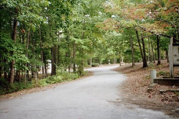
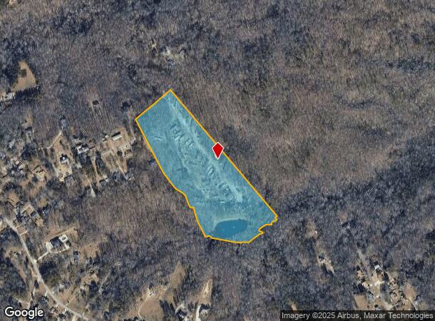
3540 Gilleland Ext
Gainesville, GA
Grady C Fraser Estates
15-00036-00-006B
GILLELAND EXTENSION
Commercialnec
Hall
X
Georgia
13013C0025D
0
2025
21 AC
2025
Gainesville/Hall County
001304
Atlanta
DEMOGRAPHICS near 3540 Gilleland Ext
1 Mile
3 Mile
5 Mile
2024 Total Population
2,468
25,428
70,397
2029 Population
2,695
28,253
78,301
Pop Growth 2024-2029
+ 9.20%
+ 11.11%
+ 11.23%
Average Age
37
37
36
2024 Total Households
853
8,356
22,906
HH Growth 2024-2029
+ 9.03%
+ 11.07%
+ 11.28%
Median Household Inc
$59,953
$65,856
$63,198
Avg Household Size
2.80
2.90
3.00
2024 Avg HH Vehicles
2.00
2.00
2.00
Median Home Value
$257,333
$247,885
$252,216
Median Year Built
1996
1998
1996
Nearby Places
Map Layers
Map Styles
 Street
 Aerial
- Restaurants
- Banks
- Shops
- Fitness
- Groceries
PUBLIC TRANSPORTATION
COMMUTER RAIL
Gainesville Amtrak Station (Crescent - Amtrak)
DRIVE
WALK
Distance
Gainesville Amtrak Station (Crescent - Amtrak)
12 min
7.4 mi
Freight Ports
Georgia Ports - Savannah
DRIVE
WALK
Distance
Georgia Ports - Savannah
323 min
254.8 mi
Nearby Properties
Address
Land Use
TOTAL SIZE
Lot Size
Zoning
Address
Land Use
TOTAL SIZE
Lot Size
Zoning
164,815 SF
29.93 AC
R-IV
Address
Land Use
TOTAL SIZE
Lot Size
Zoning
150,738 SF
43.34 AC
M-1
Address
Land Use
TOTAL SIZE
Lot Size
Zoning
112,734 SF
32.02 AC
R-4
Address
Land Use
TOTAL SIZE
Lot Size
Zoning
92,448 SF
24.25 AC
PUD
Address
Land Use
TOTAL SIZE
Lot Size
Zoning
144,744 SF
35.47 AC
C-2
Address
Land Use
TOTAL SIZE
Lot Size
Zoning
760,440 SF
53.33 AC
L-I
Address
Land Use
TOTAL SIZE
Lot Size
Zoning
3,881 SF
27.86 AC
R-IV
Address
Land Use
TOTAL SIZE
Lot Size
Zoning
45,900 SF
6.99 AC
PRD
Address
Land Use
TOTAL SIZE
Lot Size
Zoning
342,720 SF
22.95 AC
PUD
Address
Land Use
TOTAL SIZE
Lot Size
Zoning
346,875 SF
82.09 AC
H-I
Address
Land Use
TOTAL SIZE
Lot Size
Zoning
54,751 SF
33.38 AC
AR-1
Address
Land Use
TOTAL SIZE
Lot Size
Zoning
277,684 SF
23.06 AC
L-I
Address
Land Use
TOTAL SIZE
Lot Size
Zoning
225,378 SF
24.42 AC
M-1
Address
Land Use
TOTAL SIZE
Lot Size
Zoning
308,672 SF
41.22 AC
L-I
Address
Land Use
TOTAL SIZE
Lot Size
Zoning
258,800 SF
52.20 AC
H-I
Address
Land Use
TOTAL SIZE
Lot Size
Zoning
172,114 SF
43.32 AC
M-2
Address
Land Use
TOTAL SIZE
Lot Size
Zoning
192,177 SF
12.43 AC
PRD
Address
Land Use
TOTAL SIZE
Lot Size
Zoning
102,996 SF
10.94 AC
L-I
Address
Land Use
TOTAL SIZE
Lot Size
Zoning
201,322 SF
10 AC
M-1
Address
Land Use
TOTAL SIZE
Lot Size
Zoning
87,714 SF
17.16 AC
C-2
Address
Land Use
TOTAL SIZE
Lot Size
Zoning
6,876 SF
10.64 AC
PRD
Address
Land Use
TOTAL SIZE
Lot Size
Zoning
141.54 AC
R-1
Address
Land Use
TOTAL SIZE
Lot Size
Zoning
184,800 SF
15.60 AC
M-1
Address
Land Use
TOTAL SIZE
Lot Size
Zoning
148,068 SF
31.65 AC
M-1
Address
Land Use
TOTAL SIZE
Lot Size
Zoning
59,256 SF
7.27 AC
PRD
Address
Land Use
TOTAL SIZE
Lot Size
Zoning
199,610 SF
14.66 AC
L-I
Address
Land Use
TOTAL SIZE
Lot Size
Zoning
16,560 SF
9.62 AC
PRD
Address
Land Use
TOTAL SIZE
Lot Size
Zoning
95,843 SF
15.90 AC
C-2
Address
Land Use
TOTAL SIZE
Lot Size
Zoning
45,986 SF
28.83 AC
L-I
Address
Land Use
TOTAL SIZE
Lot Size
Zoning
91,728 SF
15 AC
L-I
The World's #1 Commercial Real Estate Marketplace
Connect with us
© 2025 CoStar Group
The information above has been obtained from sources believed reliable. While we do not doubt its accuracy we have not verified it and make no guarantee, warranty or representation about it. It is your responsibility to independently confirm its accuracy and completeness. Any projections, opinions, assumptions, or estimates used are for example only and do not represent the current or future performance of the property. The value of this transaction to you depends on tax and other factors which should be evaluated by your tax, financial, and legal advisors. You and your advisors should conduct a careful, independent investigation of the property to determine to your satisfaction the suitability of the property for your needs.