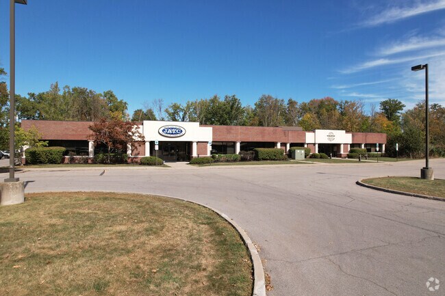
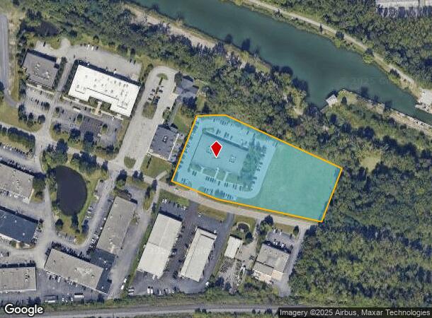
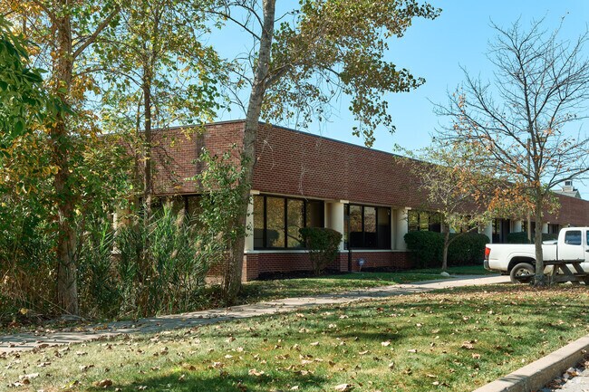
Property Record
3540 Winton Pl, Rochester, NY 14623
NEARBY LISTINGS FOR SALE OR LEASE
Property Detail
3540 Winton Pl
Rochester, NY
Van Zile Subdivision
263200-150-170-0002-006-120
T LOT 1 1ST R 22586 2001 FILED 6-19-01 L 308 PG 79 VAN ZILE SUB LOT # 1
Publicschool
Monroe
X
New York
36055C0352G
6.120
2025
4 AC
2024
South Central
013101
Rochester
21,500 SF
DEMOGRAPHICS near 3540 Winton Pl
1 Mile
3 Mile
5 Mile
2024 Total Population
6,503
57,314
191,771
2029 Population
6,431
56,580
189,172
Pop Growth 2024-2029
(1.11%)
(1.28%)
(1.36%)
Average Age
43
42
40
2024 Total Households
3,197
23,862
87,082
HH Growth 2024-2029
(1.16%)
(1.43%)
(1.40%)
Median Household Inc
$67,682
$74,264
$63,394
Avg Household Size
2.00
2.20
2.10
2024 Avg HH Vehicles
1.00
2.00
1.00
Median Home Value
$178,802
$235,461
$197,248
Median Year Built
1973
1964
1955
Nearby Places
- Restaurants
- Banks
- Shops
- Fitness
- Groceries
PUBLIC TRANSPORTATION
COMMUTER RAIL
DRIVE
WALK
Distance
16 min
6.7 mi
AIRPORT
Frederick Douglass/Greater Rochester International
DRIVE
WALK
Distance
Frederick Douglass/Greater Rochester International
14 min
7.1 mi
SALE & LEASE HISTORY
LISTING DATE
SALE/LEASE

Jan 24, 2025
For Lease
Jan 09, 2017
For Lease
Dec 12, 2024
For Lease
Nearby Properties
Address
Land Use
TOTAL SIZE
Lot Size
Zoning
Address
Land Use
TOTAL SIZE
Lot Size
Zoning
57,638 SF
227.96 AC
02 - SINGL
Address
Land Use
TOTAL SIZE
Lot Size
Zoning
Address
Land Use
TOTAL SIZE
Lot Size
Zoning
400,000 SF
43.50 AC
06 - INDUS
Address
Land Use
TOTAL SIZE
Lot Size
Zoning
65,745 SF
154.98 AC
Address
Land Use
TOTAL SIZE
Lot Size
Zoning
51,276 SF
48.95 AC
02 - SINGL
Address
Land Use
TOTAL SIZE
Lot Size
Zoning
01 - NOT Z
Address
Land Use
TOTAL SIZE
Lot Size
Zoning
Address
Land Use
TOTAL SIZE
Lot Size
Zoning
01 - NOT Z
Address
Land Use
TOTAL SIZE
Lot Size
Zoning
330,090 SF
62.41 AC
Address
Land Use
TOTAL SIZE
Lot Size
Zoning
01 - NOT Z
Address
Land Use
TOTAL SIZE
Lot Size
Zoning
0.01 AC
Address
Land Use
TOTAL SIZE
Lot Size
Zoning
6,056 SF
37.65 AC
Address
Land Use
TOTAL SIZE
Lot Size
Zoning
225,000 SF
48.60 AC
Address
Land Use
TOTAL SIZE
Lot Size
Zoning
01 - NOT Z
Address
Land Use
TOTAL SIZE
Lot Size
Zoning
424,207 SF
39.50 AC
Address
Land Use
TOTAL SIZE
Lot Size
Zoning
Address
Land Use
TOTAL SIZE
Lot Size
Zoning
130,830 SF
19.20 AC
Address
Land Use
TOTAL SIZE
Lot Size
Zoning
01 - NOT Z
Address
Land Use
TOTAL SIZE
Lot Size
Zoning
Address
Land Use
TOTAL SIZE
Lot Size
Zoning
01 - NOT Z
Address
Land Use
TOTAL SIZE
Lot Size
Zoning
Address
Land Use
TOTAL SIZE
Lot Size
Zoning
209,996 SF
36.56 AC
Address
Land Use
TOTAL SIZE
Lot Size
Zoning
160,758 SF
20.95 AC
02 - SINGL
Address
Land Use
TOTAL SIZE
Lot Size
Zoning
241,650 SF
23.77 AC
Address
Land Use
TOTAL SIZE
Lot Size
Zoning
06 - INDUS
Address
Land Use
TOTAL SIZE
Lot Size
Zoning
36,972 SF
2.79 AC
02 - SINGL
Address
Land Use
TOTAL SIZE
Lot Size
Zoning
Address
Land Use
TOTAL SIZE
Lot Size
Zoning
80,747 SF
9.37 AC
02 - SINGL
Address
Land Use
TOTAL SIZE
Lot Size
Zoning
155,517 SF
45.77 AC
Address
Land Use
TOTAL SIZE
Lot Size
Zoning
The World's #1 Commercial Real Estate Marketplace
Connect with us
© 2025 CoStar Group
The information above has been obtained from sources believed reliable. While we do not doubt its accuracy we have not verified it and make no guarantee, warranty or representation about it. It is your responsibility to independently confirm its accuracy and completeness. Any projections, opinions, assumptions, or estimates used are for example only and do not represent the current or future performance of the property. The value of this transaction to you depends on tax and other factors which should be evaluated by your tax, financial, and legal advisors. You and your advisors should conduct a careful, independent investigation of the property to determine to your satisfaction the suitability of the property for your needs.