No Photo
Property Record
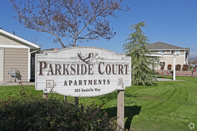
355 Danielle Way, Woodlake, CA 93286


NEARBY LISTINGS FOR SALE OR LEASE
-
-
View all Woodlake listings for sale on LoopNet.com
Property Detail
355 Danielle Way
061-100-084-000
PARCEL 1 PARCEL MAP NO 4787 PM 48-92
Apartment
Tulare
AH
California
06107C0687E
1.83 AC
2024
Northern Tulare County
2025
Visalia/Porterville
000702
Visalia-Porterville, CA
27,442 SF
DEMOGRAPHICS near 355 Danielle Way
1 Mile
3 Mile
5 Mile
2024 Total Population
7,856
9,194
10,880
2029 Population
8,172
9,546
11,270
Pop Growth 2024-2029
+ 4.02%
+ 3.83%
+ 3.58%
Average Age
34
35
36
2024 Total Households
2,283
2,714
3,259
HH Growth 2024-2029
+ 3.90%
+ 3.72%
+ 3.44%
Median Household Inc
$42,696
$41,748
$44,145
Avg Household Size
3.50
3.40
3.40
2024 Avg HH Vehicles
2.00
2.00
2.00
Median Home Value
$263,811
$276,142
$288,632
Median Year Built
1984
1983
1980
Nearby Places
Map Layers
Map Styles
 Street
 Aerial
- Restaurants
- Banks
- Shops
- Fitness
- Groceries
Nearby Properties
Address
Land Use
TOTAL SIZE
Lot Size
Zoning
Address
Land Use
TOTAL SIZE
Lot Size
Zoning
48,979 SF
2.86 AC
Address
Land Use
TOTAL SIZE
Lot Size
Zoning
174,598 SF
8.80 AC
Address
Land Use
TOTAL SIZE
Lot Size
Zoning
12,572 SF
1.62 AC
C-5
Address
Land Use
TOTAL SIZE
Lot Size
Zoning
0.24 AC
C2
Address
Land Use
TOTAL SIZE
Lot Size
Zoning
0.95 AC
Address
Land Use
TOTAL SIZE
Lot Size
Zoning
125,389 SF
5 AC
Address
Land Use
TOTAL SIZE
Lot Size
Zoning
11,145 SF
0.72 AC
R-3
Address
Land Use
TOTAL SIZE
Lot Size
Zoning
35,581 SF
0.33 AC
C-2
Address
Land Use
TOTAL SIZE
Lot Size
Zoning
38,088 SF
2.78 AC
Address
Land Use
TOTAL SIZE
Lot Size
Zoning
35,420 SF
2.98 AC
Address
Land Use
TOTAL SIZE
Lot Size
Zoning
30,564 SF
3.10 AC
Address
Land Use
TOTAL SIZE
Lot Size
Zoning
488 SF
0.12 AC
CCD1
Address
Land Use
TOTAL SIZE
Lot Size
Zoning
33,782 SF
4.25 AC
Address
Land Use
TOTAL SIZE
Lot Size
Zoning
10,000 SF
1.03 AC
Address
Land Use
TOTAL SIZE
Lot Size
Zoning
20,000 SF
3.90 AC
M-1
Address
Land Use
TOTAL SIZE
Lot Size
Zoning
28,275 SF
7.72 AC
M1
Address
Land Use
TOTAL SIZE
Lot Size
Zoning
20,100 SF
2.89 AC
Address
Land Use
TOTAL SIZE
Lot Size
Zoning
44.07 AC
AE20
Address
Land Use
TOTAL SIZE
Lot Size
Zoning
114.18 AC
AE20
Address
Land Use
TOTAL SIZE
Lot Size
Zoning
5,000 SF
0.32 AC
Address
Land Use
TOTAL SIZE
Lot Size
Zoning
4.95 AC
Address
Land Use
TOTAL SIZE
Lot Size
Zoning
3,034 SF
127.82 AC
AE20
Address
Land Use
TOTAL SIZE
Lot Size
Zoning
95.23 AC
AE20
Address
Land Use
TOTAL SIZE
Lot Size
Zoning
9,408 SF
0.69 AC
R-3
Address
Land Use
TOTAL SIZE
Lot Size
Zoning
2,673 SF
37.99 AC
AE20
Address
Land Use
TOTAL SIZE
Lot Size
Zoning
11,020 SF
9.78 AC
M-1
Address
Land Use
TOTAL SIZE
Lot Size
Zoning
12,600 SF
1.41 AC
M1
The World's #1 Commercial Real Estate Marketplace
Connect with us
© 2025 CoStar Group
The information above has been obtained from sources believed reliable. While we do not doubt its accuracy we have not verified it and make no guarantee, warranty or representation about it. It is your responsibility to independently confirm its accuracy and completeness. Any projections, opinions, assumptions, or estimates used are for example only and do not represent the current or future performance of the property. The value of this transaction to you depends on tax and other factors which should be evaluated by your tax, financial, and legal advisors. You and your advisors should conduct a careful, independent investigation of the property to determine to your satisfaction the suitability of the property for your needs.