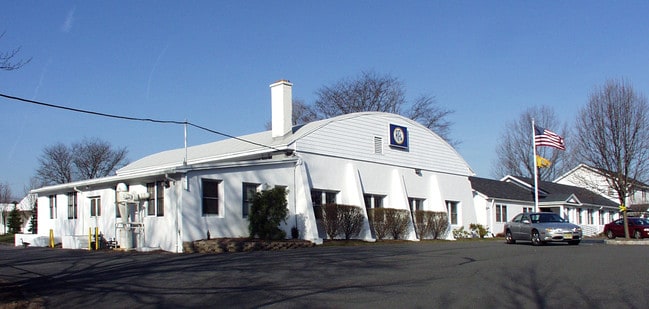
Property Record
355 Powerville Rd, Boonton, NJ 07005

NEARBY LISTINGS FOR SALE OR LEASE
Property Detail
355 Powerville Rd
Northern New Jersey
ZERO MTG AMOUNT ON DOC
Newark, NJ-PA
Morris
02-31001-0000-00001
New Jersey
Industrialgeneral
1
2024
15.84 AC
2025
Eastern Morris
041100
DEMOGRAPHICS near 355 Powerville Rd
1 Mile
3 Mile
5 Mile
2024 Total Population
1,375
23,193
92,327
2029 Population
1,394
23,282
92,582
Pop Growth 2024-2029
+ 1.38%
+ 0.38%
+ 0.28%
Average Age
44
43
42
2024 Total Households
470
8,522
34,530
HH Growth 2024-2029
+ 1.28%
+ 0.49%
+ 0.35%
Median Household Inc
$161,875
$126,871
$121,197
Avg Household Size
2.90
2.70
2.60
2024 Avg HH Vehicles
2.00
2.00
2.00
Median Home Value
$704,698
$603,797
$512,367
Median Year Built
1977
1965
1966
Nearby Places
Map Layers
Map Styles
 Street
 Aerial
- Restaurants
- Banks
- Shops
- Fitness
- Groceries
PUBLIC TRANSPORTATION
COMMUTER RAIL
Boonton (Montclair-Boonton Line - NJ Transit Commuter Rail (NJ Transit))
DRIVE
WALK
Distance
Boonton (Montclair-Boonton Line - NJ Transit Commuter Rail (NJ Transit))
8 min
3.2 mi
Mountain Lakes (Montclair-Boonton Line - NJ Transit Commuter Rail (NJ Transit))
DRIVE
WALK
Distance
Mountain Lakes (Montclair-Boonton Line - NJ Transit Commuter Rail (NJ Transit))
11 min
3.9 mi
AIRPORT
Newark Liberty International
DRIVE
WALK
Distance
Newark Liberty International
42 min
30.1 mi
LaGuardia
DRIVE
WALK
Distance
LaGuardia
64 min
44.9 mi
Freight Ports
Maher Terminal
DRIVE
WALK
Distance
Maher Terminal
47 min
31.2 mi
Nearby Properties
Address
Land Use
TOTAL SIZE
Lot Size
Zoning
Address
Land Use
TOTAL SIZE
Lot Size
Zoning
98,228 SF
16.66 AC
I-1
Address
Land Use
TOTAL SIZE
Lot Size
Zoning
132,411 SF
24.87 AC
B-5
Address
Land Use
TOTAL SIZE
Lot Size
Zoning
378.93 AC
POS
Address
Land Use
TOTAL SIZE
Lot Size
Zoning
41.21 AC
R-A
Address
Land Use
TOTAL SIZE
Lot Size
Zoning
10 AC
RASH
Address
Land Use
TOTAL SIZE
Lot Size
Zoning
50,948 SF
5.60 AC
C-1
Address
Land Use
TOTAL SIZE
Lot Size
Zoning
18.05 AC
OB
Address
Land Use
TOTAL SIZE
Lot Size
Zoning
44,390 SF
2.06 AC
I-2
Address
Land Use
TOTAL SIZE
Lot Size
Zoning
88,819 SF
80.33 AC
R-1A
Address
Land Use
TOTAL SIZE
Lot Size
Zoning
99.50 AC
R-C
Address
Land Use
TOTAL SIZE
Lot Size
Zoning
7.73 AC
ASCH
Address
Land Use
TOTAL SIZE
Lot Size
Zoning
76,160 SF
12.83 AC
I2
Address
Land Use
TOTAL SIZE
Lot Size
Zoning
1,227 SF
1,116.14 AC
R-3
Address
Land Use
TOTAL SIZE
Lot Size
Zoning
39,470 SF
4.65 AC
B-3
Address
Land Use
TOTAL SIZE
Lot Size
Zoning
14.58 AC
R-30
Address
Land Use
TOTAL SIZE
Lot Size
Zoning
294.36 AC
R-88
Address
Land Use
TOTAL SIZE
Lot Size
Zoning
4,948 SF
11.23 AC
R-40
Address
Land Use
TOTAL SIZE
Lot Size
Zoning
122,022 SF
19.09 AC
R-2A
Address
Land Use
TOTAL SIZE
Lot Size
Zoning
2,470 SF
22.29 AC
C
Address
Land Use
TOTAL SIZE
Lot Size
Zoning
12.66 AC
R-A
Address
Land Use
TOTAL SIZE
Lot Size
Zoning
7.70 AC
R-A
Address
Land Use
TOTAL SIZE
Lot Size
Zoning
12.58 AC
R-A
Address
Land Use
TOTAL SIZE
Lot Size
Zoning
91,880 SF
24.54 AC
I2
Address
Land Use
TOTAL SIZE
Lot Size
Zoning
4,272 SF
212.93 AC
R-1B
Address
Land Use
TOTAL SIZE
Lot Size
Zoning
5.30 AC
R-3B
Address
Land Use
TOTAL SIZE
Lot Size
Zoning
111,800 SF
11.37 AC
I-1
Address
Land Use
TOTAL SIZE
Lot Size
Zoning
49,221 SF
9.07 AC
R-C
Address
Land Use
TOTAL SIZE
Lot Size
Zoning
24,500 SF
3.31 AC
I2
Address
Land Use
TOTAL SIZE
Lot Size
Zoning
66,000 SF
9.39 AC
I-1
Address
Land Use
TOTAL SIZE
Lot Size
Zoning
879.26 AC
R
The World's #1 Commercial Real Estate Marketplace
Connect with us
© 2026 CoStar Group
The information above has been obtained from sources believed reliable. While we do not doubt its accuracy we have not verified it and make no guarantee, warranty or representation about it. It is your responsibility to independently confirm its accuracy and completeness. Any projections, opinions, assumptions, or estimates used are for example only and do not represent the current or future performance of the property. The value of this transaction to you depends on tax and other factors which should be evaluated by your tax, financial, and legal advisors. You and your advisors should conduct a careful, independent investigation of the property to determine to your satisfaction the suitability of the property for your needs.