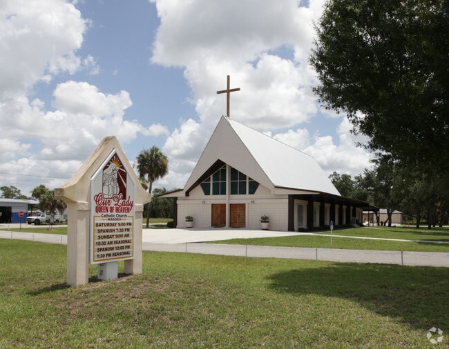
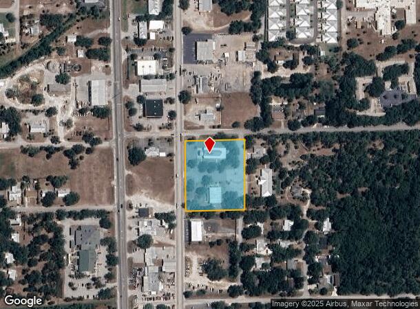
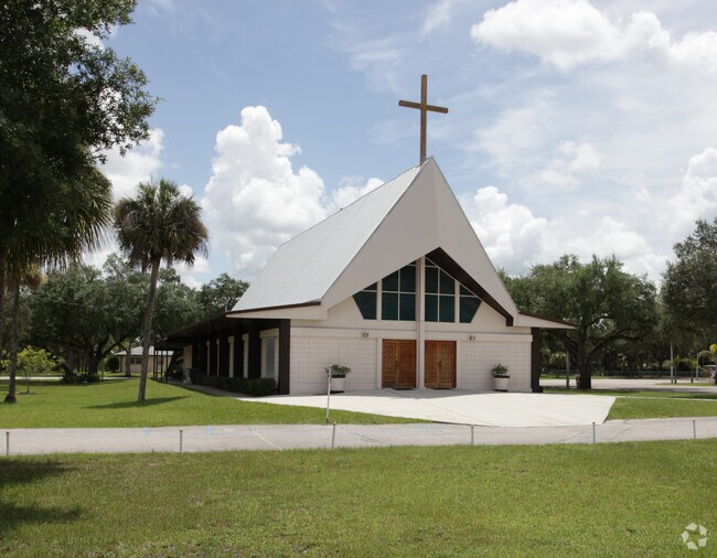
Property Record
355 S Bridge St, Labelle, FL 33935
NEARBY LISTINGS FOR SALE OR LEASE
-
-
View all Labelle listings for sale on LoopNet.com
Property Detail
355 S Bridge St
Clewiston, FL
Belle Gardens S/D Blks 66-67
2-29-43-01-010-0066-0071
LA BELLE BLK 66 BELLE GARDENS S/D LOTS 58 TO 64 + 65 TO 71 EXC W 5 FT ALSO N 362 FT OF LEE ST E BLK 66
Religious
Hendry
AH
Florida
12043C0470D
7
2025
2.33 AC
2025
Florida Central South Area
000403
Other Market Areas
9,971 SF
DEMOGRAPHICS near 355 S Bridge St
1 Mile
3 Mile
5 Mile
2024 Total Population
4,766
16,438
22,133
2029 Population
5,176
17,924
24,359
Pop Growth 2024-2029
+ 8.60%
+ 9.04%
+ 10.06%
Average Age
38
37
37
2024 Total Households
1,416
5,105
6,964
HH Growth 2024-2029
+ 9.04%
+ 9.50%
+ 10.45%
Median Household Inc
$31,479
$36,352
$39,834
Avg Household Size
3.00
3.00
3.00
2024 Avg HH Vehicles
2.00
2.00
2.00
Median Home Value
$146,623
$143,098
$149,809
Median Year Built
1983
1986
1989
Nearby Places
Map Layers
Map Styles
 Street
 Aerial
- Restaurants
- Banks
- Shops
- Fitness
- Groceries
PUBLIC TRANSPORTATION
AIRPORT
Southwest Florida International
DRIVE
WALK
Distance
Southwest Florida International
53 min
33.7 mi
Nearby Properties
Address
Land Use
TOTAL SIZE
Lot Size
Zoning
Address
Land Use
TOTAL SIZE
Lot Size
Zoning
216,868 SF
148.78 AC
LB-I-1
Address
Land Use
TOTAL SIZE
Lot Size
Zoning
92,534 SF
4.50 AC
LB-B-2
Address
Land Use
TOTAL SIZE
Lot Size
Zoning
180,634 SF
40.04 AC
RG3
Address
Land Use
TOTAL SIZE
Lot Size
Zoning
62,150 SF
1.56 AC
LB-PUBLIC
Address
Land Use
TOTAL SIZE
Lot Size
Zoning
154,926 SF
28.52 AC
A-2
Address
Land Use
TOTAL SIZE
Lot Size
Zoning
38,208 SF
2.12 AC
LB-PUBLIC
Address
Land Use
TOTAL SIZE
Lot Size
Zoning
84,621 SF
13.65 AC
C-2
Address
Land Use
TOTAL SIZE
Lot Size
Zoning
68,843 SF
6.10 AC
LB-B-2
Address
Land Use
TOTAL SIZE
Lot Size
Zoning
70,970 SF
3.14 AC
PUD
Address
Land Use
TOTAL SIZE
Lot Size
Zoning
11,174 SF
39.84 AC
Address
Land Use
TOTAL SIZE
Lot Size
Zoning
75,810 SF
26.11 AC
RG4
Address
Land Use
TOTAL SIZE
Lot Size
Zoning
82,678 SF
9.57 AC
LB-PUBLIC
Address
Land Use
TOTAL SIZE
Lot Size
Zoning
62,250 SF
14 AC
C-2
Address
Land Use
TOTAL SIZE
Lot Size
Zoning
26,947 SF
1.79 AC
LB-B-2
Address
Land Use
TOTAL SIZE
Lot Size
Zoning
52,795 SF
5.88 AC
LB-B-2
Address
Land Use
TOTAL SIZE
Lot Size
Zoning
31,615 SF
3.40 AC
LB-B-1
Address
Land Use
TOTAL SIZE
Lot Size
Zoning
7,110 SF
30.37 AC
LB-PUD
Address
Land Use
TOTAL SIZE
Lot Size
Zoning
249.50 AC
Address
Land Use
TOTAL SIZE
Lot Size
Zoning
18,643 SF
4.71 AC
LB-B-1
Address
Land Use
TOTAL SIZE
Lot Size
Zoning
28,236 SF
4.44 AC
LB-I-2
Address
Land Use
TOTAL SIZE
Lot Size
Zoning
18,900 SF
3.99 AC
PUD
Address
Land Use
TOTAL SIZE
Lot Size
Zoning
11,099 SF
2.47 AC
LB-PUD
Address
Land Use
TOTAL SIZE
Lot Size
Zoning
13,333 SF
0.58 AC
LB-R-1A
Address
Land Use
TOTAL SIZE
Lot Size
Zoning
19,486 SF
1.67 AC
LB-R-1AA
Address
Land Use
TOTAL SIZE
Lot Size
Zoning
19,140 SF
9.92 AC
LB-B-1
Address
Land Use
TOTAL SIZE
Lot Size
Zoning
26,445 SF
19.05 AC
RG1M
Address
Land Use
TOTAL SIZE
Lot Size
Zoning
9,098 SF
5.34 AC
RG1
Address
Land Use
TOTAL SIZE
Lot Size
Zoning
56.87 AC
LB-B-3
Address
Land Use
TOTAL SIZE
Lot Size
Zoning
62.40 AC
RG1
Address
Land Use
TOTAL SIZE
Lot Size
Zoning
2,520 SF
236.77 AC
LB-PUBLIC
The World's #1 Commercial Real Estate Marketplace
Connect with us
© 2025 CoStar Group
The information above has been obtained from sources believed reliable. While we do not doubt its accuracy we have not verified it and make no guarantee, warranty or representation about it. It is your responsibility to independently confirm its accuracy and completeness. Any projections, opinions, assumptions, or estimates used are for example only and do not represent the current or future performance of the property. The value of this transaction to you depends on tax and other factors which should be evaluated by your tax, financial, and legal advisors. You and your advisors should conduct a careful, independent investigation of the property to determine to your satisfaction the suitability of the property for your needs.