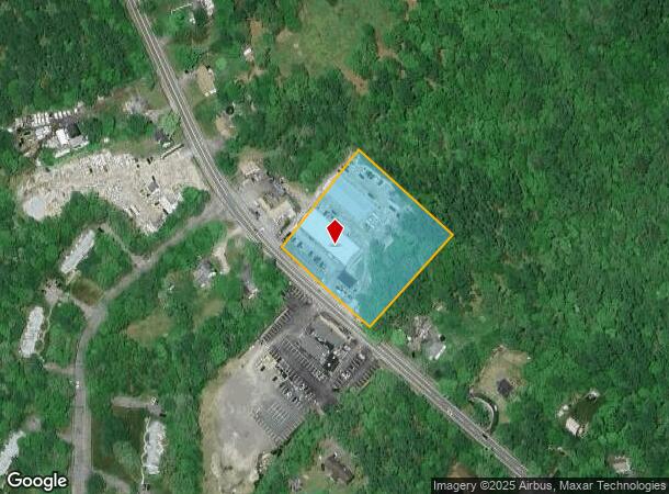
Property Record
355 Wareham St, Middleboro, MA 02346


Current Lease Availabilities
NEARBY LISTINGS FOR SALE OR LEASE
Property Detail
355 Wareham St
MIDD-000072-005542
Plymouth
Commercialnec
Massachusetts
X
5542
25023C0451J
2.37 AC
2020
Route 3 South
2025
Boston
542101
Boston-Cambridge-Newton, MA-NH
1,320 SF
DEMOGRAPHICS near 355 Wareham St
1 Mile
3 Mile
5 Mile
2024 Total Population
961
8,403
27,631
2029 Population
966
8,413
27,728
Pop Growth 2024-2029
+ 0.52%
+ 0.12%
+ 0.35%
Average Age
44
42
42
2024 Total Households
332
3,078
10,418
HH Growth 2024-2029
+ 0.60%
+ 0.10%
+ 0.27%
Median Household Inc
$91,553
$88,421
$86,409
Avg Household Size
2.70
2.60
2.60
2024 Avg HH Vehicles
2.00
2.00
2.00
Median Home Value
$409,596
$412,865
$418,365
Median Year Built
1978
1976
1975
Nearby Places
Map Layers
Map Styles
 Street
 Aerial
- Restaurants
- Banks
- Shops
- Fitness
- Groceries
PUBLIC TRANSPORTATION
COMMUTER RAIL
Middleborough/Lakeville (Middleborough/Lakeville Line - Massachusetts Bay Transportation Authority Commuter Rail (Purple Line))
DRIVE
WALK
Distance
Middleborough/Lakeville (Middleborough/Lakeville Line - Massachusetts Bay Transportation Authority Commuter Rail (Purple Line))
8 min
4.1 mi
Freight Ports
Port of New Bedford Harbor
DRIVE
WALK
Distance
Port of New Bedford Harbor
34 min
26.0 mi
Nearby Properties
Address
Land Use
TOTAL SIZE
Lot Size
Zoning
Address
Land Use
TOTAL SIZE
Lot Size
Zoning
167,715 SF
29.54 AC
Address
Land Use
TOTAL SIZE
Lot Size
Zoning
144,454 SF
66.89 AC
Address
Land Use
TOTAL SIZE
Lot Size
Zoning
38.61 AC
Address
Land Use
TOTAL SIZE
Lot Size
Zoning
173,003 SF
26.10 AC
Address
Land Use
TOTAL SIZE
Lot Size
Zoning
48.30 AC
Address
Land Use
TOTAL SIZE
Lot Size
Zoning
130,582 SF
23.41 AC
Address
Land Use
TOTAL SIZE
Lot Size
Zoning
128,922 SF
12.50 AC
Address
Land Use
TOTAL SIZE
Lot Size
Zoning
7.33 AC
Address
Land Use
TOTAL SIZE
Lot Size
Zoning
36.10 AC
Address
Land Use
TOTAL SIZE
Lot Size
Zoning
2,295.68 AC
Address
Land Use
TOTAL SIZE
Lot Size
Zoning
3.05 AC
Address
Land Use
TOTAL SIZE
Lot Size
Zoning
38,744 SF
8.50 AC
Address
Land Use
TOTAL SIZE
Lot Size
Zoning
33,870 SF
8 AC
Address
Land Use
TOTAL SIZE
Lot Size
Zoning
30,933 SF
12.67 AC
Address
Land Use
TOTAL SIZE
Lot Size
Zoning
44,379 SF
3 AC
Address
Land Use
TOTAL SIZE
Lot Size
Zoning
266 SF
1.10 AC
Address
Land Use
TOTAL SIZE
Lot Size
Zoning
54,000 SF
7 AC
Address
Land Use
TOTAL SIZE
Lot Size
Zoning
6.47 AC
Address
Land Use
TOTAL SIZE
Lot Size
Zoning
14.69 AC
Address
Land Use
TOTAL SIZE
Lot Size
Zoning
34,090 SF
3.93 AC
Address
Land Use
TOTAL SIZE
Lot Size
Zoning
55,259 SF
7.49 AC
Address
Land Use
TOTAL SIZE
Lot Size
Zoning
30,420 SF
2.99 AC
Address
Land Use
TOTAL SIZE
Lot Size
Zoning
51,043 SF
2.39 AC
Address
Land Use
TOTAL SIZE
Lot Size
Zoning
7.74 AC
Address
Land Use
TOTAL SIZE
Lot Size
Zoning
2,336 SF
24.25 AC
Address
Land Use
TOTAL SIZE
Lot Size
Zoning
29,670 SF
1.74 AC
Address
Land Use
TOTAL SIZE
Lot Size
Zoning
3.88 AC
Address
Land Use
TOTAL SIZE
Lot Size
Zoning
38,204 SF
26.59 AC
Address
Land Use
TOTAL SIZE
Lot Size
Zoning
460 SF
12.67 AC
Address
Land Use
TOTAL SIZE
Lot Size
Zoning
2.99 AC
The World's #1 Commercial Real Estate Marketplace
Connect with us
© 2026 CoStar Group
The information above has been obtained from sources believed reliable. While we do not doubt its accuracy we have not verified it and make no guarantee, warranty or representation about it. It is your responsibility to independently confirm its accuracy and completeness. Any projections, opinions, assumptions, or estimates used are for example only and do not represent the current or future performance of the property. The value of this transaction to you depends on tax and other factors which should be evaluated by your tax, financial, and legal advisors. You and your advisors should conduct a careful, independent investigation of the property to determine to your satisfaction the suitability of the property for your needs.