Property Record
3550 Pleasant Hill Rd, Duluth, GA 30096
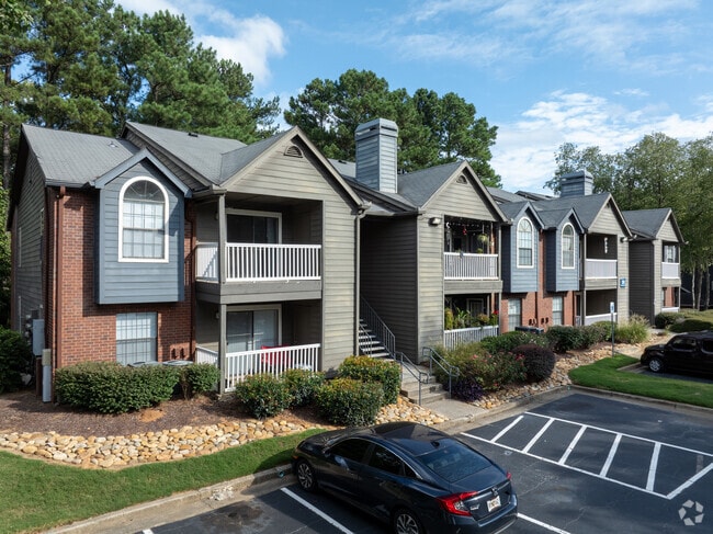

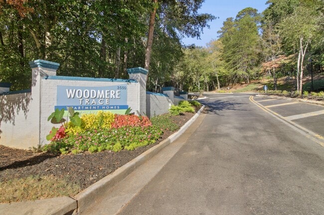
Property Detail
3550 Pleasant Hill Rd
6-291-019
PLEASANT HILL RD
Apartment
Gwinnett
PUD
Georgia
B and X Area of moderate flood hazard, usually the area between the limits of the 100-year and 500-year floods.
291
2025
16.93 AC
2025
Downtown Duluth
050219
Atlanta
197,115 SF
Atlanta-Sandy Springs-Roswell, GA
NEARBY LISTINGS FOR SALE OR LEASE
-
-
View all Duluth listings for sale on LoopNet.com
DEMOGRAPHICS near 3550 Pleasant Hill Rd
1 mile
3 mile
5 mile
2025 Total Population
12,618
73,810
212,405
2030 Population
13,214
76,860
220,686
Pop Growth 2025-2030
+ 4.72%
+ 4.13%
+ 3.90%
Average Age
38
40
38
2025 Total Households
5,146
27,344
77,422
HH Growth 2025-2030
+ 4.70%
+ 4.17%
+ 3.96%
Median Household Inc
$79,488
$95,351
$91,310
Avg Household Size
2.40
2.70
2.70
2025 Avg HH Vehicles
2.00
2.00
2.00
Median Home Value
$371,725
$444,919
$488,663
Median Year Built
1992
1993
1994
Nearby Places
Map Layers
Map Styles
 Street
 Aerial
Layers
 Traffic
 Biking
Places
Listings with unknown addresses are not visible on the map
- Restaurants
- Banks
- Shops
- Fitness
- Groceries
PUBLIC TRANSPORTATION
AIRPORT
Hartsfield - Jackson Atlanta International
Drive
Walk
Distance
Hartsfield - Jackson Atlanta International
50 min
35.5 mi
Freight Ports
Georgia Ports - Savannah
Drive
Walk
Distance
Georgia Ports - Savannah
306 min
270.5 mi
Nearby Properties
Address
Land Use
TOTAL SIZE
Lot Size
Zoning
Address
Land Use
TOTAL SIZE
Lot Size
Zoning
794,057 SF
78.64 AC
PUD
Address
Land Use
TOTAL SIZE
Lot Size
Zoning
508,494 SF
38.74 AC
RM13
Address
Land Use
TOTAL SIZE
Lot Size
Zoning
761,929 SF
65.19 AC
RM13
Address
Land Use
TOTAL SIZE
Lot Size
Zoning
356,984 SF
24.89 AC
PUD
Address
Land Use
TOTAL SIZE
Lot Size
Zoning
346,219 SF
21.95 AC
PUD
Address
Land Use
TOTAL SIZE
Lot Size
Zoning
523,344 SF
40.47 AC
RM
Address
Land Use
TOTAL SIZE
Lot Size
Zoning
439,676 SF
42.88 AC
RM13
Address
Land Use
TOTAL SIZE
Lot Size
Zoning
450,815 SF
45.79 AC
RM10
Address
Land Use
TOTAL SIZE
Lot Size
Zoning
423,004 SF
47.93 AC
RM
Address
Land Use
TOTAL SIZE
Lot Size
Zoning
503,097 SF
40 AC
RM13
Address
Land Use
TOTAL SIZE
Lot Size
Zoning
491,482 SF
41.72 AC
C1
Address
Land Use
TOTAL SIZE
Lot Size
Zoning
620,975 SF
8.10 AC
PUD
Address
Land Use
TOTAL SIZE
Lot Size
Zoning
341,506 SF
36.69 AC
C1
Address
Land Use
TOTAL SIZE
Lot Size
Zoning
329,029 SF
21.16 AC
C1
Address
Land Use
TOTAL SIZE
Lot Size
Zoning
372,904 SF
11.64 AC
PUD
Address
Land Use
TOTAL SIZE
Lot Size
Zoning
609,495 SF
6.28 AC
PUD
Address
Land Use
TOTAL SIZE
Lot Size
Zoning
418,495 SF
22.06 AC
PUD
Address
Land Use
TOTAL SIZE
Lot Size
Zoning
88.90 AC
AG1
Address
Land Use
TOTAL SIZE
Lot Size
Zoning
287,824 SF
31.59 AC
RM
Address
Land Use
TOTAL SIZE
Lot Size
Zoning
217,080 SF
49.32 AC
M1
Address
Land Use
TOTAL SIZE
Lot Size
Zoning
263,285 SF
22.50 AC
RM
Address
Land Use
TOTAL SIZE
Lot Size
Zoning
252,043 SF
22.03 AC
RM
Address
Land Use
TOTAL SIZE
Lot Size
Zoning
256,640 SF
28.59 AC
RM
Address
Land Use
TOTAL SIZE
Lot Size
Zoning
230,830 SF
20.14 AC
RM10
Address
Land Use
TOTAL SIZE
Lot Size
Zoning
1,052,800 SF
51.40 AC
M2
Address
Land Use
TOTAL SIZE
Lot Size
Zoning
326,904 SF
46.73 AC
OI
Address
Land Use
TOTAL SIZE
Lot Size
Zoning
304,001 SF
32 AC
PUD
Address
Land Use
TOTAL SIZE
Lot Size
Zoning
235,586 SF
16.21 AC
PUD
Address
Land Use
TOTAL SIZE
Lot Size
Zoning
308,804 SF
31.10 AC
C2
The World's #1 Commercial Real Estate Marketplace
Connect with us
© 2026 CoStar Group
The information above has been obtained from sources believed reliable. While we do not doubt its accuracy we have not verified it and make no guarantee, warranty or representation about it. It is your responsibility to independently confirm its accuracy and completeness. Any projections, opinions, assumptions, or estimates used are for example only and do not represent the current or future performance of the property. The value of this transaction to you depends on tax and other factors which should be evaluated by your tax, financial, and legal advisors. You and your advisors should conduct a careful, independent investigation of the property to determine to your satisfaction the suitability of the property for your needs.