Property Record
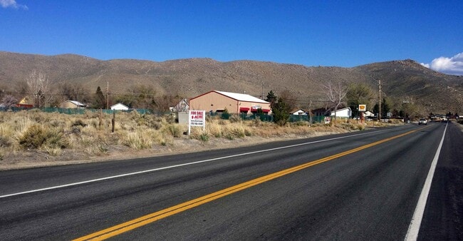
3552 James Dean Ct, Reno, NV 89508

Property Detail
3552 James Dean Ct
Reno, NV
PM 2958 LT 1B
087-550-05
WASHOE
Commercialacreage
Nevada
GC
1b
B and X Area of moderate flood hazard, usually the area between the limits of the 100-year and 500-year floods.
1 AC
2025
N Outlying Washoe County
2026
Reno/Sparks
002612
NEARBY LISTINGS FOR SALE OR LEASE
DEMOGRAPHICS near 3552 James Dean Ct
1 mile
3 mile
5 mile
2025 Total Population
3,715
11,506
20,305
2030 Population
3,767
11,779
20,652
Pop Growth 2025-2030
+ 1.40%
+ 2.37%
+ 1.71%
Average Age
42
41
39
2025 Total Households
1,341
4,079
7,044
HH Growth 2025-2030
+ 1.49%
+ 2.55%
+ 1.90%
Median Household Inc
$76,405
$86,410
$85,433
Avg Household Size
2.70
2.70
2.80
2025 Avg HH Vehicles
3.00
3.00
3.00
Median Home Value
$355,714
$443,122
$430,301
Median Year Built
1991
2002
2000
Nearby Places
Map Layers
Map Styles
 Street
 Aerial
Layers
 Traffic
 Biking
Places
Listings with unknown addresses are not visible on the map
- Restaurants
- Banks
- Shops
- Fitness
- Groceries
PUBLIC TRANSPORTATION
AIRPORT
Reno/Tahoe International
Drive
Walk
Distance
Reno/Tahoe International
41 min
20.6 mi
SALE & LEASE HISTORY
LISTING DATE
SALE/LEASE

Aug 22, 2023
For Sale
Nearby Properties
Address
Land Use
TOTAL SIZE
Lot Size
Zoning
Address
Land Use
TOTAL SIZE
Lot Size
Zoning
139,843 SF
20.90 AC
PSP 95% /
Address
Land Use
TOTAL SIZE
Lot Size
Zoning
86,134 SF
10.07 AC
MDS
Address
Land Use
TOTAL SIZE
Lot Size
Zoning
994 SF
73.47 AC
PSP
Address
Land Use
TOTAL SIZE
Lot Size
Zoning
21,189 SF
12.37 AC
TC
Address
Land Use
TOTAL SIZE
Lot Size
Zoning
41,962 SF
10 AC
PSP
Address
Land Use
TOTAL SIZE
Lot Size
Zoning
79,500 SF
16 AC
I
Address
Land Use
TOTAL SIZE
Lot Size
Zoning
13,453 SF
4.66 AC
LDS
Address
Land Use
TOTAL SIZE
Lot Size
Zoning
8,020 SF
1.42 AC
NC
Address
Land Use
TOTAL SIZE
Lot Size
Zoning
58 AC
I 73% / GR
Address
Land Use
TOTAL SIZE
Lot Size
Zoning
32.67 AC
I
Address
Land Use
TOTAL SIZE
Lot Size
Zoning
10.27 AC
I
Address
Land Use
TOTAL SIZE
Lot Size
Zoning
7,261 SF
2.01 AC
PF
Address
Land Use
TOTAL SIZE
Lot Size
Zoning
1.24 AC
PSP
Address
Land Use
TOTAL SIZE
Lot Size
Zoning
16,896 SF
13.13 AC
I
Address
Land Use
TOTAL SIZE
Lot Size
Zoning
18.94 AC
NC 21% / I
Address
Land Use
TOTAL SIZE
Lot Size
Zoning
2,236 SF
86.32 AC
AGPRES
Address
Land Use
TOTAL SIZE
Lot Size
Zoning
8,000 SF
1 AC
NC
Address
Land Use
TOTAL SIZE
Lot Size
Zoning
308.60 AC
SP
Address
Land Use
TOTAL SIZE
Lot Size
Zoning
15.29 AC
GC
Address
Land Use
TOTAL SIZE
Lot Size
Zoning
99.28 AC
SPD
Address
Land Use
TOTAL SIZE
Lot Size
Zoning
13.03 AC
PR
Address
Land Use
TOTAL SIZE
Lot Size
Zoning
12,240 SF
4.23 AC
NC 71%/ PS
Address
Land Use
TOTAL SIZE
Lot Size
Zoning
243.02 AC
LDS
Address
Land Use
TOTAL SIZE
Lot Size
Zoning
3,515 SF
13.46 AC
PR
Address
Land Use
TOTAL SIZE
Lot Size
Zoning
2,400 SF
0.90 AC
NC
Address
Land Use
TOTAL SIZE
Lot Size
Zoning
9.74 AC
NC
Address
Land Use
TOTAL SIZE
Lot Size
Zoning
0.92 AC
PSP
Address
Land Use
TOTAL SIZE
Lot Size
Zoning
14.38 AC
I
Address
Land Use
TOTAL SIZE
Lot Size
Zoning
Address
Land Use
TOTAL SIZE
Lot Size
Zoning
2,400 SF
0.97 AC
GC
The World's #1 Commercial Real Estate Marketplace
Connect with us
© 2026 CoStar Group
The information above has been obtained from sources believed reliable. While we do not doubt its accuracy we have not verified it and make no guarantee, warranty or representation about it. It is your responsibility to independently confirm its accuracy and completeness. Any projections, opinions, assumptions, or estimates used are for example only and do not represent the current or future performance of the property. The value of this transaction to you depends on tax and other factors which should be evaluated by your tax, financial, and legal advisors. You and your advisors should conduct a careful, independent investigation of the property to determine to your satisfaction the suitability of the property for your needs.