Property Record
3555 Marcola Rd, Springfield, OR 97477
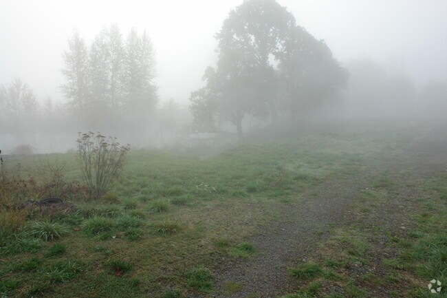
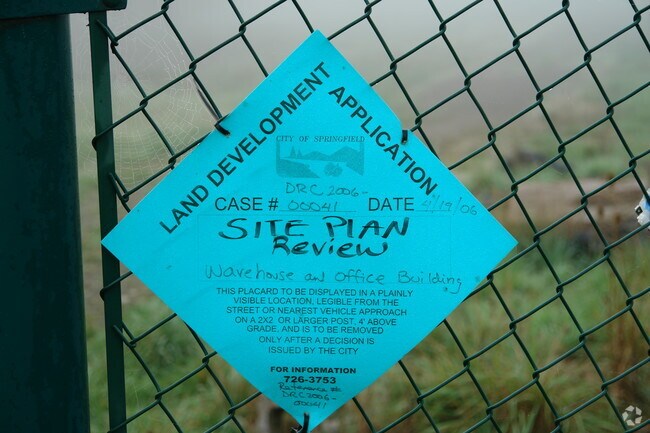
Property Detail
3555 Marcola Rd
Eugene-Springfield, OR
TL 00900
0113801
Lane
Industrialgeneral
Oregon
HI
900
B and X Area of moderate flood hazard, usually the area between the limits of the 100-year and 500-year floods.
4.27 AC
2025
Lane County
2025
Portland
002001
NEARBY LISTINGS FOR SALE OR LEASE
DEMOGRAPHICS near 3555 Marcola Rd
1 mile
3 mile
5 mile
2025 Total Population
4,605
49,312
100,833
2030 Population
4,679
48,853
100,132
Pop Growth 2025-2030
+ 1.61%
(0.93%)
(0.70%)
Average Age
42
40
39
2025 Total Households
1,825
19,665
39,506
HH Growth 2025-2030
+ 1.70%
(1.05%)
(0.84%)
Median Household Inc
$79,671
$69,748
$70,323
Avg Household Size
2.50
2.40
2.40
2025 Avg HH Vehicles
2.00
2.00
2.00
Median Home Value
$438,427
$362,379
$408,368
Median Year Built
1977
1972
1976
Nearby Places
Map Layers
Map Styles
 Street
 Aerial
Transit
 Traffic
 Biking
Places
Listings with unknown addresses are not visible on the map
- Restaurants
- Banks
- Shops
- Fitness
- Groceries
PUBLIC TRANSPORTATION
COMMUTER RAIL
Drive
Walk
Distance
11 min
6.5 mi
AIRPORT
Mahlon Sweet Field
Drive
Walk
Distance
Mahlon Sweet Field
26 min
15.0 mi
Nearby Properties
Address
Land Use
TOTAL SIZE
Lot Size
Zoning
Address
Land Use
TOTAL SIZE
Lot Size
Zoning
Address
Land Use
TOTAL SIZE
Lot Size
Zoning
9.57 AC
LD
Address
Land Use
TOTAL SIZE
Lot Size
Zoning
179 AC
E30
Address
Land Use
TOTAL SIZE
Lot Size
Zoning
33.20 AC
HI
Address
Land Use
TOTAL SIZE
Lot Size
Zoning
22.52 AC
LD
Address
Land Use
TOTAL SIZE
Lot Size
Zoning
Address
Land Use
TOTAL SIZE
Lot Size
Zoning
Address
Land Use
TOTAL SIZE
Lot Size
Zoning
11.23 AC
Address
Land Use
TOTAL SIZE
Lot Size
Zoning
Address
Land Use
TOTAL SIZE
Lot Size
Zoning
Address
Land Use
TOTAL SIZE
Lot Size
Zoning
50.28 AC
LD
Address
Land Use
TOTAL SIZE
Lot Size
Zoning
28.66 AC
LMI
Address
Land Use
TOTAL SIZE
Lot Size
Zoning
19.48 AC
LD
Address
Land Use
TOTAL SIZE
Lot Size
Zoning
35.91 AC
HI
Address
Land Use
TOTAL SIZE
Lot Size
Zoning
27.44 AC
LD
Address
Land Use
TOTAL SIZE
Lot Size
Zoning
Address
Land Use
TOTAL SIZE
Lot Size
Zoning
15.54 AC
HI
Address
Land Use
TOTAL SIZE
Lot Size
Zoning
15.15 AC
LD
Address
Land Use
TOTAL SIZE
Lot Size
Zoning
11.12 AC
HI
Address
Land Use
TOTAL SIZE
Lot Size
Zoning
10.70 AC
LD
Address
Land Use
TOTAL SIZE
Lot Size
Zoning
9.19 AC
E25
Address
Land Use
TOTAL SIZE
Lot Size
Zoning
9.40 AC
LD
Address
Land Use
TOTAL SIZE
Lot Size
Zoning
3.58 AC
HD
Address
Land Use
TOTAL SIZE
Lot Size
Zoning
0.99 AC
MUC
Address
Land Use
TOTAL SIZE
Lot Size
Zoning
18.78 AC
LD
Address
Land Use
TOTAL SIZE
Lot Size
Zoning
13.84 AC
HD
Address
Land Use
TOTAL SIZE
Lot Size
Zoning
57.39 AC
CC
Address
Land Use
TOTAL SIZE
Lot Size
Zoning
9.23 AC
LD
Address
Land Use
TOTAL SIZE
Lot Size
Zoning
18.70 AC
E30
Address
Land Use
TOTAL SIZE
Lot Size
Zoning
7.06 AC
HI
The World's #1 Commercial Real Estate Marketplace
Connect with us
© 2026 CoStar Group
The information above has been obtained from sources believed reliable. While we do not doubt its accuracy we have not verified it and make no guarantee, warranty or representation about it. It is your responsibility to independently confirm its accuracy and completeness. Any projections, opinions, assumptions, or estimates used are for example only and do not represent the current or future performance of the property. The value of this transaction to you depends on tax and other factors which should be evaluated by your tax, financial, and legal advisors. You and your advisors should conduct a careful, independent investigation of the property to determine to your satisfaction the suitability of the property for your needs.