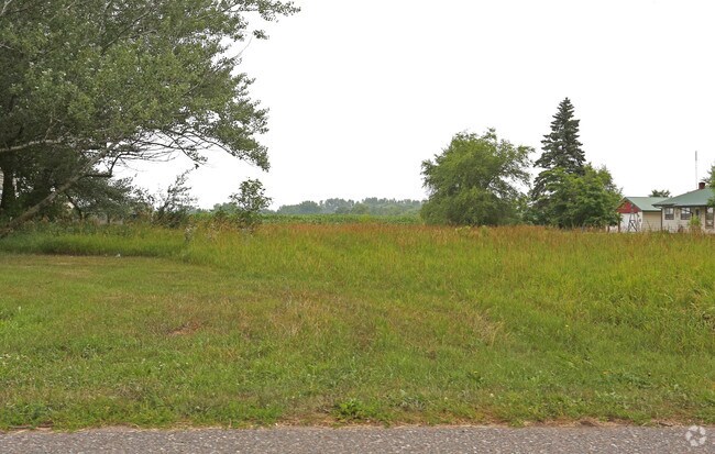
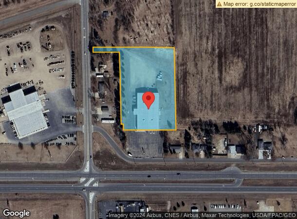
Property Record
3555 Shadowwood Dr Ne, Sauk Rapids, MN 56379
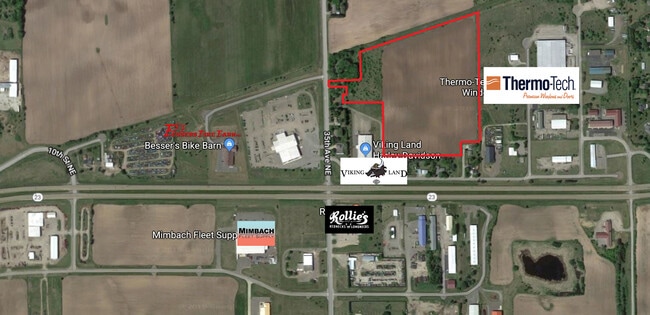
NEARBY LISTINGS FOR SALE OR LEASE
Property Detail
3555 Shadowwood Dr Ne
St. Cloud, MN
Brennans Addition
09.00459.05
SECT-28 TWP-036 RANGE-030 3.50 AC PART OF SW1/4 NW1/4 COMM A NW COR OF LOT 19 OF BRENNAN'S ADDN TH N 30.97 FT TH NWLY 10.95
Commercialnec
Benton
X
Minnesota
27009C0280E
19
2025
3.50 AC
2025
Benton County
020300
Minneapolis/St Paul
10,024 SF
DEMOGRAPHICS near 3555 Shadowwood Dr Ne
1 Mile
3 Mile
5 Mile
2024 Total Population
727
10,394
54,389
2029 Population
750
10,567
56,083
Pop Growth 2024-2029
+ 3.16%
+ 1.66%
+ 3.11%
Average Age
39
36
35
2024 Total Households
258
4,303
20,893
HH Growth 2024-2029
+ 3.10%
+ 1.51%
+ 3.11%
Median Household Inc
$95,426
$63,030
$50,378
Avg Household Size
2.80
2.40
2.30
2024 Avg HH Vehicles
2.00
2.00
2.00
Median Home Value
$305,435
$249,518
$179,202
Median Year Built
2003
1988
1976
Nearby Places
Map Layers
Map Styles
 Street
 Aerial
- Restaurants
- Banks
- Shops
- Fitness
- Groceries
PUBLIC TRANSPORTATION
COMMUTER RAIL
DRIVE
WALK
Distance
6 min
3.5 mi
SALE & LEASE HISTORY
LISTING DATE
SALE/LEASE

Sep 24, 2016
For Sale
Jul 19, 2017
For Sale
Dec 09, 2016
For Sale
Aug 02, 2018
For Sale
Nearby Properties
Address
Land Use
TOTAL SIZE
Lot Size
Zoning
Address
Land Use
TOTAL SIZE
Lot Size
Zoning
362,000 SF
86.20 AC
Address
Land Use
TOTAL SIZE
Lot Size
Zoning
Address
Land Use
TOTAL SIZE
Lot Size
Zoning
Address
Land Use
TOTAL SIZE
Lot Size
Zoning
127,460 SF
5 AC
Address
Land Use
TOTAL SIZE
Lot Size
Zoning
6.61 AC
Address
Land Use
TOTAL SIZE
Lot Size
Zoning
Address
Land Use
TOTAL SIZE
Lot Size
Zoning
29,349 SF
4.83 AC
Address
Land Use
TOTAL SIZE
Lot Size
Zoning
71,940 SF
1.99 AC
Address
Land Use
TOTAL SIZE
Lot Size
Zoning
81,500 SF
11.01 AC
Address
Land Use
TOTAL SIZE
Lot Size
Zoning
4.21 AC
Address
Land Use
TOTAL SIZE
Lot Size
Zoning
61,680 SF
3.39 AC
Address
Land Use
TOTAL SIZE
Lot Size
Zoning
Address
Land Use
TOTAL SIZE
Lot Size
Zoning
32.29 AC
Address
Land Use
TOTAL SIZE
Lot Size
Zoning
4.73 AC
Address
Land Use
TOTAL SIZE
Lot Size
Zoning
Address
Land Use
TOTAL SIZE
Lot Size
Zoning
Address
Land Use
TOTAL SIZE
Lot Size
Zoning
Address
Land Use
TOTAL SIZE
Lot Size
Zoning
Address
Land Use
TOTAL SIZE
Lot Size
Zoning
Address
Land Use
TOTAL SIZE
Lot Size
Zoning
Address
Land Use
TOTAL SIZE
Lot Size
Zoning
72,750 SF
8.26 AC
Address
Land Use
TOTAL SIZE
Lot Size
Zoning
114,600 SF
1.30 AC
Address
Land Use
TOTAL SIZE
Lot Size
Zoning
142,080 SF
12.40 AC
Address
Land Use
TOTAL SIZE
Lot Size
Zoning
65,600 SF
6.67 AC
Address
Land Use
TOTAL SIZE
Lot Size
Zoning
2.55 AC
Address
Land Use
TOTAL SIZE
Lot Size
Zoning
Address
Land Use
TOTAL SIZE
Lot Size
Zoning
101,616 SF
4.20 AC
Address
Land Use
TOTAL SIZE
Lot Size
Zoning
Address
Land Use
TOTAL SIZE
Lot Size
Zoning
9.14 AC
Address
Land Use
TOTAL SIZE
Lot Size
Zoning
The World's #1 Commercial Real Estate Marketplace
Connect with us
© 2026 CoStar Group
The information above has been obtained from sources believed reliable. While we do not doubt its accuracy we have not verified it and make no guarantee, warranty or representation about it. It is your responsibility to independently confirm its accuracy and completeness. Any projections, opinions, assumptions, or estimates used are for example only and do not represent the current or future performance of the property. The value of this transaction to you depends on tax and other factors which should be evaluated by your tax, financial, and legal advisors. You and your advisors should conduct a careful, independent investigation of the property to determine to your satisfaction the suitability of the property for your needs.