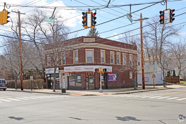
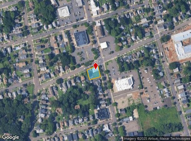
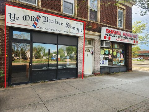
Property Record
360 Campbell Ave, West Haven, CT 06516
NEARBY LISTINGS FOR SALE OR LEASE
Property Detail
360 Campbell Ave
Departmentstore
New Haven
X
Connecticut
09009C0439J
0.24 AC
2025
West Haven
2025
Westchester/So Connecticut
154900
New Haven-Milford, CT
3,498 SF
WHAV-000035-000489
DEMOGRAPHICS near 360 Campbell Ave
1 Mile
3 Mile
5 Mile
2024 Total Population
18,619
86,027
215,699
2029 Population
18,152
85,163
213,500
Pop Growth 2024-2029
(2.51%)
(1.00%)
(1.02%)
Average Age
41
38
38
2024 Total Households
7,915
34,296
83,836
HH Growth 2024-2029
(2.43%)
(0.89%)
(1.01%)
Median Household Inc
$62,890
$60,903
$61,797
Avg Household Size
2.20
2.30
2.30
2024 Avg HH Vehicles
1.00
1.00
1.00
Median Home Value
$205,783
$227,427
$258,700
Median Year Built
1951
1959
1956
Nearby Places
Map Layers
Map Styles
 Street
 Aerial
- Restaurants
- Banks
- Shops
- Fitness
- Groceries
PUBLIC TRANSPORTATION
COMMUTER RAIL
DRIVE
WALK
Distance
2 min
1.1 mi
DRIVE
WALK
Distance
6 min
2.7 mi
AIRPORT
Tweed/New Haven
DRIVE
WALK
Distance
Tweed/New Haven
16 min
7.8 mi
SALE & LEASE HISTORY
LISTING DATE
SALE/LEASE

May 14, 2025
For Lease
Feb 12, 2025
For Sale
Nearby Properties
Address
Land Use
TOTAL SIZE
Lot Size
Zoning
Address
Land Use
TOTAL SIZE
Lot Size
Zoning
289,886 SF
2.21 AC
BD2
Address
Land Use
TOTAL SIZE
Lot Size
Zoning
56,359 SF
17.09 AC
RCPD
Address
Land Use
TOTAL SIZE
Lot Size
Zoning
83,314 SF
2.14 AC
BA
Address
Land Use
TOTAL SIZE
Lot Size
Zoning
50.14 AC
PRD
Address
Land Use
TOTAL SIZE
Lot Size
Zoning
81,870 SF
3.86 AC
RM2
Address
Land Use
TOTAL SIZE
Lot Size
Zoning
446,320 SF
BD1
Address
Land Use
TOTAL SIZE
Lot Size
Zoning
133,767 SF
1.25 AC
BD2
Address
Land Use
TOTAL SIZE
Lot Size
Zoning
486,703 SF
2.12 AC
BD
Address
Land Use
TOTAL SIZE
Lot Size
Zoning
72,708 SF
1.91 AC
PDU 87
Address
Land Use
TOTAL SIZE
Lot Size
Zoning
117,902 SF
1.41 AC
BD
Address
Land Use
TOTAL SIZE
Lot Size
Zoning
318,210 SF
2.73 AC
BA
Address
Land Use
TOTAL SIZE
Lot Size
Zoning
123,166 SF
2.33 AC
RH2
Address
Land Use
TOTAL SIZE
Lot Size
Zoning
42.52 AC
PF
Address
Land Use
TOTAL SIZE
Lot Size
Zoning
123,518 SF
2.88 AC
RH2
Address
Land Use
TOTAL SIZE
Lot Size
Zoning
117,066 SF
71.34 AC
IH
Address
Land Use
TOTAL SIZE
Lot Size
Zoning
287,844 SF
2.11 AC
IL
Address
Land Use
TOTAL SIZE
Lot Size
Zoning
158,622 SF
2.09 AC
BA/RM2
Address
Land Use
TOTAL SIZE
Lot Size
Zoning
29.78 AC
PRD
Address
Land Use
TOTAL SIZE
Lot Size
Zoning
76,945 SF
8.52 AC
RM2
Address
Land Use
TOTAL SIZE
Lot Size
Zoning
35.05 AC
LI-2
Address
Land Use
TOTAL SIZE
Lot Size
Zoning
125,577 SF
0.90 AC
RH2
Address
Land Use
TOTAL SIZE
Lot Size
Zoning
17,462 SF
86.34 AC
PARK
Address
Land Use
TOTAL SIZE
Lot Size
Zoning
205,756 SF
1.27 AC
PDD 15
Address
Land Use
TOTAL SIZE
Lot Size
Zoning
88,578 SF
0.42 AC
PDD 98
Address
Land Use
TOTAL SIZE
Lot Size
Zoning
88,689 SF
0.98 AC
BD
Address
Land Use
TOTAL SIZE
Lot Size
Zoning
840,277 SF
4.28 AC
BD2
Address
Land Use
TOTAL SIZE
Lot Size
Zoning
495,934 SF
0.61 AC
BD
Address
Land Use
TOTAL SIZE
Lot Size
Zoning
119,187 SF
1.38 AC
RO
Address
Land Use
TOTAL SIZE
Lot Size
Zoning
54,372 SF
2.42 AC
BD2
Address
Land Use
TOTAL SIZE
Lot Size
Zoning
45,176 SF
2.93 AC
RH2
The World's #1 Commercial Real Estate Marketplace
Connect with us
© 2025 CoStar Group
The information above has been obtained from sources believed reliable. While we do not doubt its accuracy we have not verified it and make no guarantee, warranty or representation about it. It is your responsibility to independently confirm its accuracy and completeness. Any projections, opinions, assumptions, or estimates used are for example only and do not represent the current or future performance of the property. The value of this transaction to you depends on tax and other factors which should be evaluated by your tax, financial, and legal advisors. You and your advisors should conduct a careful, independent investigation of the property to determine to your satisfaction the suitability of the property for your needs.