Property Record
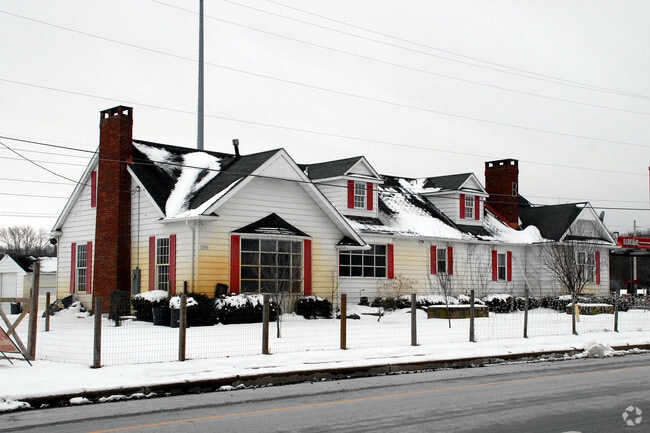
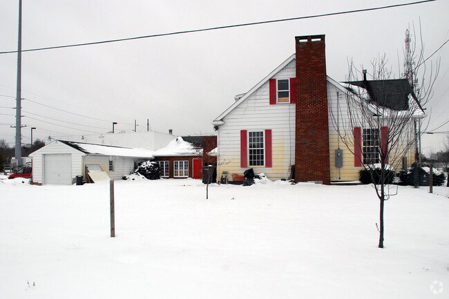
356 Route 40, Penns Grove, NJ 08069

Property Detail
356 Route 40
02-00262-0000-00002
INCL BLK 262 LOTS 2 3 7 & 8
Servicestation
SALEM
GC
New Jersey
AE The base floodplain where base flood elevations are provided. AE Zones are now used on new format FIRMs instead of A1-A30 Zones.
2
2024
6.35 AC
2025
Salem County
020600
Philadelphia
9,158 SF
Philadelphia-Camden-Wilmington, PA-NJ-DE-MD
NEARBY LISTINGS FOR SALE OR LEASE
-
-
View all Penns Grove listings for sale on LoopNet.com
DEMOGRAPHICS near 356 Route 40
1 mile
3 mile
5 mile
2025 Total Population
365
12,437
36,541
2030 Population
370
12,635
37,384
Pop Growth 2025-2030
+ 1.37%
+ 1.59%
+ 2.31%
Average Age
46
42
41
2025 Total Households
146
4,994
14,061
HH Growth 2025-2030
+ 1.37%
+ 1.58%
+ 2.28%
Median Household Inc
$68,749
$81,052
$75,119
Avg Household Size
2.40
2.40
2.50
2025 Avg HH Vehicles
2.00
2.00
2.00
Median Home Value
$231,521
$221,730
$217,995
Median Year Built
1954
1957
1958
Nearby Places
Map Layers
Map Styles
 Street
 Aerial
Layers
 Traffic
 Biking
Places
Listings with unknown addresses are not visible on the map
- Restaurants
- Banks
- Shops
- Fitness
- Groceries
PUBLIC TRANSPORTATION
COMMUTER RAIL
Wilmington (R2 - Southeastern Pennsylvania Transportation Authority Regional Rail (SEPTA Regional Rail))
Drive
Walk
Distance
Wilmington (R2 - Southeastern Pennsylvania Transportation Authority Regional Rail (SEPTA Regional Rail))
16 min
8.2 mi
AIRPORT
Philadelphia International
Drive
Walk
Distance
Philadelphia International
37 min
24.9 mi
Freight Ports
Port of Wilmington, RI
Drive
Walk
Distance
Port of Wilmington, RI
16 min
8.1 mi
Nearby Properties
Address
Land Use
TOTAL SIZE
Lot Size
Zoning
Address
Land Use
TOTAL SIZE
Lot Size
Zoning
118.77 AC
GC
Address
Land Use
TOTAL SIZE
Lot Size
Zoning
412.70 AC
06
Address
Land Use
TOTAL SIZE
Lot Size
Zoning
150.60 AC
AG
Address
Land Use
TOTAL SIZE
Lot Size
Zoning
47.91 AC
IC
Address
Land Use
TOTAL SIZE
Lot Size
Zoning
Address
Land Use
TOTAL SIZE
Lot Size
Zoning
41.27 AC
GC
Address
Land Use
TOTAL SIZE
Lot Size
Zoning
10.75 AC
LC
Address
Land Use
TOTAL SIZE
Lot Size
Zoning
118.77 AC
GC
Address
Land Use
TOTAL SIZE
Lot Size
Zoning
29.05 AC
GC
Address
Land Use
TOTAL SIZE
Lot Size
Zoning
23,402 SF
44.89 AC
LR
Address
Land Use
TOTAL SIZE
Lot Size
Zoning
26.64 AC
GI
Address
Land Use
TOTAL SIZE
Lot Size
Zoning
150.60 AC
AG
Address
Land Use
TOTAL SIZE
Lot Size
Zoning
47.91 AC
IC
Address
Land Use
TOTAL SIZE
Lot Size
Zoning
10.28 AC
IC
Address
Land Use
TOTAL SIZE
Lot Size
Zoning
41.27 AC
GC
Address
Land Use
TOTAL SIZE
Lot Size
Zoning
29.05 AC
GC
Address
Land Use
TOTAL SIZE
Lot Size
Zoning
1,133.55 AC
GI
Address
Land Use
TOTAL SIZE
Lot Size
Zoning
11.76 AC
GC
Address
Land Use
TOTAL SIZE
Lot Size
Zoning
2,016 SF
1.44 AC
02
Address
Land Use
TOTAL SIZE
Lot Size
Zoning
Address
Land Use
TOTAL SIZE
Lot Size
Zoning
31.77 AC
GC
Address
Land Use
TOTAL SIZE
Lot Size
Zoning
19,576 SF
5.70 AC
Address
Land Use
TOTAL SIZE
Lot Size
Zoning
Address
Land Use
TOTAL SIZE
Lot Size
Zoning
25,268 SF
5 AC
LR
Address
Land Use
TOTAL SIZE
Lot Size
Zoning
1,260 SF
3.39 AC
02
Address
Land Use
TOTAL SIZE
Lot Size
Zoning
9,636 SF
10.97 AC
GC
Address
Land Use
TOTAL SIZE
Lot Size
Zoning
Address
Land Use
TOTAL SIZE
Lot Size
Zoning
12,672 SF
11.10 AC
Address
Land Use
TOTAL SIZE
Lot Size
Zoning
6.03 AC
MHR
Address
Land Use
TOTAL SIZE
Lot Size
Zoning
5,520 SF
1.25 AC
The World's #1 Commercial Real Estate Marketplace
Connect with us
© 2026 CoStar Group
The information above has been obtained from sources believed reliable. While we do not doubt its accuracy we have not verified it and make no guarantee, warranty or representation about it. It is your responsibility to independently confirm its accuracy and completeness. Any projections, opinions, assumptions, or estimates used are for example only and do not represent the current or future performance of the property. The value of this transaction to you depends on tax and other factors which should be evaluated by your tax, financial, and legal advisors. You and your advisors should conduct a careful, independent investigation of the property to determine to your satisfaction the suitability of the property for your needs.