Property Record
3563 Philips Hwy, Jacksonville, FL 32207


NEARBY LISTINGS FOR SALE OR LEASE
Property Detail
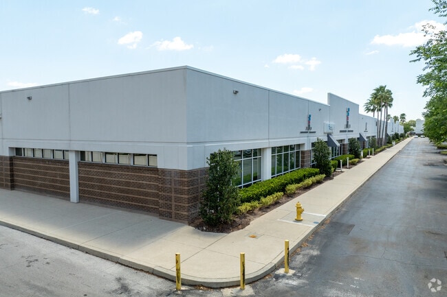
3563 Philips Hwy
Jacksonville, FL
Section Land
126071-0060
31-2S-27E 24.02 PT W1/2 OF NE1/4, PT GOVT LOT 4 RECD O/R 18715-1358 BEING PARCEL 4 (EX PT RECD O/R 6123-1974,20221-176, 20436-2437, 20789-378)
Officebuilding
Duval
X
Florida
12031C0367J
4
2024
24.02 AC
2025
San Marco
000600
Jacksonville (Florida)
379,026 SF
DEMOGRAPHICS near 3563 Philips Hwy
1 Mile
3 Mile
5 Mile
2024 Total Population
11,741
67,965
204,434
2029 Population
12,489
71,906
215,696
Pop Growth 2024-2029
+ 6.37%
+ 5.80%
+ 5.51%
Average Age
38
40
39
2024 Total Households
4,795
28,463
86,597
HH Growth 2024-2029
+ 6.63%
+ 6.22%
+ 5.75%
Median Household Inc
$42,738
$48,143
$48,671
Avg Household Size
2.40
2.20
2.20
2024 Avg HH Vehicles
1.00
1.00
1.00
Median Home Value
$167,603
$246,529
$235,189
Median Year Built
1960
1966
1967
Nearby Places
Map Layers
Map Styles
 Street
 Aerial
- Restaurants
- Banks
- Shops
- Fitness
- Groceries
PUBLIC TRANSPORTATION
COMMUTER RAIL
DRIVE
WALK
Distance
19 min
9.9 mi
AIRPORT
Jacksonville International
DRIVE
WALK
Distance
Jacksonville International
30 min
18.5 mi
Freight Ports
Jacksonville Port
DRIVE
WALK
Distance
Jacksonville Port
14 min
7.3 mi
Nearby Properties
Address
Land Use
TOTAL SIZE
Lot Size
Zoning
Address
Land Use
TOTAL SIZE
Lot Size
Zoning
1,086,885 SF
16.83 AC
CCBD
Address
Land Use
TOTAL SIZE
Lot Size
Zoning
1,150,143 SF
43.90 AC
CCBD
Address
Land Use
TOTAL SIZE
Lot Size
Zoning
442,972 SF
5.33 AC
PUD
Address
Land Use
TOTAL SIZE
Lot Size
Zoning
875,866 SF
22.33 AC
PBF-3
Address
Land Use
TOTAL SIZE
Lot Size
Zoning
165,408 SF
2.45 AC
CCBD
Address
Land Use
TOTAL SIZE
Lot Size
Zoning
521,850 SF
10.06 AC
CCBD
Address
Land Use
TOTAL SIZE
Lot Size
Zoning
831,560 SF
1.16 AC
PUD
Address
Land Use
TOTAL SIZE
Lot Size
Zoning
146,636 SF
2.88 AC
CCBD
Address
Land Use
TOTAL SIZE
Lot Size
Zoning
369,638 SF
6.30 AC
CCBD
Address
Land Use
TOTAL SIZE
Lot Size
Zoning
992,501 SF
2.97 AC
CCBD
Address
Land Use
TOTAL SIZE
Lot Size
Zoning
194,877 SF
11.64 AC
CCBD
Address
Land Use
TOTAL SIZE
Lot Size
Zoning
336,623 SF
1.98 AC
CCBD
Address
Land Use
TOTAL SIZE
Lot Size
Zoning
453,728 SF
8.20 AC
CCBD
Address
Land Use
TOTAL SIZE
Lot Size
Zoning
224,600 SF
3.41 AC
PUD
Address
Land Use
TOTAL SIZE
Lot Size
Zoning
253,858 SF
4.93 AC
PUD
Address
Land Use
TOTAL SIZE
Lot Size
Zoning
270,000 SF
8.90 AC
PUD
Address
Land Use
TOTAL SIZE
Lot Size
Zoning
203,763 SF
9.97 AC
PUD
Address
Land Use
TOTAL SIZE
Lot Size
Zoning
211,073 SF
8.99 AC
PUD
Address
Land Use
TOTAL SIZE
Lot Size
Zoning
189,151 SF
3.57 AC
PUD
Address
Land Use
TOTAL SIZE
Lot Size
Zoning
335,832 SF
6.67 AC
PBF-2
Address
Land Use
TOTAL SIZE
Lot Size
Zoning
155,495 SF
3.01 AC
CCBD
Address
Land Use
TOTAL SIZE
Lot Size
Zoning
229,284 SF
7.24 AC
PUD
Address
Land Use
TOTAL SIZE
Lot Size
Zoning
181,522 SF
6.56 AC
PUD
Address
Land Use
TOTAL SIZE
Lot Size
Zoning
410,225 SF
22.11 AC
PUD
Address
Land Use
TOTAL SIZE
Lot Size
Zoning
415,146 SF
19.27 AC
RMD-D
Address
Land Use
TOTAL SIZE
Lot Size
Zoning
187,581 SF
3.13 AC
PUD
Address
Land Use
TOTAL SIZE
Lot Size
Zoning
93,059 SF
8.54 AC
CCG-2
Address
Land Use
TOTAL SIZE
Lot Size
Zoning
23,689 SF
19.97 AC
CCBD
Address
Land Use
TOTAL SIZE
Lot Size
Zoning
304,461 SF
62.44 AC
PBF-2
Address
Land Use
TOTAL SIZE
Lot Size
Zoning
436,458 SF
6.94 AC
PUD
The World's #1 Commercial Real Estate Marketplace
Connect with us
© 2025 CoStar Group
The information above has been obtained from sources believed reliable. While we do not doubt its accuracy we have not verified it and make no guarantee, warranty or representation about it. It is your responsibility to independently confirm its accuracy and completeness. Any projections, opinions, assumptions, or estimates used are for example only and do not represent the current or future performance of the property. The value of this transaction to you depends on tax and other factors which should be evaluated by your tax, financial, and legal advisors. You and your advisors should conduct a careful, independent investigation of the property to determine to your satisfaction the suitability of the property for your needs.