Property Record
3568 Winsted Rd, Torrington, CT 06790
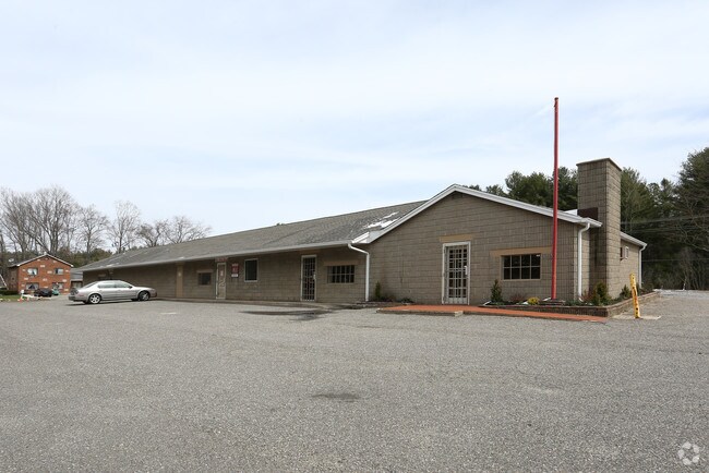


Property Detail
3568 Winsted Rd
TORR-000242-000002-000001
Nw Hills
Storebuilding
Connecticut
LB
1
2025
1.07 AC
2025
Rt 8/Winsted
310700
Hartford
4,994 SF
Torrington, CT
NEARBY LISTINGS FOR SALE OR LEASE
DEMOGRAPHICS near 3568 Winsted Rd
1 mile
3 mile
5 mile
2025 Total Population
450
10,502
28,014
2030 Population
461
10,774
28,353
Pop Growth 2025-2030
+ 2.44%
+ 2.59%
+ 1.21%
Average Age
42
45
45
2025 Total Households
170
4,399
12,128
HH Growth 2025-2030
+ 2.94%
+ 2.66%
+ 1.23%
Median Household Inc
$95,535
$86,125
$82,119
Avg Household Size
2.50
2.30
2.20
2025 Avg HH Vehicles
2.00
2.00
2.00
Median Home Value
$260,526
$283,886
$261,605
Median Year Built
1983
1972
1969
Nearby Places
Map Layers
Map Styles
 Street
 Aerial
Transit
 Traffic
 Biking
Places
Listings with unknown addresses are not visible on the map
- Restaurants
- Banks
- Shops
- Fitness
- Groceries
PUBLIC TRANSPORTATION
AIRPORT
Bradley International
Drive
Walk
Distance
Bradley International
55 min
27.0 mi
Freight Ports
Port of New Haven
Drive
Walk
Distance
Port of New Haven
70 min
50.5 mi
SALE & LEASE HISTORY
LISTING DATE
SALE/LEASE

Sep 24, 2016
For Lease
Sep 23, 2016
For Sale
Aug 08, 2017
For Lease
Nearby Properties
Address
Land Use
TOTAL SIZE
Lot Size
Zoning
Address
Land Use
TOTAL SIZE
Lot Size
Zoning
224,385 SF
26.20 AC
RU-2
Address
Land Use
TOTAL SIZE
Lot Size
Zoning
13.79 AC
CX
Address
Land Use
TOTAL SIZE
Lot Size
Zoning
200,000 SF
32.82 AC
IP
Address
Land Use
TOTAL SIZE
Lot Size
Zoning
20,544 SF
2.42 AC
CB-2
Address
Land Use
TOTAL SIZE
Lot Size
Zoning
30.48 AC
IP
Address
Land Use
TOTAL SIZE
Lot Size
Zoning
24,618 SF
3.63 AC
CB-2
Address
Land Use
TOTAL SIZE
Lot Size
Zoning
5.11 AC
R-3
Address
Land Use
TOTAL SIZE
Lot Size
Zoning
2.32 AC
CB-2
Address
Land Use
TOTAL SIZE
Lot Size
Zoning
132,962 SF
7.30 AC
IP
Address
Land Use
TOTAL SIZE
Lot Size
Zoning
53,252 SF
32.19 AC
RU-1
Address
Land Use
TOTAL SIZE
Lot Size
Zoning
93,750 SF
9.19 AC
IP
Address
Land Use
TOTAL SIZE
Lot Size
Zoning
129,282 SF
27.60 AC
I
Address
Land Use
TOTAL SIZE
Lot Size
Zoning
90,039 SF
6.98 AC
IP
Address
Land Use
TOTAL SIZE
Lot Size
Zoning
33,268 SF
5.27 AC
RA-2
Address
Land Use
TOTAL SIZE
Lot Size
Zoning
193.61 AC
I
Address
Land Use
TOTAL SIZE
Lot Size
Zoning
10.69 AC
IP
Address
Land Use
TOTAL SIZE
Lot Size
Zoning
338.20 AC
R2
Address
Land Use
TOTAL SIZE
Lot Size
Zoning
68,056 SF
16.97 AC
IP
Address
Land Use
TOTAL SIZE
Lot Size
Zoning
50,068 SF
1.97 AC
R-3
Address
Land Use
TOTAL SIZE
Lot Size
Zoning
24,000 SF
0.44 AC
CB-2
Address
Land Use
TOTAL SIZE
Lot Size
Zoning
77,420 SF
8.70 AC
IP
Address
Land Use
TOTAL SIZE
Lot Size
Zoning
14.46 AC
R-1
Address
Land Use
TOTAL SIZE
Lot Size
Zoning
42,850 SF
0.36 AC
CB-3
Address
Land Use
TOTAL SIZE
Lot Size
Zoning
10.25 AC
IP
Address
Land Use
TOTAL SIZE
Lot Size
Zoning
50,096 SF
9.66 AC
IP
Address
Land Use
TOTAL SIZE
Lot Size
Zoning
161.20 AC
R60
Address
Land Use
TOTAL SIZE
Lot Size
Zoning
3.17 AC
IB-3
Address
Land Use
TOTAL SIZE
Lot Size
Zoning
14,496 SF
4.50 AC
LB
Address
Land Use
TOTAL SIZE
Lot Size
Zoning
10,125 SF
1.34 AC
CB-2
Address
Land Use
TOTAL SIZE
Lot Size
Zoning
7.20 AC
I
The World's #1 Commercial Real Estate Marketplace
Connect with us
© 2026 CoStar Group
The information above has been obtained from sources believed reliable. While we do not doubt its accuracy we have not verified it and make no guarantee, warranty or representation about it. It is your responsibility to independently confirm its accuracy and completeness. Any projections, opinions, assumptions, or estimates used are for example only and do not represent the current or future performance of the property. The value of this transaction to you depends on tax and other factors which should be evaluated by your tax, financial, and legal advisors. You and your advisors should conduct a careful, independent investigation of the property to determine to your satisfaction the suitability of the property for your needs.