Property Record
357 Main St, Winthrop, ME 04364
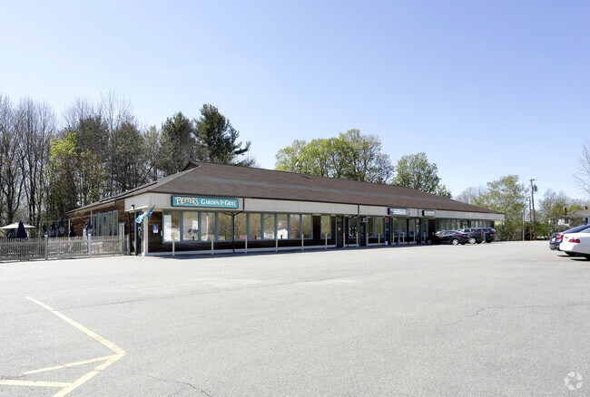

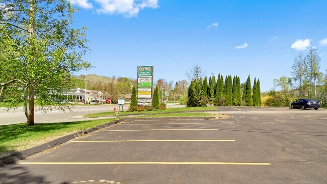

Property Detail
357 Main St
WINP-000032-000000-000038
Kennebec
Commercialbuilding
Maine
MIX
38
B and X Area of moderate flood hazard, usually the area between the limits of the 100-year and 500-year floods.
3.14 AC
2025
Maine South & Augusta
2025
Other Market Areas
014001
Augusta-Waterville, ME
11,036 SF
NEARBY LISTINGS FOR SALE OR LEASE
-
-
View all Winthrop listings for sale on LoopNet.com
DEMOGRAPHICS near 357 Main St
1 mile
3 mile
5 mile
2025 Total Population
1,962
5,598
10,674
2030 Population
2,012
5,744
10,940
Pop Growth 2025-2030
+ 2.55%
+ 2.61%
+ 2.49%
Average Age
43
44
45
2025 Total Households
905
2,433
4,571
HH Growth 2025-2030
+ 2.65%
+ 2.84%
+ 2.73%
Median Household Inc
$63,120
$75,347
$78,256
Avg Household Size
2.10
2.20
2.30
2025 Avg HH Vehicles
2.00
2.00
2.00
Median Home Value
$264,465
$308,964
$314,896
Median Year Built
1960
1974
1977
Nearby Places
Map Layers
Map Styles
 Street
 Aerial
Layers
 Traffic
 Biking
Places
Listings with unknown addresses are not visible on the map
- Restaurants
- Banks
- Shops
- Fitness
- Groceries
SALE & LEASE HISTORY
LISTING DATE
SALE/LEASE

Sep 24, 2016
For Sale
May 15, 2018
For Lease
Jun 19, 2020
For Lease
Jul 08, 2020
For Sale
Jan 04, 2017
For Lease
Nearby Properties
Address
Land Use
TOTAL SIZE
Lot Size
Zoning
Address
Land Use
TOTAL SIZE
Lot Size
Zoning
72,274 SF
90.83 AC
MIX
Address
Land Use
TOTAL SIZE
Lot Size
Zoning
Address
Land Use
TOTAL SIZE
Lot Size
Zoning
21,042 SF
MIX
Address
Land Use
TOTAL SIZE
Lot Size
Zoning
232,995 SF
54.40 AC
MIX
Address
Land Use
TOTAL SIZE
Lot Size
Zoning
17.75 AC
V
Address
Land Use
TOTAL SIZE
Lot Size
Zoning
3.14 AC
V
Address
Land Use
TOTAL SIZE
Lot Size
Zoning
122,149 SF
18.97 AC
GC
Address
Land Use
TOTAL SIZE
Lot Size
Zoning
36,453 SF
3.94 AC
GC
Address
Land Use
TOTAL SIZE
Lot Size
Zoning
149.78 AC
MIX
Address
Land Use
TOTAL SIZE
Lot Size
Zoning
9,786 SF
2.32 AC
GC
Address
Land Use
TOTAL SIZE
Lot Size
Zoning
17.10 AC
GC
Address
Land Use
TOTAL SIZE
Lot Size
Zoning
124.99 AC
MIX
Address
Land Use
TOTAL SIZE
Lot Size
Zoning
14,360 SF
1.24 AC
GC
Address
Land Use
TOTAL SIZE
Lot Size
Zoning
10 AC
MIX
Address
Land Use
TOTAL SIZE
Lot Size
Zoning
13,718 SF
5.30 AC
RU
Address
Land Use
TOTAL SIZE
Lot Size
Zoning
3.67 AC
GR
Address
Land Use
TOTAL SIZE
Lot Size
Zoning
3.19 AC
V
Address
Land Use
TOTAL SIZE
Lot Size
Zoning
3,168 SF
1.97 AC
GC
Address
Land Use
TOTAL SIZE
Lot Size
Zoning
10,902 SF
3.20 AC
GC
Address
Land Use
TOTAL SIZE
Lot Size
Zoning
1,176 SF
RP
Address
Land Use
TOTAL SIZE
Lot Size
Zoning
2.15 AC
GR
Address
Land Use
TOTAL SIZE
Lot Size
Zoning
8.50 AC
RU
Address
Land Use
TOTAL SIZE
Lot Size
Zoning
3.50 AC
MIX
Address
Land Use
TOTAL SIZE
Lot Size
Zoning
5.65 AC
MIX
Address
Land Use
TOTAL SIZE
Lot Size
Zoning
2,788 SF
19.53 AC
MIX
Address
Land Use
TOTAL SIZE
Lot Size
Zoning
5,835 SF
18.95 AC
MIX
Address
Land Use
TOTAL SIZE
Lot Size
Zoning
8,400 SF
1.47 AC
GC
Address
Land Use
TOTAL SIZE
Lot Size
Zoning
20,400 SF
3.10 AC
GC
Address
Land Use
TOTAL SIZE
Lot Size
Zoning
96.66 AC
MIX
Address
Land Use
TOTAL SIZE
Lot Size
Zoning
4,457 SF
1.84 AC
PW
The World's #1 Commercial Real Estate Marketplace
Connect with us
© 2026 CoStar Group
The information above has been obtained from sources believed reliable. While we do not doubt its accuracy we have not verified it and make no guarantee, warranty or representation about it. It is your responsibility to independently confirm its accuracy and completeness. Any projections, opinions, assumptions, or estimates used are for example only and do not represent the current or future performance of the property. The value of this transaction to you depends on tax and other factors which should be evaluated by your tax, financial, and legal advisors. You and your advisors should conduct a careful, independent investigation of the property to determine to your satisfaction the suitability of the property for your needs.