Property Record
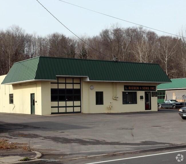
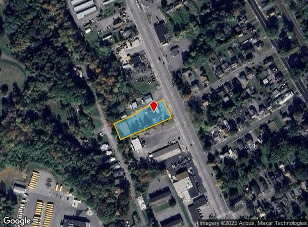
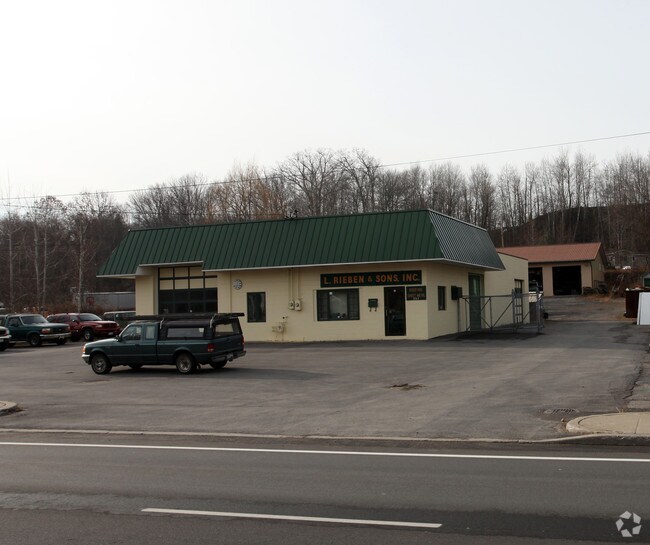
357 Oriskany Blvd, Whitesboro, NY 13492
NEARBY LISTINGS FOR SALE OR LEASE
-
-
View all Whitesboro listings for sale on LoopNet.com
Property Detail
357 Oriskany Blvd
305-005-0001-002-000-0000
Oneida
Warehouse
New York
X
2.000
36065C0593F
0.79 AC
2025
Outlying Oneida County
2024
Utica/Rome
023200
Utica-Rome, NY
3,456 SF
DEMOGRAPHICS near 357 Oriskany Blvd
1 Mile
3 Mile
5 Mile
2024 Total Population
4,251
26,190
83,286
2029 Population
4,173
25,732
81,802
Pop Growth 2024-2029
(1.83%)
(1.75%)
(1.78%)
Average Age
41
42
41
2024 Total Households
1,978
10,282
34,080
HH Growth 2024-2029
(2.02%)
(2.01%)
(1.83%)
Median Household Inc
$63,876
$66,542
$54,025
Avg Household Size
2.10
2.20
2.20
2024 Avg HH Vehicles
2.00
2.00
1.00
Median Home Value
$146,416
$163,449
$153,148
Median Year Built
1953
1955
1952
Nearby Places
- Restaurants
- Banks
- Shops
- Fitness
- Groceries
PUBLIC TRANSPORTATION
COMMUTER RAIL
Utica Amtrak Station (Empire Service - Amtrak, Lake Shore Limited - Amtrak, Maple Leaf - Amtrak)
DRIVE
WALK
Distance
Utica Amtrak Station (Empire Service - Amtrak, Lake Shore Limited - Amtrak, Maple Leaf - Amtrak)
8 min
5.0 mi
Utica (Toronto - New York - VIA Rail)
DRIVE
WALK
Distance
Utica (Toronto - New York - VIA Rail)
8 min
5.1 mi
Freight Ports
Albany, NY Port
DRIVE
WALK
Distance
Albany, NY Port
120 min
100.1 mi
Nearby Properties
Address
Land Use
TOTAL SIZE
Lot Size
Zoning
Address
Land Use
TOTAL SIZE
Lot Size
Zoning
Address
Land Use
TOTAL SIZE
Lot Size
Zoning
127.26 AC
Address
Land Use
TOTAL SIZE
Lot Size
Zoning
1 AC
Address
Land Use
TOTAL SIZE
Lot Size
Zoning
1 AC
Address
Land Use
TOTAL SIZE
Lot Size
Zoning
446,163 SF
24.07 AC
05 - COMME
Address
Land Use
TOTAL SIZE
Lot Size
Zoning
Address
Land Use
TOTAL SIZE
Lot Size
Zoning
3,995 SF
261.48 AC
Address
Land Use
TOTAL SIZE
Lot Size
Zoning
74,414 SF
45.44 AC
01
Address
Land Use
TOTAL SIZE
Lot Size
Zoning
289,000 SF
12.50 AC
Address
Land Use
TOTAL SIZE
Lot Size
Zoning
109,000 SF
13.56 AC
01 - NOT Z
Address
Land Use
TOTAL SIZE
Lot Size
Zoning
50,000 SF
4.20 AC
05 - COMME
Address
Land Use
TOTAL SIZE
Lot Size
Zoning
208,247 SF
20.43 AC
Address
Land Use
TOTAL SIZE
Lot Size
Zoning
131,534 SF
16 AC
05 - COMME
Address
Land Use
TOTAL SIZE
Lot Size
Zoning
180,605 SF
40.60 AC
Address
Land Use
TOTAL SIZE
Lot Size
Zoning
55,916 SF
4.50 AC
Address
Land Use
TOTAL SIZE
Lot Size
Zoning
98,900 SF
28.20 AC
05 - COMME
Address
Land Use
TOTAL SIZE
Lot Size
Zoning
26,085 SF
8.10 AC
01 - NOT Z
Address
Land Use
TOTAL SIZE
Lot Size
Zoning
94,050 SF
22.58 AC
05 - COMME
Address
Land Use
TOTAL SIZE
Lot Size
Zoning
77,584 SF
8 AC
Address
Land Use
TOTAL SIZE
Lot Size
Zoning
8.31 AC
05
Address
Land Use
TOTAL SIZE
Lot Size
Zoning
47,732 SF
0.86 AC
DS
Address
Land Use
TOTAL SIZE
Lot Size
Zoning
57,170 SF
4.40 AC
Address
Land Use
TOTAL SIZE
Lot Size
Zoning
31,023 SF
1.72 AC
Address
Land Use
TOTAL SIZE
Lot Size
Zoning
88,408 SF
6.83 AC
1
Address
Land Use
TOTAL SIZE
Lot Size
Zoning
116,536 SF
71.27 AC
01 - NOT Z
Address
Land Use
TOTAL SIZE
Lot Size
Zoning
10,000 SF
4.30 AC
Address
Land Use
TOTAL SIZE
Lot Size
Zoning
97,800 SF
20.90 AC
05 - COMME
Address
Land Use
TOTAL SIZE
Lot Size
Zoning
113,003 SF
20.18 AC
Address
Land Use
TOTAL SIZE
Lot Size
Zoning
89,690 SF
13.50 AC
05 - COMME
Address
Land Use
TOTAL SIZE
Lot Size
Zoning
720 SF
15.14 AC
05 - COMME
The World's #1 Commercial Real Estate Marketplace
Connect with us
© 2025 CoStar Group
The information above has been obtained from sources believed reliable. While we do not doubt its accuracy we have not verified it and make no guarantee, warranty or representation about it. It is your responsibility to independently confirm its accuracy and completeness. Any projections, opinions, assumptions, or estimates used are for example only and do not represent the current or future performance of the property. The value of this transaction to you depends on tax and other factors which should be evaluated by your tax, financial, and legal advisors. You and your advisors should conduct a careful, independent investigation of the property to determine to your satisfaction the suitability of the property for your needs.