Property Record
357 Windigrove Dr, Waynesboro, VA 22980

Property Detail
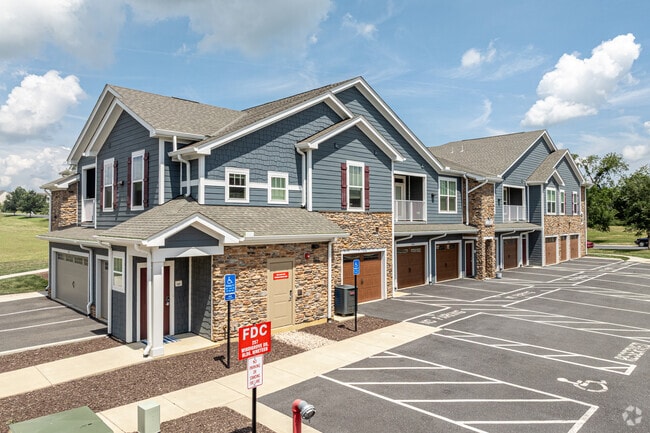
357 Windigrove Dr
62-8-3-2
BLOCK 3 LOT 2 WAYNESBORO PLACE
Apartment
Waynesboro City
PUD
Virginia
B and X Area of moderate flood hazard, usually the area between the limits of the 100-year and 500-year floods.
2
2025
11.54 AC
2025
Staunton & Harrisonburg
003500
Other Market Areas
25,100 SF
Staunton-Stuarts Draft, VA
NEARBY LISTINGS FOR SALE OR LEASE
-
-
View all Waynesboro listings for sale on LoopNet.com
DEMOGRAPHICS near 357 Windigrove Dr
1 mile
3 mile
5 mile
2025 Total Population
3,355
24,544
41,277
2030 Population
3,529
25,537
42,714
Pop Growth 2025-2030
+ 5.19%
+ 4.05%
+ 3.48%
Average Age
43
43
43
2025 Total Households
1,498
10,526
17,324
HH Growth 2025-2030
+ 5.27%
+ 4.11%
+ 3.60%
Median Household Inc
$54,041
$60,886
$63,039
Avg Household Size
2.20
2.30
2.30
2025 Avg HH Vehicles
2.00
2.00
2.00
Median Home Value
$303,634
$283,204
$283,785
Median Year Built
1973
1976
1984
Nearby Places
Map Layers
Map Styles
 Street
 Aerial
Transit
 Traffic
 Biking
Places
Listings with unknown addresses are not visible on the map
- Restaurants
- Banks
- Shops
- Fitness
- Groceries
PUBLIC TRANSPORTATION
AIRPORT
Charlottesville-Albemarle
Drive
Walk
Distance
Charlottesville-Albemarle
52 min
36.6 mi
Freight Ports
Virginia Port Authority - Richmond
Drive
Walk
Distance
Virginia Port Authority - Richmond
123 min
104.6 mi
Nearby Properties
Address
Land Use
TOTAL SIZE
Lot Size
Zoning
Address
Land Use
TOTAL SIZE
Lot Size
Zoning
94,995 SF
20.92 AC
H-B
Address
Land Use
TOTAL SIZE
Lot Size
Zoning
150,944 SF
22.24 AC
RG-5
Address
Land Use
TOTAL SIZE
Lot Size
Zoning
165,670 SF
5.31 AC
R-O
Address
Land Use
TOTAL SIZE
Lot Size
Zoning
11,510 SF
8.31 AC
PUD
Address
Land Use
TOTAL SIZE
Lot Size
Zoning
73,371 SF
13.23 AC
H-B
Address
Land Use
TOTAL SIZE
Lot Size
Zoning
10,527 SF
140.52 AC
RS-12
Address
Land Use
TOTAL SIZE
Lot Size
Zoning
2.08 AC
RG-5
Address
Land Use
TOTAL SIZE
Lot Size
Zoning
191,715 SF
22.54 AC
H-B
Address
Land Use
TOTAL SIZE
Lot Size
Zoning
48,888 SF
9.01 AC
RG-5
Address
Land Use
TOTAL SIZE
Lot Size
Zoning
226,688 SF
24.21 AC
GENERAL IN
Address
Land Use
TOTAL SIZE
Lot Size
Zoning
947 SF
13.62 AC
RG-5
Address
Land Use
TOTAL SIZE
Lot Size
Zoning
29,582 SF
5.36 AC
PUD
Address
Land Use
TOTAL SIZE
Lot Size
Zoning
138,341 SF
18.94 AC
H-B
Address
Land Use
TOTAL SIZE
Lot Size
Zoning
312,551 SF
23.37 AC
L-I
Address
Land Use
TOTAL SIZE
Lot Size
Zoning
301,338 SF
21.52 AC
H-I
Address
Land Use
TOTAL SIZE
Lot Size
Zoning
128,670 SF
10.15 AC
H-B
Address
Land Use
TOTAL SIZE
Lot Size
Zoning
325,376 SF
33 AC
GENERAL IN
Address
Land Use
TOTAL SIZE
Lot Size
Zoning
15,304 SF
13.39 AC
RS-12
Address
Land Use
TOTAL SIZE
Lot Size
Zoning
75,609 SF
12.01 AC
RS-7
Address
Land Use
TOTAL SIZE
Lot Size
Zoning
58,713 SF
3.52 AC
H-B
Address
Land Use
TOTAL SIZE
Lot Size
Zoning
8,050 SF
4.50 AC
R-MF
Address
Land Use
TOTAL SIZE
Lot Size
Zoning
96,070 SF
27.10 AC
H-B
Address
Land Use
TOTAL SIZE
Lot Size
Zoning
104,940 SF
17.26 AC
H-B
Address
Land Use
TOTAL SIZE
Lot Size
Zoning
69,455 SF
2.59 AC
H-B
Address
Land Use
TOTAL SIZE
Lot Size
Zoning
31,977 SF
5.07 AC
RS-12
Address
Land Use
TOTAL SIZE
Lot Size
Zoning
460 SF
144.09 AC
H-I
Address
Land Use
TOTAL SIZE
Lot Size
Zoning
54,400 SF
9.33 AC
H-B
Address
Land Use
TOTAL SIZE
Lot Size
Zoning
7,512 SF
6.39 AC
R-MF
Address
Land Use
TOTAL SIZE
Lot Size
Zoning
2,460 SF
31.78 AC
PUD
The World's #1 Commercial Real Estate Marketplace
Connect with us
© 2026 CoStar Group
The information above has been obtained from sources believed reliable. While we do not doubt its accuracy we have not verified it and make no guarantee, warranty or representation about it. It is your responsibility to independently confirm its accuracy and completeness. Any projections, opinions, assumptions, or estimates used are for example only and do not represent the current or future performance of the property. The value of this transaction to you depends on tax and other factors which should be evaluated by your tax, financial, and legal advisors. You and your advisors should conduct a careful, independent investigation of the property to determine to your satisfaction the suitability of the property for your needs.