Property Record
3575 W Us Highway 40, Greenfield, IN 46140
NEARBY LISTINGS FOR SALE OR LEASE
-
-
View all Greenfield listings for sale on LoopNet.com
Property Detail
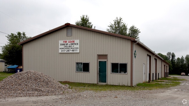
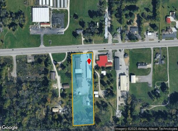
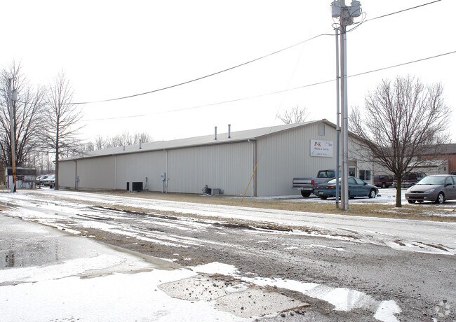
3575 W Us Highway 40
30-10-04-600-027.000-012
MD N 1/2 4-15-6 4.2AC
Industrialgeneral
Hancock
X
Indiana
18059C0138D
4.20 AC
2024
Hancock County
2024
Indianapolis
411000
Indianapolis-Carmel-Anderson, IN
7,552 SF
DEMOGRAPHICS near 3575 W Us Highway 40
1 Mile
3 Mile
5 Mile
2024 Total Population
2,394
8,403
35,467
2029 Population
2,693
9,356
38,717
Pop Growth 2024-2029
+ 12.49%
+ 11.34%
+ 9.16%
Average Age
40
41
41
2024 Total Households
952
3,328
13,754
HH Growth 2024-2029
+ 12.92%
+ 11.69%
+ 9.57%
Median Household Inc
$83,244
$81,753
$85,994
Avg Household Size
2.50
2.50
2.50
2024 Avg HH Vehicles
2.00
2.00
2.00
Median Home Value
$232,732
$226,495
$210,611
Median Year Built
1991
1990
1991
Nearby Places
Map Layers
Map Styles
 Street
 Aerial
- Restaurants
- Banks
- Shops
- Fitness
- Groceries
PUBLIC TRANSPORTATION
AIRPORT
Indianapolis International
DRIVE
WALK
Distance
Indianapolis International
52 min
30.1 mi
Nearby Properties
Address
Land Use
TOTAL SIZE
Lot Size
Zoning
Address
Land Use
TOTAL SIZE
Lot Size
Zoning
54.63 AC
Address
Land Use
TOTAL SIZE
Lot Size
Zoning
15,904 SF
25.81 AC
Address
Land Use
TOTAL SIZE
Lot Size
Zoning
68,060 SF
9.15 AC
Address
Land Use
TOTAL SIZE
Lot Size
Zoning
18,064 SF
6.17 AC
Address
Land Use
TOTAL SIZE
Lot Size
Zoning
33,475 SF
5.32 AC
Address
Land Use
TOTAL SIZE
Lot Size
Zoning
18,128 SF
3.44 AC
Address
Land Use
TOTAL SIZE
Lot Size
Zoning
22,835 SF
11.66 AC
Address
Land Use
TOTAL SIZE
Lot Size
Zoning
14,287 SF
4.24 AC
Address
Land Use
TOTAL SIZE
Lot Size
Zoning
18,407 SF
12.50 AC
Address
Land Use
TOTAL SIZE
Lot Size
Zoning
15,704 SF
4.75 AC
Address
Land Use
TOTAL SIZE
Lot Size
Zoning
20.03 AC
Address
Land Use
TOTAL SIZE
Lot Size
Zoning
9,361 SF
2.26 AC
Address
Land Use
TOTAL SIZE
Lot Size
Zoning
18,064 SF
3.52 AC
Address
Land Use
TOTAL SIZE
Lot Size
Zoning
2,630 SF
22.52 AC
Address
Land Use
TOTAL SIZE
Lot Size
Zoning
9,220 SF
1.48 AC
Address
Land Use
TOTAL SIZE
Lot Size
Zoning
14,576 SF
2.48 AC
Address
Land Use
TOTAL SIZE
Lot Size
Zoning
13,260 SF
11.02 AC
Address
Land Use
TOTAL SIZE
Lot Size
Zoning
10,500 SF
4.76 AC
Address
Land Use
TOTAL SIZE
Lot Size
Zoning
3,111 SF
1.32 AC
Address
Land Use
TOTAL SIZE
Lot Size
Zoning
6,000 SF
7.60 AC
Address
Land Use
TOTAL SIZE
Lot Size
Zoning
5,120 SF
11 AC
Address
Land Use
TOTAL SIZE
Lot Size
Zoning
960 SF
4.10 AC
Address
Land Use
TOTAL SIZE
Lot Size
Zoning
8,160 SF
10 AC
Address
Land Use
TOTAL SIZE
Lot Size
Zoning
896 SF
4.01 AC
Address
Land Use
TOTAL SIZE
Lot Size
Zoning
1,860 SF
1.92 AC
Address
Land Use
TOTAL SIZE
Lot Size
Zoning
2,880 SF
24.94 AC
Address
Land Use
TOTAL SIZE
Lot Size
Zoning
8,100 SF
4.32 AC
Address
Land Use
TOTAL SIZE
Lot Size
Zoning
10,237 SF
9.59 AC
Address
Land Use
TOTAL SIZE
Lot Size
Zoning
9,000 SF
10 AC
Address
Land Use
TOTAL SIZE
Lot Size
Zoning
4,046 SF
0.56 AC
The World's #1 Commercial Real Estate Marketplace
Connect with us
© 2025 CoStar Group
The information above has been obtained from sources believed reliable. While we do not doubt its accuracy we have not verified it and make no guarantee, warranty or representation about it. It is your responsibility to independently confirm its accuracy and completeness. Any projections, opinions, assumptions, or estimates used are for example only and do not represent the current or future performance of the property. The value of this transaction to you depends on tax and other factors which should be evaluated by your tax, financial, and legal advisors. You and your advisors should conduct a careful, independent investigation of the property to determine to your satisfaction the suitability of the property for your needs.