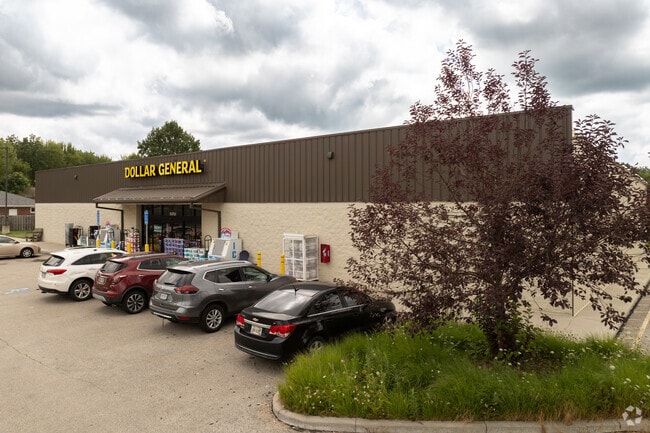
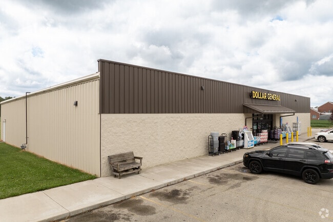
Property Record
35755 Royalton Rd, Grafton, OH 44044

NEARBY LISTINGS FOR SALE OR LEASE
-
-
View all Grafton listings for sale on LoopNet.com
Property Detail
35755 Royalton Rd
11-00-045-000-051
Eaton Township
Departmentstore
Lorain
X
Ohio
39093C0234D
2.91 AC
2024
Lorain County
2024
Cleveland
091100
Cleveland-Elyria, OH
9,100 SF
DEMOGRAPHICS near 35755 Royalton Rd
1 Mile
3 Mile
5 Mile
2024 Total Population
1,474
8,216
49,029
2029 Population
1,543
8,527
50,619
Pop Growth 2024-2029
+ 4.68%
+ 3.79%
+ 3.24%
Average Age
42
43
43
2024 Total Households
578
2,927
18,576
HH Growth 2024-2029
+ 4.50%
+ 4.13%
+ 3.42%
Median Household Inc
$65,800
$70,197
$76,219
Avg Household Size
2.50
2.40
2.40
2024 Avg HH Vehicles
2.00
2.00
2.00
Median Home Value
$145,719
$193,217
$210,789
Median Year Built
1956
1969
1987
Nearby Places
Map Layers
Map Styles
 Street
 Aerial
- Restaurants
- Banks
- Shops
- Fitness
- Groceries
PUBLIC TRANSPORTATION
COMMUTER RAIL
Elyria Amtrak (Capitol Limited - Amtrak, Lake Shore Limited - Amtrak)
DRIVE
WALK
Distance
Elyria Amtrak (Capitol Limited - Amtrak, Lake Shore Limited - Amtrak)
11 min
7.5 mi
AIRPORT
Cleveland-Hopkins International
DRIVE
WALK
Distance
Cleveland-Hopkins International
24 min
15.4 mi
Freight Ports
Port of Toledo
DRIVE
WALK
Distance
Port of Toledo
118 min
97.8 mi
SALE & LEASE HISTORY
LISTING DATE
SALE/LEASE

Jan 30, 2017
For Sale
Jan 30, 2017
For Sale
Nearby Properties
Address
Land Use
TOTAL SIZE
Lot Size
Zoning
Address
Land Use
TOTAL SIZE
Lot Size
Zoning
347,284 SF
34.50 AC
Address
Land Use
TOTAL SIZE
Lot Size
Zoning
79,531 SF
51.20 AC
Address
Land Use
TOTAL SIZE
Lot Size
Zoning
155,964 SF
15.06 AC
Address
Land Use
TOTAL SIZE
Lot Size
Zoning
6,031 SF
92.10 AC
Address
Land Use
TOTAL SIZE
Lot Size
Zoning
66,690 SF
14 AC
Address
Land Use
TOTAL SIZE
Lot Size
Zoning
72,170 SF
27.60 AC
Address
Land Use
TOTAL SIZE
Lot Size
Zoning
33,400 SF
13.90 AC
Address
Land Use
TOTAL SIZE
Lot Size
Zoning
39,212 SF
25 AC
Address
Land Use
TOTAL SIZE
Lot Size
Zoning
16,960 SF
137.91 AC
Address
Land Use
TOTAL SIZE
Lot Size
Zoning
21,599 SF
1 AC
Address
Land Use
TOTAL SIZE
Lot Size
Zoning
14,696 SF
25 AC
Address
Land Use
TOTAL SIZE
Lot Size
Zoning
59,120 SF
80.37 AC
Address
Land Use
TOTAL SIZE
Lot Size
Zoning
14,760 SF
3.14 AC
Address
Land Use
TOTAL SIZE
Lot Size
Zoning
11,000 SF
28.37 AC
Address
Land Use
TOTAL SIZE
Lot Size
Zoning
15,822 SF
20.01 AC
Address
Land Use
TOTAL SIZE
Lot Size
Zoning
9,764 SF
56.20 AC
Address
Land Use
TOTAL SIZE
Lot Size
Zoning
64,180 SF
13.03 AC
Address
Land Use
TOTAL SIZE
Lot Size
Zoning
8,827 SF
45.42 AC
Address
Land Use
TOTAL SIZE
Lot Size
Zoning
149.50 AC
Address
Land Use
TOTAL SIZE
Lot Size
Zoning
73.93 AC
Address
Land Use
TOTAL SIZE
Lot Size
Zoning
2,644 SF
145.84 AC
Address
Land Use
TOTAL SIZE
Lot Size
Zoning
5,900 SF
7.94 AC
Address
Land Use
TOTAL SIZE
Lot Size
Zoning
16.87 AC
Address
Land Use
TOTAL SIZE
Lot Size
Zoning
15,115 SF
4.85 AC
Address
Land Use
TOTAL SIZE
Lot Size
Zoning
9,128 SF
1.39 AC
Address
Land Use
TOTAL SIZE
Lot Size
Zoning
131.87 AC
Address
Land Use
TOTAL SIZE
Lot Size
Zoning
24,654 SF
6.86 AC
Address
Land Use
TOTAL SIZE
Lot Size
Zoning
28,728 SF
23.60 AC
Address
Land Use
TOTAL SIZE
Lot Size
Zoning
13,700 SF
49.25 AC
The World's #1 Commercial Real Estate Marketplace
Connect with us
© 2026 CoStar Group
The information above has been obtained from sources believed reliable. While we do not doubt its accuracy we have not verified it and make no guarantee, warranty or representation about it. It is your responsibility to independently confirm its accuracy and completeness. Any projections, opinions, assumptions, or estimates used are for example only and do not represent the current or future performance of the property. The value of this transaction to you depends on tax and other factors which should be evaluated by your tax, financial, and legal advisors. You and your advisors should conduct a careful, independent investigation of the property to determine to your satisfaction the suitability of the property for your needs.