Property Record
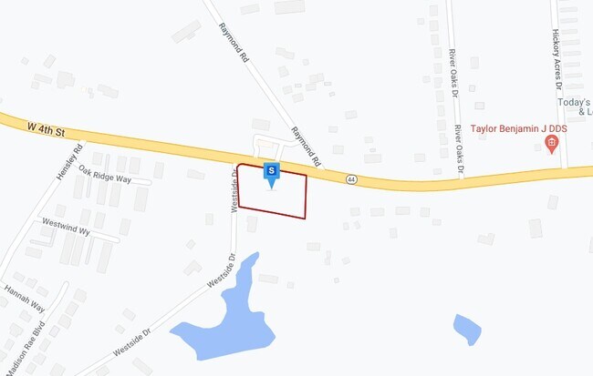
358 Westside Dr, Shepherdsville, KY 40165

Property Detail
358 Westside Dr
Louisville/Jefferson County, KY-IN
LTS 1 2 & 3 WESTSIDE DR
424097
Bullitt
Commercialnec
Kentucky
AE The base floodplain where base flood elevations are provided. AE Zones are now used on new format FIRMs instead of A1-A30 Zones.
1-3
2025
1.30 AC
2025
Bullitt County
020702
Louisville
NEARBY LISTINGS FOR SALE OR LEASE
DEMOGRAPHICS near 358 Westside Dr
1 mile
3 mile
5 mile
2025 Total Population
5,033
18,285
26,775
2030 Population
5,189
18,999
27,883
Pop Growth 2025-2030
+ 3.10%
+ 3.90%
+ 4.14%
Average Age
37
39
41
2025 Total Households
1,949
7,053
10,318
HH Growth 2025-2030
+ 3.03%
+ 3.87%
+ 4.12%
Median Household Inc
$53,142
$61,163
$66,795
Avg Household Size
2.50
2.60
2.60
2025 Avg HH Vehicles
2.00
2.00
2.00
Median Home Value
$155,645
$218,088
$246,562
Median Year Built
1991
1993
1992
Nearby Places
Map Layers
Map Styles
 Street
 Aerial
Layers
 Traffic
 Biking
Places
Listings with unknown addresses are not visible on the map
- Restaurants
- Banks
- Shops
- Fitness
- Groceries
PUBLIC TRANSPORTATION
AIRPORT
Louisville Muhammad Ali International
Drive
Walk
Distance
Louisville Muhammad Ali International
27 min
17.5 mi
Freight Ports
Port of Toledo
Drive
Walk
Distance
Port of Toledo
379 min
324.6 mi
Nearby Properties
Address
Land Use
TOTAL SIZE
Lot Size
Zoning
Address
Land Use
TOTAL SIZE
Lot Size
Zoning
Address
Land Use
TOTAL SIZE
Lot Size
Zoning
Address
Land Use
TOTAL SIZE
Lot Size
Zoning
Address
Land Use
TOTAL SIZE
Lot Size
Zoning
Address
Land Use
TOTAL SIZE
Lot Size
Zoning
42.39 AC
Address
Land Use
TOTAL SIZE
Lot Size
Zoning
Address
Land Use
TOTAL SIZE
Lot Size
Zoning
Address
Land Use
TOTAL SIZE
Lot Size
Zoning
Address
Land Use
TOTAL SIZE
Lot Size
Zoning
400,260 SF
32.97 AC
Address
Land Use
TOTAL SIZE
Lot Size
Zoning
Address
Land Use
TOTAL SIZE
Lot Size
Zoning
Address
Land Use
TOTAL SIZE
Lot Size
Zoning
Address
Land Use
TOTAL SIZE
Lot Size
Zoning
Address
Land Use
TOTAL SIZE
Lot Size
Zoning
Address
Land Use
TOTAL SIZE
Lot Size
Zoning
912 SF
37 AC
Address
Land Use
TOTAL SIZE
Lot Size
Zoning
46,120 SF
7.50 AC
Address
Land Use
TOTAL SIZE
Lot Size
Zoning
3,937 SF
15.26 AC
Address
Land Use
TOTAL SIZE
Lot Size
Zoning
Address
Land Use
TOTAL SIZE
Lot Size
Zoning
Address
Land Use
TOTAL SIZE
Lot Size
Zoning
7,088 SF
17.45 AC
Address
Land Use
TOTAL SIZE
Lot Size
Zoning
Address
Land Use
TOTAL SIZE
Lot Size
Zoning
Address
Land Use
TOTAL SIZE
Lot Size
Zoning
Address
Land Use
TOTAL SIZE
Lot Size
Zoning
Address
Land Use
TOTAL SIZE
Lot Size
Zoning
48,325 SF
5.35 AC
Address
Land Use
TOTAL SIZE
Lot Size
Zoning
13.42 AC
Address
Land Use
TOTAL SIZE
Lot Size
Zoning
102,305 SF
10.70 AC
Address
Land Use
TOTAL SIZE
Lot Size
Zoning
70,768 SF
8.70 AC
Address
Land Use
TOTAL SIZE
Lot Size
Zoning
Address
Land Use
TOTAL SIZE
Lot Size
Zoning
The World's #1 Commercial Real Estate Marketplace
Connect with us
© 2026 CoStar Group
The information above has been obtained from sources believed reliable. While we do not doubt its accuracy we have not verified it and make no guarantee, warranty or representation about it. It is your responsibility to independently confirm its accuracy and completeness. Any projections, opinions, assumptions, or estimates used are for example only and do not represent the current or future performance of the property. The value of this transaction to you depends on tax and other factors which should be evaluated by your tax, financial, and legal advisors. You and your advisors should conduct a careful, independent investigation of the property to determine to your satisfaction the suitability of the property for your needs.