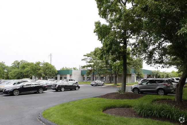
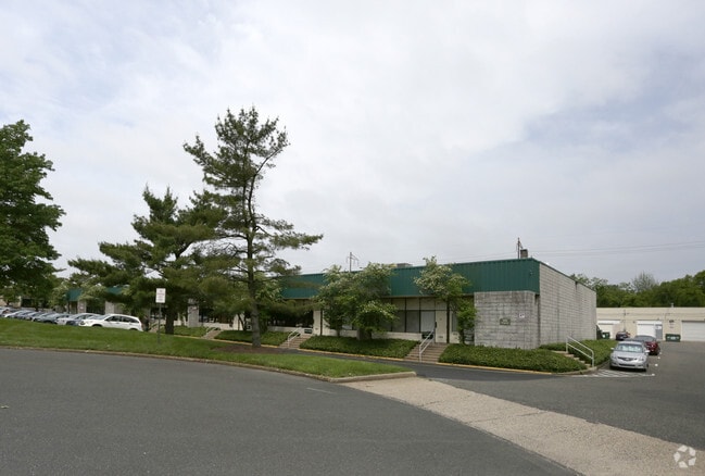
Property Record
3580 Progress Dr, Bensalem, PA 19020


Current Lease Availabilities
Property Detail
3580 Progress Dr
02-075-043-009
LOT #9-1 SEC 2 EXPRESSWAY 95IND PARK
Warehouse
Bucks
M2
Pennsylvania
B and X Area of moderate flood hazard, usually the area between the limits of the 100-year and 500-year floods.
9
2024
5.31 AC
2025
Bucks
100102
Philadelphia
57,706 SF
Philadelphia-Camden-Wilmington, PA-NJ-DE-MD
NEARBY LISTINGS FOR SALE OR LEASE
DEMOGRAPHICS near 3580 Progress Dr
1 mile
3 mile
5 mile
2025 Total Population
7,386
87,923
259,766
2030 Population
7,401
88,590
261,250
Pop Growth 2025-2030
+ 0.20%
+ 0.76%
+ 0.57%
Average Age
41
42
42
2025 Total Households
2,768
33,747
100,122
HH Growth 2025-2030
+ 0.07%
+ 0.82%
+ 0.46%
Median Household Inc
$88,484
$78,510
$82,395
Avg Household Size
2.60
2.50
2.50
2025 Avg HH Vehicles
2.00
2.00
2.00
Median Home Value
$362,543
$300,039
$304,677
Median Year Built
1972
1968
1966
Nearby Places
Map Layers
Map Styles
 Street
 Aerial
Layers
 Traffic
 Biking
Places
Listings with unknown addresses are not visible on the map
- Restaurants
- Banks
- Shops
- Fitness
- Groceries
PUBLIC TRANSPORTATION
TRANSIT/SUBWAY
Eddington (R7 - Southeastern Pennsylvania Transportation Authority Regional Rail (SEPTA Regional Rail))
Drive
Walk
Distance
Eddington (R7 - Southeastern Pennsylvania Transportation Authority Regional Rail (SEPTA Regional Rail))
3 min
15 min
0.8 mi
COMMUTER RAIL
Eddington (R7 - Southeastern Pennsylvania Transportation Authority Regional Rail (SEPTA Regional Rail))
Drive
Walk
Distance
Eddington (R7 - Southeastern Pennsylvania Transportation Authority Regional Rail (SEPTA Regional Rail))
3 min
15 min
0.8 mi
Croydon (R7 - Southeastern Pennsylvania Transportation Authority Regional Rail (SEPTA Regional Rail))
Drive
Walk
Distance
Croydon (R7 - Southeastern Pennsylvania Transportation Authority Regional Rail (SEPTA Regional Rail))
8 min
2.3 mi
AIRPORT
Trenton Mercer
Drive
Walk
Distance
Trenton Mercer
30 min
18.5 mi
Philadelphia International
Drive
Walk
Distance
Philadelphia International
42 min
26.9 mi
Nearby Properties
Address
Land Use
TOTAL SIZE
Lot Size
Zoning
Address
Land Use
TOTAL SIZE
Lot Size
Zoning
34,350 SF
336 AC
SPPOA
Address
Land Use
TOTAL SIZE
Lot Size
Zoning
6,290 SF
177.73 AC
RSA4
Address
Land Use
TOTAL SIZE
Lot Size
Zoning
1,615,457 SF
119.41 AC
CA2
Address
Land Use
TOTAL SIZE
Lot Size
Zoning
410.98 AC
R2
Address
Land Use
TOTAL SIZE
Lot Size
Zoning
453,038 SF
34.79 AC
I1
Address
Land Use
TOTAL SIZE
Lot Size
Zoning
300,700 SF
30.41 AC
I1
Address
Land Use
TOTAL SIZE
Lot Size
Zoning
207,500 SF
16.18 AC
I1
Address
Land Use
TOTAL SIZE
Lot Size
Zoning
241,392 SF
24.15 AC
I1
Address
Land Use
TOTAL SIZE
Lot Size
Zoning
179,868 SF
11.70 AC
CA2
Address
Land Use
TOTAL SIZE
Lot Size
Zoning
123,411 SF
12.80 AC
RSD3
Address
Land Use
TOTAL SIZE
Lot Size
Zoning
32.72 AC
Address
Land Use
TOTAL SIZE
Lot Size
Zoning
Address
Land Use
TOTAL SIZE
Lot Size
Zoning
136,315 SF
11.38 AC
CA1
Address
Land Use
TOTAL SIZE
Lot Size
Zoning
234,965 SF
18.36 AC
CA1
Address
Land Use
TOTAL SIZE
Lot Size
Zoning
74,878 SF
8.45 AC
CA1
Address
Land Use
TOTAL SIZE
Lot Size
Zoning
1,325 SF
18.73 AC
Address
Land Use
TOTAL SIZE
Lot Size
Zoning
160,862 SF
5.93 AC
RM2
Address
Land Use
TOTAL SIZE
Lot Size
Zoning
3.44 AC
I-2
Address
Land Use
TOTAL SIZE
Lot Size
Zoning
13.66 AC
SPPOA
Address
Land Use
TOTAL SIZE
Lot Size
Zoning
72,715 SF
46.60 AC
RSD2
Address
Land Use
TOTAL SIZE
Lot Size
Zoning
75,280 SF
7.98 AC
CA1
Address
Land Use
TOTAL SIZE
Lot Size
Zoning
11.06 AC
SPPOA
Address
Land Use
TOTAL SIZE
Lot Size
Zoning
15.09 AC
I-1
Address
Land Use
TOTAL SIZE
Lot Size
Zoning
1,808 SF
16.06 AC
I-2
Address
Land Use
TOTAL SIZE
Lot Size
Zoning
78,110 SF
12.20 AC
RSA4
Address
Land Use
TOTAL SIZE
Lot Size
Zoning
8.96 AC
SPPOA
Address
Land Use
TOTAL SIZE
Lot Size
Zoning
2.18 AC
Address
Land Use
TOTAL SIZE
Lot Size
Zoning
155,000 SF
10.17 AC
CA1
Address
Land Use
TOTAL SIZE
Lot Size
Zoning
153,644 SF
10.08 AC
CA1
Address
Land Use
TOTAL SIZE
Lot Size
Zoning
153,644 SF
10.08 AC
CA1
The World's #1 Commercial Real Estate Marketplace
Connect with us
© 2026 CoStar Group
The information above has been obtained from sources believed reliable. While we do not doubt its accuracy we have not verified it and make no guarantee, warranty or representation about it. It is your responsibility to independently confirm its accuracy and completeness. Any projections, opinions, assumptions, or estimates used are for example only and do not represent the current or future performance of the property. The value of this transaction to you depends on tax and other factors which should be evaluated by your tax, financial, and legal advisors. You and your advisors should conduct a careful, independent investigation of the property to determine to your satisfaction the suitability of the property for your needs.