Property Record
3583 Miller Rd, Flint, MI 48503


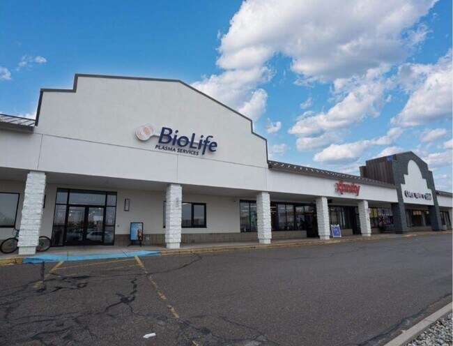
Property Detail
3583 Miller Rd
07-27-100-026
A PARCEL OF LAND BEG AT W 1/4 COR OF SEC TH N 1 DEG 17 MIN 46 SEC W 200 FT TH N 88 DEG 42 MIN 14 SEC E 550 FT TH N 1 DEG 17
Commercialnec
GENESEE
AE The base floodplain where base flood elevations are provided. AE Zones are now used on new format FIRMs instead of A1-A30 Zones.
Michigan
2024
28.67 AC
2025
Flint
002800
Detroit
130,127 SF
Flint, MI
NEARBY LISTINGS FOR SALE OR LEASE
DEMOGRAPHICS near 3583 Miller Rd
1 mile
3 mile
5 mile
2025 Total Population
1,507
38,157
112,695
2030 Population
1,467
37,858
112,732
Pop Growth 2025-2030
(2.65%)
(0.78%)
+ 0.03%
Average Age
45
40
41
2025 Total Households
727
16,310
47,521
HH Growth 2025-2030
(2.61%)
(0.82%)
+ 0.03%
Median Household Inc
$42,909
$55,180
$51,118
Avg Household Size
2.00
2.30
2.30
2025 Avg HH Vehicles
1.00
1.00
2.00
Median Home Value
$168,496
$121,955
$118,156
Median Year Built
1963
1962
1962
Nearby Places
Map Layers
Map Styles
 Street
 Aerial
Layers
 Traffic
 Biking
Places
Listings with unknown addresses are not visible on the map
- Restaurants
- Banks
- Shops
- Fitness
- Groceries
PUBLIC TRANSPORTATION
COMMUTER RAIL
Flint Amtrak Station (Blue Water - Amtrak)
Drive
Walk
Distance
Flint Amtrak Station (Blue Water - Amtrak)
12 min
6.9 mi
AIRPORT
Bishop International
Drive
Walk
Distance
Bishop International
16 min
4.7 mi
Freight Ports
Port of Toledo
Drive
Walk
Distance
Port of Toledo
133 min
112.1 mi
SALE & LEASE HISTORY
LISTING DATE
SALE/LEASE

Sep 24, 2016
For Lease
Jun 22, 2017
For Lease
Jan 09, 2023
For Sale
Feb 26, 2019
For Sale
Aug 29, 2019
For Lease
Nearby Properties
Address
Land Use
TOTAL SIZE
Lot Size
Zoning
Address
Land Use
TOTAL SIZE
Lot Size
Zoning
381,509 SF
371.45 AC
PC
Address
Land Use
TOTAL SIZE
Lot Size
Zoning
Address
Land Use
TOTAL SIZE
Lot Size
Zoning
911,140 SF
Address
Land Use
TOTAL SIZE
Lot Size
Zoning
260,000 SF
15.55 AC
PC
Address
Land Use
TOTAL SIZE
Lot Size
Zoning
101,590 SF
5.54 AC
Address
Land Use
TOTAL SIZE
Lot Size
Zoning
120,487 SF
5.81 AC
PRC
Address
Land Use
TOTAL SIZE
Lot Size
Zoning
51.34 AC
I-2
Address
Land Use
TOTAL SIZE
Lot Size
Zoning
54,651 SF
3.06 AC
Address
Land Use
TOTAL SIZE
Lot Size
Zoning
585,182 SF
78.28 AC
Address
Land Use
TOTAL SIZE
Lot Size
Zoning
401,680 SF
20.41 AC
PC
Address
Land Use
TOTAL SIZE
Lot Size
Zoning
112,232 SF
196 AC
Address
Land Use
TOTAL SIZE
Lot Size
Zoning
65,746 SF
3.97 AC
C-4
Address
Land Use
TOTAL SIZE
Lot Size
Zoning
Address
Land Use
TOTAL SIZE
Lot Size
Zoning
406,416 SF
21.10 AC
PC
Address
Land Use
TOTAL SIZE
Lot Size
Zoning
75,536 SF
8.97 AC
PRC
Address
Land Use
TOTAL SIZE
Lot Size
Zoning
99,992 SF
8.39 AC
Address
Land Use
TOTAL SIZE
Lot Size
Zoning
59,232 SF
3.65 AC
Address
Land Use
TOTAL SIZE
Lot Size
Zoning
100,000 SF
Address
Land Use
TOTAL SIZE
Lot Size
Zoning
100,750 SF
Address
Land Use
TOTAL SIZE
Lot Size
Zoning
460,000 SF
51.12 AC
PC
Address
Land Use
TOTAL SIZE
Lot Size
Zoning
247,555 SF
198 AC
Address
Land Use
TOTAL SIZE
Lot Size
Zoning
85,936 SF
12.71 AC
Address
Land Use
TOTAL SIZE
Lot Size
Zoning
61,892 SF
10.61 AC
Address
Land Use
TOTAL SIZE
Lot Size
Zoning
153,343 SF
14.83 AC
Address
Land Use
TOTAL SIZE
Lot Size
Zoning
74.13 AC
I-2
Address
Land Use
TOTAL SIZE
Lot Size
Zoning
64,150 SF
3.64 AC
PRC
Address
Land Use
TOTAL SIZE
Lot Size
Zoning
48,557 SF
2.99 AC
Address
Land Use
TOTAL SIZE
Lot Size
Zoning
27,100 SF
4.73 AC
Address
Land Use
TOTAL SIZE
Lot Size
Zoning
76,823 SF
114 AC
Address
Land Use
TOTAL SIZE
Lot Size
Zoning
23,500 SF
4.96 AC
The World's #1 Commercial Real Estate Marketplace
Connect with us
© 2026 CoStar Group
The information above has been obtained from sources believed reliable. While we do not doubt its accuracy we have not verified it and make no guarantee, warranty or representation about it. It is your responsibility to independently confirm its accuracy and completeness. Any projections, opinions, assumptions, or estimates used are for example only and do not represent the current or future performance of the property. The value of this transaction to you depends on tax and other factors which should be evaluated by your tax, financial, and legal advisors. You and your advisors should conduct a careful, independent investigation of the property to determine to your satisfaction the suitability of the property for your needs.