Property Record
3585 Harrison Blvd, Ogden, UT 84403


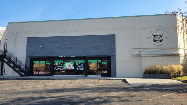
Current Lease Availabilities
Property Detail
3585 Harrison Blvd
Ogden, UT
BEGINNING AT A POINT ON THE EAST LINE OF BRINKER AVENUE (A 54 FOOT WIDE ROAD) WHICH POINT IS NORTH 89D02' WEST 6.00 FEET FROM
05-050-0004
Weber
Stripcommercialcenter
Utah
B and X Area of moderate flood hazard, usually the area between the limits of the 100-year and 500-year floods.
13,30
2025
1.44 AC
2025
Davis/Weber Counties
201600
Salt Lake City
10,690 SF
NEARBY LISTINGS FOR SALE OR LEASE
DEMOGRAPHICS near 3585 Harrison Blvd
1 mile
3 mile
5 mile
2025 Total Population
13,686
80,600
144,767
2030 Population
13,917
83,122
149,640
Pop Growth 2025-2030
+ 1.69%
+ 3.13%
+ 3.37%
Average Age
35
37
36
2025 Total Households
4,885
30,282
53,372
HH Growth 2025-2030
+ 2.01%
+ 3.48%
+ 3.66%
Median Household Inc
$75,380
$73,655
$75,961
Avg Household Size
2.70
2.50
2.60
2025 Avg HH Vehicles
2.00
2.00
2.00
Median Home Value
$365,117
$396,932
$393,057
Median Year Built
1954
1966
1974
Nearby Places
Map Layers
Map Styles
 Street
 Aerial
Layers
 Traffic
 Biking
Places
Listings with unknown addresses are not visible on the map
- Restaurants
- Banks
- Shops
- Fitness
- Groceries
PUBLIC TRANSPORTATION
COMMUTER RAIL
Ogden (FrontRunner North - Utah Transit Authority (UTA))
Drive
Walk
Distance
Ogden (FrontRunner North - Utah Transit Authority (UTA))
7 min
3.6 mi
Roy (FrontRunner North - Utah Transit Authority (UTA))
Drive
Walk
Distance
Roy (FrontRunner North - Utah Transit Authority (UTA))
13 min
6.4 mi
AIRPORT
Salt Lake City International
Drive
Walk
Distance
Salt Lake City International
47 min
35.0 mi
Freight Ports
Port of Stockton
Drive
Walk
Distance
Port of Stockton
747 min
725.4 mi
Nearby Properties
Address
Land Use
TOTAL SIZE
Lot Size
Zoning
Address
Land Use
TOTAL SIZE
Lot Size
Zoning
790,525 SF
57.26 AC
Address
Land Use
TOTAL SIZE
Lot Size
Zoning
200,509 SF
12.75 AC
Address
Land Use
TOTAL SIZE
Lot Size
Zoning
97,932 SF
3.07 AC
Address
Land Use
TOTAL SIZE
Lot Size
Zoning
52,200 SF
9.95 AC
Address
Land Use
TOTAL SIZE
Lot Size
Zoning
305,444 SF
1.58 AC
Address
Land Use
TOTAL SIZE
Lot Size
Zoning
152,877 SF
4.96 AC
Address
Land Use
TOTAL SIZE
Lot Size
Zoning
83,038 SF
7.54 AC
Address
Land Use
TOTAL SIZE
Lot Size
Zoning
48,177 SF
5.54 AC
Address
Land Use
TOTAL SIZE
Lot Size
Zoning
98,660 SF
3.18 AC
Address
Land Use
TOTAL SIZE
Lot Size
Zoning
106,752 SF
10.35 AC
Address
Land Use
TOTAL SIZE
Lot Size
Zoning
22,227 SF
10.81 AC
Address
Land Use
TOTAL SIZE
Lot Size
Zoning
119,043 SF
2.05 AC
Address
Land Use
TOTAL SIZE
Lot Size
Zoning
95,949 SF
3.29 AC
Address
Land Use
TOTAL SIZE
Lot Size
Zoning
4,442 SF
7.19 AC
Address
Land Use
TOTAL SIZE
Lot Size
Zoning
166,800 SF
0.12 AC
Address
Land Use
TOTAL SIZE
Lot Size
Zoning
225,497 SF
20.33 AC
Address
Land Use
TOTAL SIZE
Lot Size
Zoning
19,594 SF
1.12 AC
Address
Land Use
TOTAL SIZE
Lot Size
Zoning
47,750 SF
2.10 AC
Address
Land Use
TOTAL SIZE
Lot Size
Zoning
73,942 SF
8.87 AC
Address
Land Use
TOTAL SIZE
Lot Size
Zoning
7,567 SF
5.12 AC
Address
Land Use
TOTAL SIZE
Lot Size
Zoning
14,520 SF
6.86 AC
Address
Land Use
TOTAL SIZE
Lot Size
Zoning
2,938 SF
9.69 AC
Address
Land Use
TOTAL SIZE
Lot Size
Zoning
151,615 SF
5.08 AC
Address
Land Use
TOTAL SIZE
Lot Size
Zoning
100,056 SF
2.03 AC
Address
Land Use
TOTAL SIZE
Lot Size
Zoning
10,440 SF
4.24 AC
The World's #1 Commercial Real Estate Marketplace
Connect with us
© 2026 CoStar Group
The information above has been obtained from sources believed reliable. While we do not doubt its accuracy we have not verified it and make no guarantee, warranty or representation about it. It is your responsibility to independently confirm its accuracy and completeness. Any projections, opinions, assumptions, or estimates used are for example only and do not represent the current or future performance of the property. The value of this transaction to you depends on tax and other factors which should be evaluated by your tax, financial, and legal advisors. You and your advisors should conduct a careful, independent investigation of the property to determine to your satisfaction the suitability of the property for your needs.