Property Record
359 E Northfield Rd, Livingston, NJ 07039

Property Detail
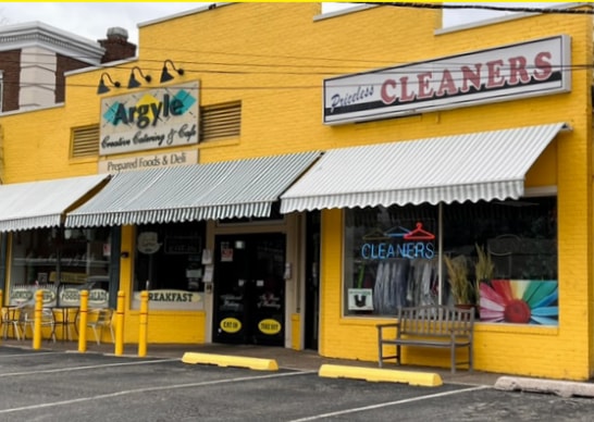
359 E Northfield Rd
10-02504-0000-00019
53X174
Storemultistory
Essex
P-B3
New Jersey
B and X Area of moderate flood hazard, usually the area between the limits of the 100-year and 500-year floods.
19
2024
0.21 AC
2025
Suburban Essex/Rt 280
020600
Northern New Jersey
3,804 SF
Newark, NJ
NEARBY LISTINGS FOR SALE OR LEASE
DEMOGRAPHICS near 359 E Northfield Rd
1 mile
3 mile
5 mile
2025 Total Population
10,916
97,066
431,885
2030 Population
11,687
102,693
452,274
Pop Growth 2025-2030
+ 7.06%
+ 5.80%
+ 4.72%
Average Age
44
41
40
2025 Total Households
4,125
33,471
156,854
HH Growth 2025-2030
+ 6.79%
+ 5.84%
+ 4.85%
Median Household Inc
$186,414
$196,951
$104,465
Avg Household Size
2.50
2.80
2.70
2025 Avg HH Vehicles
2.00
2.00
2.00
Median Home Value
$731,660
$759,044
$633,198
Median Year Built
1968
1958
1956
Nearby Places
Map Layers
Map Styles
 Street
 Aerial
Layers
 Traffic
 Biking
Places
Listings with unknown addresses are not visible on the map
- Restaurants
- Banks
- Shops
- Fitness
- Groceries
PUBLIC TRANSPORTATION
COMMUTER RAIL
Millburn (Morris & Essex Gladstone Branch - NJ Transit Commuter Rail (NJ Transit), Morris & Essex Morristown Line - NJ Transit Commuter Rail (NJ Transit))
Drive
Walk
Distance
Millburn (Morris & Essex Gladstone Branch - NJ Transit Commuter Rail (NJ Transit), Morris & Essex Morristown Line - NJ Transit Commuter Rail (NJ Transit))
10 min
3.8 mi
Highland Avenue (Morris & Essex Gladstone Branch - NJ Transit Commuter Rail (NJ Transit), Morris & Essex Morristown Line - NJ Transit Commuter Rail (NJ Transit))
Drive
Walk
Distance
Highland Avenue (Morris & Essex Gladstone Branch - NJ Transit Commuter Rail (NJ Transit), Morris & Essex Morristown Line - NJ Transit Commuter Rail (NJ Transit))
11 min
4.3 mi
AIRPORT
Newark Liberty International
Drive
Walk
Distance
Newark Liberty International
26 min
13.0 mi
LaGuardia
Drive
Walk
Distance
LaGuardia
55 min
27.7 mi
John F Kennedy International
Drive
Walk
Distance
John F Kennedy International
66 min
37.1 mi
Freight Ports
Maher Terminal
Drive
Walk
Distance
Maher Terminal
31 min
14.9 mi
SALE & LEASE HISTORY
LISTING DATE
SALE/LEASE

May 09, 2023
For Sale
Nearby Properties
Address
Land Use
TOTAL SIZE
Lot Size
Zoning
Address
Land Use
TOTAL SIZE
Lot Size
Zoning
58,665.50 AC
R-1
Address
Land Use
TOTAL SIZE
Lot Size
Zoning
231 AC
R1-7
Address
Land Use
TOTAL SIZE
Lot Size
Zoning
219 AC
R1-7
Address
Land Use
TOTAL SIZE
Lot Size
Zoning
2,626 SF
650.80 AC
Address
Land Use
TOTAL SIZE
Lot Size
Zoning
33.60 AC
P-C
Address
Land Use
TOTAL SIZE
Lot Size
Zoning
47.02 AC
R-1
Address
Land Use
TOTAL SIZE
Lot Size
Zoning
34.47 AC
R-2
Address
Land Use
TOTAL SIZE
Lot Size
Zoning
42.64 AC
D-S
Address
Land Use
TOTAL SIZE
Lot Size
Zoning
Address
Land Use
TOTAL SIZE
Lot Size
Zoning
Address
Land Use
TOTAL SIZE
Lot Size
Zoning
0.23 AC
REDV
Address
Land Use
TOTAL SIZE
Lot Size
Zoning
4.60 AC
PRD
Address
Land Use
TOTAL SIZE
Lot Size
Zoning
18.98 AC
R-5B
Address
Land Use
TOTAL SIZE
Lot Size
Zoning
19.70 AC
R-4
Address
Land Use
TOTAL SIZE
Lot Size
Zoning
101.44 AC
OB-1
Address
Land Use
TOTAL SIZE
Lot Size
Zoning
317,431 SF
20.97 AC
R-2
Address
Land Use
TOTAL SIZE
Lot Size
Zoning
23.40 AC
R1
Address
Land Use
TOTAL SIZE
Lot Size
Zoning
19,498 SF
0.67 AC
FVRZ
Address
Land Use
TOTAL SIZE
Lot Size
Zoning
11,296 SF
17.50 AC
R-G
Address
Land Use
TOTAL SIZE
Lot Size
Zoning
119,746 SF
8.79 AC
R-1
Address
Land Use
TOTAL SIZE
Lot Size
Zoning
55.22 AC
R-2
Address
Land Use
TOTAL SIZE
Lot Size
Zoning
Address
Land Use
TOTAL SIZE
Lot Size
Zoning
5.65 AC
R100
Address
Land Use
TOTAL SIZE
Lot Size
Zoning
561,510 SF
35.55 AC
P-B2
Address
Land Use
TOTAL SIZE
Lot Size
Zoning
12,808 SF
12.08 AC
R-G
Address
Land Use
TOTAL SIZE
Lot Size
Zoning
216,359 SF
13.87 AC
R-5B
Address
Land Use
TOTAL SIZE
Lot Size
Zoning
6.74 AC
R-1
Address
Land Use
TOTAL SIZE
Lot Size
Zoning
19.70 AC
R-3
Address
Land Use
TOTAL SIZE
Lot Size
Zoning
15.50 AC
R-1
Address
Land Use
TOTAL SIZE
Lot Size
Zoning
110,049 SF
4.45 AC
R-5D
The World's #1 Commercial Real Estate Marketplace
Connect with us
© 2026 CoStar Group
The information above has been obtained from sources believed reliable. While we do not doubt its accuracy we have not verified it and make no guarantee, warranty or representation about it. It is your responsibility to independently confirm its accuracy and completeness. Any projections, opinions, assumptions, or estimates used are for example only and do not represent the current or future performance of the property. The value of this transaction to you depends on tax and other factors which should be evaluated by your tax, financial, and legal advisors. You and your advisors should conduct a careful, independent investigation of the property to determine to your satisfaction the suitability of the property for your needs.