Property Record
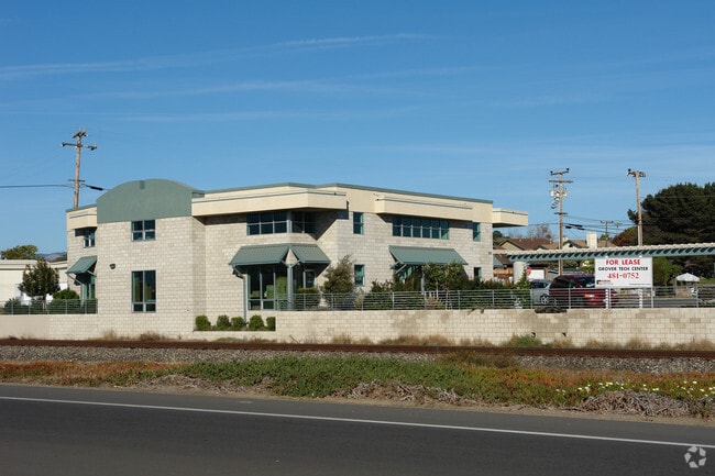
359 Front St, Grover Beach, CA 93433


Property Detail
359 Front St
060-131-020
CY GB PM 54/74 PTN PAR 1
Multipleuses
San Luis Obispo
CIC
California
B and X Area of moderate flood hazard, usually the area between the limits of the 100-year and 500-year floods.
2.18 AC
2023
South 101 Corridor
2025
San Luis Obispo/Paso Robles
012102
San Luis Obispo-Paso Robles, CA
5,097 SF
NEARBY LISTINGS FOR SALE OR LEASE
DEMOGRAPHICS near 359 Front St
1 mile
3 mile
5 mile
2025 Total Population
8,299
39,683
52,542
2030 Population
8,360
39,714
52,548
Pop Growth 2025-2030
+ 0.74%
+ 0.08%
+ 0.01%
Average Age
43
43
45
2025 Total Households
3,529
16,276
21,791
HH Growth 2025-2030
+ 0.60%
+ 0.04%
(0.02%)
Median Household Inc
$91,644
$89,464
$96,297
Avg Household Size
2.30
2.40
2.40
2025 Avg HH Vehicles
2.00
2.00
2.00
Median Home Value
$746,183
$774,561
$834,287
Median Year Built
1975
1980
1980
Nearby Places
Map Layers
Map Styles
 Street
 Aerial
Transit
 Traffic
 Biking
Places
Listings with unknown addresses are not visible on the map
- Restaurants
- Banks
- Shops
- Fitness
- Groceries
PUBLIC TRANSPORTATION
COMMUTER RAIL
Grover Beach Amtrak (Pacific Surfliner - Amtrak)
Drive
Walk
Distance
Grover Beach Amtrak (Pacific Surfliner - Amtrak)
2 min
12 min
0.6 mi
AIRPORT
San Luis County Regional
Drive
Walk
Distance
San Luis County Regional
18 min
10.2 mi
Freight Ports
The Port of Hueneme
Drive
Walk
Distance
The Port of Hueneme
156 min
120.8 mi
SALE & LEASE HISTORY
LISTING DATE
SALE/LEASE

Aug 22, 2017
For Lease
Nearby Properties
Address
Land Use
TOTAL SIZE
Lot Size
Zoning
Address
Land Use
TOTAL SIZE
Lot Size
Zoning
94,017 SF
1.45 AC
CD
Address
Land Use
TOTAL SIZE
Lot Size
Zoning
52,717 SF
6.30 AC
VR
Address
Land Use
TOTAL SIZE
Lot Size
Zoning
149,488 SF
14.90 AC
Address
Land Use
TOTAL SIZE
Lot Size
Zoning
77,687 SF
4.80 AC
R4
Address
Land Use
TOTAL SIZE
Lot Size
Zoning
84,460 SF
4.12 AC
RRH
Address
Land Use
TOTAL SIZE
Lot Size
Zoning
1.20 AC
Address
Land Use
TOTAL SIZE
Lot Size
Zoning
66,455 SF
22.18 AC
GC
Address
Land Use
TOTAL SIZE
Lot Size
Zoning
40,860 SF
3.72 AC
CRS
Address
Land Use
TOTAL SIZE
Lot Size
Zoning
880 AC
RL
Address
Land Use
TOTAL SIZE
Lot Size
Zoning
58,544 SF
9.51 AC
R4
Address
Land Use
TOTAL SIZE
Lot Size
Zoning
21,865 SF
1.10 AC
C2
Address
Land Use
TOTAL SIZE
Lot Size
Zoning
85,866 SF
7.18 AC
GC
Address
Land Use
TOTAL SIZE
Lot Size
Zoning
74,553 SF
6.14 AC
CBD
Address
Land Use
TOTAL SIZE
Lot Size
Zoning
44,067 SF
2.38 AC
O
Address
Land Use
TOTAL SIZE
Lot Size
Zoning
99,676 SF
3.12 AC
RC
Address
Land Use
TOTAL SIZE
Lot Size
Zoning
816 SF
4.09 AC
CPC
Address
Land Use
TOTAL SIZE
Lot Size
Zoning
55,156 SF
6.88 AC
CG
Address
Land Use
TOTAL SIZE
Lot Size
Zoning
1,464 SF
3.62 AC
CS
Address
Land Use
TOTAL SIZE
Lot Size
Zoning
75,066 SF
1.11 AC
R4
Address
Land Use
TOTAL SIZE
Lot Size
Zoning
5,264 SF
7.91 AC
RMF
Address
Land Use
TOTAL SIZE
Lot Size
Zoning
2.60 AC
R3
Address
Land Use
TOTAL SIZE
Lot Size
Zoning
64,430 SF
2.20 AC
R4
Address
Land Use
TOTAL SIZE
Lot Size
Zoning
43,040 SF
3.08 AC
PC
Address
Land Use
TOTAL SIZE
Lot Size
Zoning
34,122 SF
7.68 AC
GC
Address
Land Use
TOTAL SIZE
Lot Size
Zoning
5,993 SF
1.17 AC
R4
Address
Land Use
TOTAL SIZE
Lot Size
Zoning
86,620 SF
6.40 AC
PD
Address
Land Use
TOTAL SIZE
Lot Size
Zoning
4.82 AC
R4
Address
Land Use
TOTAL SIZE
Lot Size
Zoning
62,984 SF
1.50 AC
GC
Address
Land Use
TOTAL SIZE
Lot Size
Zoning
56,280 SF
2.28 AC
Address
Land Use
TOTAL SIZE
Lot Size
Zoning
36,054 SF
2.90 AC
CRS
The World's #1 Commercial Real Estate Marketplace
Connect with us
© 2026 CoStar Group
The information above has been obtained from sources believed reliable. While we do not doubt its accuracy we have not verified it and make no guarantee, warranty or representation about it. It is your responsibility to independently confirm its accuracy and completeness. Any projections, opinions, assumptions, or estimates used are for example only and do not represent the current or future performance of the property. The value of this transaction to you depends on tax and other factors which should be evaluated by your tax, financial, and legal advisors. You and your advisors should conduct a careful, independent investigation of the property to determine to your satisfaction the suitability of the property for your needs.