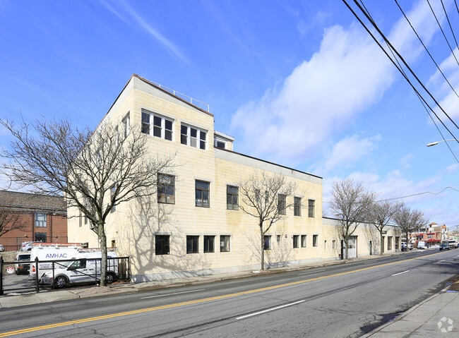
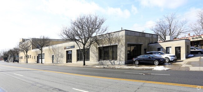
Property Record
359 White Plains Rd, Eastchester, NY 10709
NEARBY LISTINGS FOR SALE OR LEASE
Property Detail
359 White Plains Rd
2489-067-000-00007-000-0009
Westchester
Apartment
New York
X
9
36119C0329F
0.14 AC
2025
Southeast
2024
Westchester/So Connecticut
005100
New York-Jersey City-White Plains, NY-NJ
DEMOGRAPHICS near 359 White Plains Rd
1 Mile
3 Mile
5 Mile
2024 Total Population
21,361
184,881
553,837
2029 Population
20,923
180,583
535,934
Pop Growth 2024-2029
(2.05%)
(2.32%)
(3.23%)
Average Age
42
43
41
2024 Total Households
8,132
69,783
204,503
HH Growth 2024-2029
(2.29%)
(2.42%)
(3.33%)
Median Household Inc
$141,317
$119,242
$92,045
Avg Household Size
2.50
2.50
2.60
2024 Avg HH Vehicles
2.00
2.00
1.00
Median Home Value
$713,725
$648,234
$639,124
Median Year Built
1954
1952
1952
Nearby Places
- Restaurants
- Banks
- Shops
- Fitness
- Groceries
PUBLIC TRANSPORTATION
TRANSIT/SUBWAY
Crestwood Station (Harlem Line - Metro-North Commuter Railroad Company (Metro-North))
DRIVE
WALK
Distance
Crestwood Station (Harlem Line - Metro-North Commuter Railroad Company (Metro-North))
4 min
15 min
0.8 mi
Tuckahoe Station (Harlem Line - Metro-North Commuter Railroad Company (Metro-North))
DRIVE
WALK
Distance
Tuckahoe Station (Harlem Line - Metro-North Commuter Railroad Company (Metro-North))
2 min
17 min
0.9 mi
COMMUTER RAIL
Crestwood Station (Harlem Line - Metro-North Commuter Railroad Company (Metro-North))
DRIVE
WALK
Distance
Crestwood Station (Harlem Line - Metro-North Commuter Railroad Company (Metro-North))
2 min
15 min
0.7 mi
Tuckahoe Station (Harlem Line - Metro-North Commuter Railroad Company (Metro-North))
DRIVE
WALK
Distance
Tuckahoe Station (Harlem Line - Metro-North Commuter Railroad Company (Metro-North))
2 min
18 min
0.9 mi
AIRPORT
Westchester County
DRIVE
WALK
Distance
Westchester County
22 min
13.8 mi
LaGuardia
DRIVE
WALK
Distance
LaGuardia
29 min
17.0 mi
John F Kennedy International
DRIVE
WALK
Distance
John F Kennedy International
36 min
24.6 mi
Freight Ports
NY - Red Hook Container Terminal
DRIVE
WALK
Distance
NY - Red Hook Container Terminal
44 min
27.5 mi
Nearby Properties
Address
Land Use
TOTAL SIZE
Lot Size
Zoning
Address
Land Use
TOTAL SIZE
Lot Size
Zoning
18,000 SF
13.85 AC
A
Address
Land Use
TOTAL SIZE
Lot Size
Zoning
201,590 SF
4.13 AC
BA
Address
Land Use
TOTAL SIZE
Lot Size
Zoning
301,156 SF
13.94 AC
A
Address
Land Use
TOTAL SIZE
Lot Size
Zoning
70,737 SF
1.67 AC
BB
Address
Land Use
TOTAL SIZE
Lot Size
Zoning
13.22 AC
CA
Address
Land Use
TOTAL SIZE
Lot Size
Zoning
77.52 AC
A3
Address
Land Use
TOTAL SIZE
Lot Size
Zoning
64,165 SF
3.24 AC
B
Address
Land Use
TOTAL SIZE
Lot Size
Zoning
82,895 SF
23.03 AC
A2
Address
Land Use
TOTAL SIZE
Lot Size
Zoning
5,170 SF
9.08 AC
B
Address
Land Use
TOTAL SIZE
Lot Size
Zoning
98,910 SF
0.91 AC
VCR-0
Address
Land Use
TOTAL SIZE
Lot Size
Zoning
67,917 SF
6.79 AC
A4
Address
Land Use
TOTAL SIZE
Lot Size
Zoning
1,451 SF
6.97 AC
CA
Address
Land Use
TOTAL SIZE
Lot Size
Zoning
58,450 SF
0.38 AC
VCR-2
Address
Land Use
TOTAL SIZE
Lot Size
Zoning
26,138 SF
0.33 AC
PUD-1
Address
Land Use
TOTAL SIZE
Lot Size
Zoning
76,258 SF
4.22 AC
R7.5
Address
Land Use
TOTAL SIZE
Lot Size
Zoning
13.56 AC
R-15
Address
Land Use
TOTAL SIZE
Lot Size
Zoning
7,855 SF
1.10 AC
C
Address
Land Use
TOTAL SIZE
Lot Size
Zoning
67,572 SF
0.46 AC
VCO-2
Address
Land Use
TOTAL SIZE
Lot Size
Zoning
50,302 SF
0.59 AC
VCR-2
Address
Land Use
TOTAL SIZE
Lot Size
Zoning
69.90 AC
R-20
Address
Land Use
TOTAL SIZE
Lot Size
Zoning
136,050 SF
1.42 AC
PUD-1
Address
Land Use
TOTAL SIZE
Lot Size
Zoning
5.50 AC
R-20
Address
Land Use
TOTAL SIZE
Lot Size
Zoning
3.52 AC
CA
Address
Land Use
TOTAL SIZE
Lot Size
Zoning
29,405 SF
0.80 AC
A3
Address
Land Use
TOTAL SIZE
Lot Size
Zoning
5.69 AC
CA
Address
Land Use
TOTAL SIZE
Lot Size
Zoning
32,612 SF
138.70 AC
AA1/A
Address
Land Use
TOTAL SIZE
Lot Size
Zoning
12,093 SF
0.50 AC
A5
Address
Land Use
TOTAL SIZE
Lot Size
Zoning
27.22 AC
A2/A3
Address
Land Use
TOTAL SIZE
Lot Size
Zoning
36,413 SF
0.89 AC
A
Address
Land Use
TOTAL SIZE
Lot Size
Zoning
26,813 SF
4.17 AC
A3
The World's #1 Commercial Real Estate Marketplace
Connect with us
© 2025 CoStar Group
The information above has been obtained from sources believed reliable. While we do not doubt its accuracy we have not verified it and make no guarantee, warranty or representation about it. It is your responsibility to independently confirm its accuracy and completeness. Any projections, opinions, assumptions, or estimates used are for example only and do not represent the current or future performance of the property. The value of this transaction to you depends on tax and other factors which should be evaluated by your tax, financial, and legal advisors. You and your advisors should conduct a careful, independent investigation of the property to determine to your satisfaction the suitability of the property for your needs.