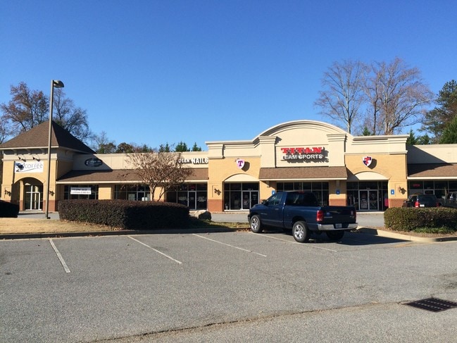
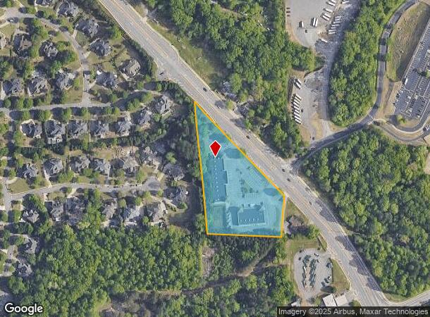
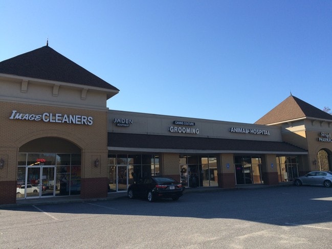
Property Record
3590 Old Atlanta Rd, Suwanee, GA 30024

NEARBY LISTINGS FOR SALE OR LEASE
Property Detail
3590 Old Atlanta Rd
Atlanta-Sandy Springs-Roswell, GA
Old Atlanta Comm
159-512
2-1 999
Commercialnec
Forsyth
X
Georgia
13117C0232F
999
2024
3.34 AC
2025
Cumming/Forsyth Cnty
130615
Atlanta
21,740 SF
DEMOGRAPHICS near 3590 Old Atlanta Rd
1 Mile
3 Mile
5 Mile
2024 Total Population
7,183
60,574
163,111
2029 Population
8,235
69,199
179,139
Pop Growth 2024-2029
+ 14.65%
+ 14.24%
+ 9.83%
Average Age
38
38
38
2024 Total Households
2,047
18,440
52,112
HH Growth 2024-2029
+ 14.70%
+ 14.35%
+ 9.89%
Median Household Inc
$174,688
$161,011
$146,123
Avg Household Size
3.50
3.30
3.10
2024 Avg HH Vehicles
3.00
2.00
2.00
Median Home Value
$645,614
$548,027
$481,114
Median Year Built
1998
2003
2001
Nearby Places
Map Layers
Map Styles
 Street
 Aerial
- Restaurants
- Banks
- Shops
- Fitness
- Groceries
SALE & LEASE HISTORY
LISTING DATE
SALE/LEASE

Sep 24, 2016
For Lease
Sep 12, 2017
For Lease
Nov 17, 2025
For Lease
Aug 03, 2017
For Lease
Nearby Properties
Address
Land Use
TOTAL SIZE
Lot Size
Zoning
Address
Land Use
TOTAL SIZE
Lot Size
Zoning
424,176 SF
59.62 AC
R3
Address
Land Use
TOTAL SIZE
Lot Size
Zoning
370,414 SF
14.34 AC
PMUD
Address
Land Use
TOTAL SIZE
Lot Size
Zoning
321,116 SF
17.06 AC
CBD
Address
Land Use
TOTAL SIZE
Lot Size
Zoning
47,721 SF
12.99 AC
CBD
Address
Land Use
TOTAL SIZE
Lot Size
Zoning
99,600 SF
91.27 AC
CR1
Address
Land Use
TOTAL SIZE
Lot Size
Zoning
291,232 SF
71.66 AC
RES3
Address
Land Use
TOTAL SIZE
Lot Size
Zoning
408 SF
217.12 AC
R100
Address
Land Use
TOTAL SIZE
Lot Size
Zoning
186,015 SF
13.72 AC
MP
Address
Land Use
TOTAL SIZE
Lot Size
Zoning
115,555 SF
34.65 AC
R100MOD
Address
Land Use
TOTAL SIZE
Lot Size
Zoning
14,880 SF
16.51 AC
CBD
Address
Land Use
TOTAL SIZE
Lot Size
Zoning
101,510 SF
15.45 AC
CBD
Address
Land Use
TOTAL SIZE
Lot Size
Zoning
45,603 SF
8.36 AC
CBD
Address
Land Use
TOTAL SIZE
Lot Size
Zoning
117,036 SF
13.62 AC
CBD
Address
Land Use
TOTAL SIZE
Lot Size
Zoning
73,022 SF
6.57 AC
CBD
Address
Land Use
TOTAL SIZE
Lot Size
Zoning
3,366 SF
20.07 AC
PUD
Address
Land Use
TOTAL SIZE
Lot Size
Zoning
73,963 SF
10.57 AC
CBD
Address
Land Use
TOTAL SIZE
Lot Size
Zoning
126,920 SF
12.25 AC
M1
Address
Land Use
TOTAL SIZE
Lot Size
Zoning
98,593 SF
34.52 AC
R2R
Address
Land Use
TOTAL SIZE
Lot Size
Zoning
99,972 SF
5.61 AC
CBD
Address
Land Use
TOTAL SIZE
Lot Size
Zoning
772.94 AC
MINE
Address
Land Use
TOTAL SIZE
Lot Size
Zoning
18,344 SF
58.35 AC
R2R
Address
Land Use
TOTAL SIZE
Lot Size
Zoning
67,580 SF
10.60 AC
CBD
Address
Land Use
TOTAL SIZE
Lot Size
Zoning
88,534 SF
7.15 AC
CBD
Address
Land Use
TOTAL SIZE
Lot Size
Zoning
72,567 SF
5.60 AC
HB
Address
Land Use
TOTAL SIZE
Lot Size
Zoning
133,842 SF
27.23 AC
CR1
Address
Land Use
TOTAL SIZE
Lot Size
Zoning
168,330 SF
52.73 AC
R1
Address
Land Use
TOTAL SIZE
Lot Size
Zoning
130,285 SF
25.09 AC
RES4
Address
Land Use
TOTAL SIZE
Lot Size
Zoning
1,858 SF
55.66 AC
CBD
Address
Land Use
TOTAL SIZE
Lot Size
Zoning
100 SF
121.48 AC
A1
Address
Land Use
TOTAL SIZE
Lot Size
Zoning
97,794 SF
13.27 AC
M1
The World's #1 Commercial Real Estate Marketplace
Connect with us
© 2025 CoStar Group
The information above has been obtained from sources believed reliable. While we do not doubt its accuracy we have not verified it and make no guarantee, warranty or representation about it. It is your responsibility to independently confirm its accuracy and completeness. Any projections, opinions, assumptions, or estimates used are for example only and do not represent the current or future performance of the property. The value of this transaction to you depends on tax and other factors which should be evaluated by your tax, financial, and legal advisors. You and your advisors should conduct a careful, independent investigation of the property to determine to your satisfaction the suitability of the property for your needs.