Property Record
36 Lachance St, Gardner, MA 01440


Property Detail
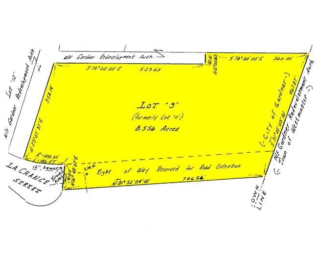
36 Lachance St
GARD-000017X-000006-000017
Worcester
Warehouse
Massachusetts
C and X Area of minimal flood hazard, usually depicted on FIRMs as above the 500-year flood level.
17
2025
8.01 AC
2025
Outlying Worcester
707500
Boston
17,804 SF
Worcester, MA
NEARBY LISTINGS FOR SALE OR LEASE
DEMOGRAPHICS near 36 Lachance St
1 mile
3 mile
5 mile
2025 Total Population
1,509
23,149
34,977
2030 Population
1,548
23,790
35,993
Pop Growth 2025-2030
+ 2.58%
+ 2.77%
+ 2.90%
Average Age
44
43
43
2025 Total Households
426
9,391
13,968
HH Growth 2025-2030
+ 3.05%
+ 2.96%
+ 3.05%
Median Household Inc
$110,648
$68,355
$77,352
Avg Household Size
2.50
2.30
2.40
2025 Avg HH Vehicles
2.00
2.00
2.00
Median Home Value
$401,546
$344,193
$358,556
Median Year Built
1975
1955
1963
Nearby Places
Map Layers
Map Styles
 Street
 Aerial
Layers
 Traffic
 Biking
Places
Listings with unknown addresses are not visible on the map
- Restaurants
- Banks
- Shops
- Fitness
- Groceries
PUBLIC TRANSPORTATION
COMMUTER RAIL
Wachusett (Fitchburg Line - MBTA)
Drive
Walk
Distance
Wachusett (Fitchburg Line - MBTA)
13 min
7.4 mi
AIRPORT
Worcester Regional
Drive
Walk
Distance
Worcester Regional
52 min
30.7 mi
Freight Ports
Port of Boston
Drive
Walk
Distance
Port of Boston
86 min
57.0 mi
Nearby Properties
Address
Land Use
TOTAL SIZE
Lot Size
Zoning
Address
Land Use
TOTAL SIZE
Lot Size
Zoning
321,793 SF
268 AC
Address
Land Use
TOTAL SIZE
Lot Size
Zoning
8.18 AC
Address
Land Use
TOTAL SIZE
Lot Size
Zoning
189,424 SF
12.60 AC
Address
Land Use
TOTAL SIZE
Lot Size
Zoning
104,279 SF
9.60 AC
Address
Land Use
TOTAL SIZE
Lot Size
Zoning
234 AC
Address
Land Use
TOTAL SIZE
Lot Size
Zoning
11.75 AC
Address
Land Use
TOTAL SIZE
Lot Size
Zoning
193,446 SF
17.34 AC
Address
Land Use
TOTAL SIZE
Lot Size
Zoning
123,353 SF
2.51 AC
Address
Land Use
TOTAL SIZE
Lot Size
Zoning
87,326 SF
20.74 AC
Address
Land Use
TOTAL SIZE
Lot Size
Zoning
118,778 SF
1.25 AC
Address
Land Use
TOTAL SIZE
Lot Size
Zoning
15.68 AC
Address
Land Use
TOTAL SIZE
Lot Size
Zoning
7,644 SF
18.38 AC
Address
Land Use
TOTAL SIZE
Lot Size
Zoning
12.20 AC
Address
Land Use
TOTAL SIZE
Lot Size
Zoning
89,712 SF
55.30 AC
Address
Land Use
TOTAL SIZE
Lot Size
Zoning
3.48 AC
Address
Land Use
TOTAL SIZE
Lot Size
Zoning
262,800 SF
32.80 AC
Address
Land Use
TOTAL SIZE
Lot Size
Zoning
287,824 SF
5.87 AC
Address
Land Use
TOTAL SIZE
Lot Size
Zoning
3.60 AC
Address
Land Use
TOTAL SIZE
Lot Size
Zoning
32,562 SF
2.57 AC
Address
Land Use
TOTAL SIZE
Lot Size
Zoning
74.90 AC
Address
Land Use
TOTAL SIZE
Lot Size
Zoning
164,545 SF
50.64 AC
Address
Land Use
TOTAL SIZE
Lot Size
Zoning
4.47 AC
Address
Land Use
TOTAL SIZE
Lot Size
Zoning
136,517 SF
11.01 AC
Address
Land Use
TOTAL SIZE
Lot Size
Zoning
2.90 AC
Address
Land Use
TOTAL SIZE
Lot Size
Zoning
16.03 AC
Address
Land Use
TOTAL SIZE
Lot Size
Zoning
8.17 AC
Address
Land Use
TOTAL SIZE
Lot Size
Zoning
11.38 AC
Address
Land Use
TOTAL SIZE
Lot Size
Zoning
80,507 SF
8.87 AC
Address
Land Use
TOTAL SIZE
Lot Size
Zoning
1.94 AC
Address
Land Use
TOTAL SIZE
Lot Size
Zoning
12.83 AC
The World's #1 Commercial Real Estate Marketplace
Connect with us
© 2026 CoStar Group
The information above has been obtained from sources believed reliable. While we do not doubt its accuracy we have not verified it and make no guarantee, warranty or representation about it. It is your responsibility to independently confirm its accuracy and completeness. Any projections, opinions, assumptions, or estimates used are for example only and do not represent the current or future performance of the property. The value of this transaction to you depends on tax and other factors which should be evaluated by your tax, financial, and legal advisors. You and your advisors should conduct a careful, independent investigation of the property to determine to your satisfaction the suitability of the property for your needs.