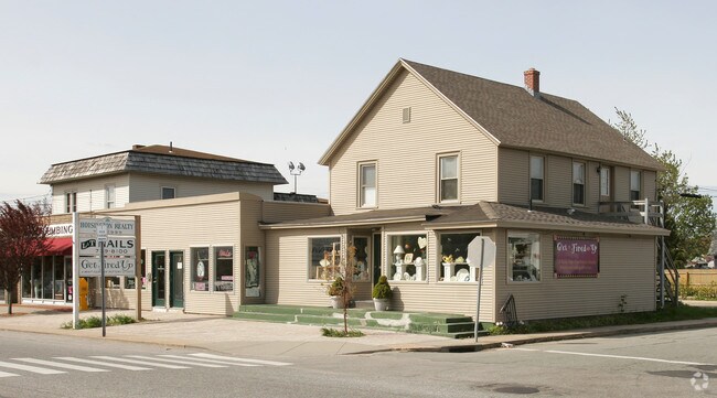
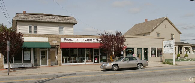
Property Record
36 Pennsylvania Ave, Niantic, CT 06357
NEARBY LISTINGS FOR SALE OR LEASE
Property Detail
36 Pennsylvania Ave
Commercialofficeresidentialmixeduse
New London
X
Connecticut
09011C0479J
0.23 AC
2025
SW New London/East Lyme
2025
Hartford
716101
Norwich-New London-Willimantic, CT
4,104 SF
ELYM-001201-000088
DEMOGRAPHICS near 36 Pennsylvania Ave
1 Mile
3 Mile
5 Mile
2024 Total Population
3,487
20,883
51,475
2029 Population
3,586
21,195
51,718
Pop Growth 2024-2029
+ 2.84%
+ 1.49%
+ 0.47%
Average Age
50
47
44
2024 Total Households
1,756
9,061
21,516
HH Growth 2024-2029
+ 2.90%
+ 1.43%
+ 0.50%
Median Household Inc
$95,561
$97,190
$86,084
Avg Household Size
1.90
2.10
2.20
2024 Avg HH Vehicles
2.00
2.00
2.00
Median Home Value
$328,024
$346,342
$323,043
Median Year Built
1958
1966
1964
Nearby Places
Map Layers
Map Styles
 Street
 Aerial
- Restaurants
- Banks
- Shops
- Fitness
- Groceries
PUBLIC TRANSPORTATION
COMMUTER RAIL
New London (Shore Line East - Shore Line East)
DRIVE
WALK
Distance
New London (Shore Line East - Shore Line East)
13 min
6.0 mi
Freight Ports
Port of New Haven
DRIVE
WALK
Distance
Port of New Haven
54 min
39.5 mi
Nearby Properties
Address
Land Use
TOTAL SIZE
Lot Size
Zoning
Address
Land Use
TOTAL SIZE
Lot Size
Zoning
525.72 AC
I-G
Address
Land Use
TOTAL SIZE
Lot Size
Zoning
Address
Land Use
TOTAL SIZE
Lot Size
Zoning
66.17 AC
LI
Address
Land Use
TOTAL SIZE
Lot Size
Zoning
Address
Land Use
TOTAL SIZE
Lot Size
Zoning
617.95 AC
Address
Land Use
TOTAL SIZE
Lot Size
Zoning
Address
Land Use
TOTAL SIZE
Lot Size
Zoning
68,244 SF
25.67 AC
R-40
Address
Land Use
TOTAL SIZE
Lot Size
Zoning
14.76 AC
CA
Address
Land Use
TOTAL SIZE
Lot Size
Zoning
62,878 SF
6.01 AC
CA
Address
Land Use
TOTAL SIZE
Lot Size
Zoning
55,906 SF
2.16 AC
CB
Address
Land Use
TOTAL SIZE
Lot Size
Zoning
Address
Land Use
TOTAL SIZE
Lot Size
Zoning
48,697 SF
3.83 AC
TC-80
Address
Land Use
TOTAL SIZE
Lot Size
Zoning
67,784 SF
5.53 AC
CA
Address
Land Use
TOTAL SIZE
Lot Size
Zoning
18.40 AC
R80
Address
Land Use
TOTAL SIZE
Lot Size
Zoning
10.79 AC
R40
Address
Land Use
TOTAL SIZE
Lot Size
Zoning
29,627 SF
20 AC
R-40
Address
Land Use
TOTAL SIZE
Lot Size
Zoning
59,162 SF
7.22 AC
R-40
Address
Land Use
TOTAL SIZE
Lot Size
Zoning
3.29 AC
CB
Address
Land Use
TOTAL SIZE
Lot Size
Zoning
56,568 SF
3.65 AC
LI
Address
Land Use
TOTAL SIZE
Lot Size
Zoning
29,830 SF
4.85 AC
LI
Address
Land Use
TOTAL SIZE
Lot Size
Zoning
57,298 SF
2.13 AC
CA
Address
Land Use
TOTAL SIZE
Lot Size
Zoning
36,657 SF
4.56 AC
CA
Address
Land Use
TOTAL SIZE
Lot Size
Zoning
2 AC
R40
Address
Land Use
TOTAL SIZE
Lot Size
Zoning
7.13 AC
R-40
Address
Land Use
TOTAL SIZE
Lot Size
Zoning
5.13 AC
CM
Address
Land Use
TOTAL SIZE
Lot Size
Zoning
38,837 SF
2.15 AC
R40
Address
Land Use
TOTAL SIZE
Lot Size
Zoning
5.35 AC
RU12W
Address
Land Use
TOTAL SIZE
Lot Size
Zoning
27,356 SF
0.95 AC
CB
Address
Land Use
TOTAL SIZE
Lot Size
Zoning
166.34 AC
OS
Address
Land Use
TOTAL SIZE
Lot Size
Zoning
1.97 AC
CM
The World's #1 Commercial Real Estate Marketplace
Connect with us
© 2026 CoStar Group
The information above has been obtained from sources believed reliable. While we do not doubt its accuracy we have not verified it and make no guarantee, warranty or representation about it. It is your responsibility to independently confirm its accuracy and completeness. Any projections, opinions, assumptions, or estimates used are for example only and do not represent the current or future performance of the property. The value of this transaction to you depends on tax and other factors which should be evaluated by your tax, financial, and legal advisors. You and your advisors should conduct a careful, independent investigation of the property to determine to your satisfaction the suitability of the property for your needs.