Property Record
36 Plainfield Pike, Plainfield, CT 06374

Property Detail
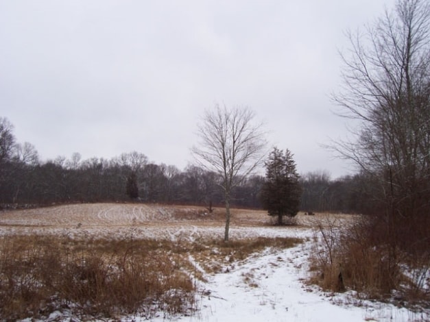
36 Plainfield Pike
PLAI-000016-000057-000002
Northeastern Ct
Vacantlandnec
Connecticut
C2
2
A Areas with a 1% annual chance of flooding and a 26% chance of flooding over the life of a 30-year mortgage.
22.09 AC
2024
Windham County
2025
Hartford
907200
Willimantic, CT
1,545 SF
NEARBY LISTINGS FOR SALE OR LEASE
DEMOGRAPHICS near 36 Plainfield Pike
1 mile
3 mile
5 mile
2025 Total Population
1,798
11,657
20,572
2030 Population
1,834
11,959
21,023
Pop Growth 2025-2030
+ 2.00%
+ 2.59%
+ 2.19%
Average Age
43
42
42
2025 Total Households
701
4,629
8,086
HH Growth 2025-2030
+ 2.00%
+ 2.72%
+ 2.31%
Median Household Inc
$66,014
$73,744
$80,343
Avg Household Size
2.40
2.40
2.50
2025 Avg HH Vehicles
2.00
2.00
2.00
Median Home Value
$254,739
$259,117
$279,331
Median Year Built
1972
1968
1970
Nearby Places
Map Layers
Map Styles
 Street
 Aerial
Transit
 Traffic
 Biking
Places
Listings with unknown addresses are not visible on the map
- Restaurants
- Banks
- Shops
- Fitness
- Groceries
PUBLIC TRANSPORTATION
AIRPORT
Rhode Island Tf Green International
Drive
Walk
Distance
Rhode Island Tf Green International
49 min
37.3 mi
Freight Ports
Port of Davisville, RI
Drive
Walk
Distance
Port of Davisville, RI
60 min
34.7 mi
SALE & LEASE HISTORY
LISTING DATE
SALE/LEASE

Feb 10, 2021
For Sale
Nearby Properties
Address
Land Use
TOTAL SIZE
Lot Size
Zoning
Address
Land Use
TOTAL SIZE
Lot Size
Zoning
202.19 AC
IND
Address
Land Use
TOTAL SIZE
Lot Size
Zoning
202,044 SF
52.20 AC
I
Address
Land Use
TOTAL SIZE
Lot Size
Zoning
37.12 AC
RA60
Address
Land Use
TOTAL SIZE
Lot Size
Zoning
54,304 SF
28.41 AC
IND-2
Address
Land Use
TOTAL SIZE
Lot Size
Zoning
13,444 SF
10.94 AC
RA30
Address
Land Use
TOTAL SIZE
Lot Size
Zoning
27,400 SF
4.34 AC
C2
Address
Land Use
TOTAL SIZE
Lot Size
Zoning
55,128 SF
5 AC
RA19
Address
Land Use
TOTAL SIZE
Lot Size
Zoning
15.20 AC
C
Address
Land Use
TOTAL SIZE
Lot Size
Zoning
10.29 AC
RA19
Address
Land Use
TOTAL SIZE
Lot Size
Zoning
2,836 SF
139.54 AC
I
Address
Land Use
TOTAL SIZE
Lot Size
Zoning
35,165 SF
6.63 AC
RA30
Address
Land Use
TOTAL SIZE
Lot Size
Zoning
11.29 AC
C
Address
Land Use
TOTAL SIZE
Lot Size
Zoning
6.26 AC
C
Address
Land Use
TOTAL SIZE
Lot Size
Zoning
34,830 SF
2.52 AC
C2
Address
Land Use
TOTAL SIZE
Lot Size
Zoning
80,180 SF
9.66 AC
IND-1
Address
Land Use
TOTAL SIZE
Lot Size
Zoning
10,937 SF
2.54 AC
C2
Address
Land Use
TOTAL SIZE
Lot Size
Zoning
11.40 AC
CI
Address
Land Use
TOTAL SIZE
Lot Size
Zoning
28,494 SF
6.67 AC
C2
Address
Land Use
TOTAL SIZE
Lot Size
Zoning
8.30 AC
RA30
Address
Land Use
TOTAL SIZE
Lot Size
Zoning
13,812 SF
1.70 AC
RA19
Address
Land Use
TOTAL SIZE
Lot Size
Zoning
26,796 SF
2.89 AC
I
Address
Land Use
TOTAL SIZE
Lot Size
Zoning
233,322 SF
13.60 AC
I
Address
Land Use
TOTAL SIZE
Lot Size
Zoning
18,600 SF
2.50 AC
RA19
Address
Land Use
TOTAL SIZE
Lot Size
Zoning
12,692 SF
2.46 AC
C2
Address
Land Use
TOTAL SIZE
Lot Size
Zoning
334 AC
RA60
Address
Land Use
TOTAL SIZE
Lot Size
Zoning
52.63 AC
IND-1
Address
Land Use
TOTAL SIZE
Lot Size
Zoning
10,000 SF
6.25 AC
IND
Address
Land Use
TOTAL SIZE
Lot Size
Zoning
6,889 SF
1.04 AC
C
Address
Land Use
TOTAL SIZE
Lot Size
Zoning
27,060 SF
2.76 AC
C2
Address
Land Use
TOTAL SIZE
Lot Size
Zoning
5.18 AC
IND
The World's #1 Commercial Real Estate Marketplace
Connect with us
© 2026 CoStar Group
The information above has been obtained from sources believed reliable. While we do not doubt its accuracy we have not verified it and make no guarantee, warranty or representation about it. It is your responsibility to independently confirm its accuracy and completeness. Any projections, opinions, assumptions, or estimates used are for example only and do not represent the current or future performance of the property. The value of this transaction to you depends on tax and other factors which should be evaluated by your tax, financial, and legal advisors. You and your advisors should conduct a careful, independent investigation of the property to determine to your satisfaction the suitability of the property for your needs.