Property Record
360 E Hundred Rd, Chester, VA 23836
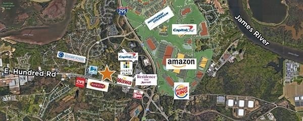

Property Detail
360 E Hundred Rd
816-65-21-77-000-000
E HUNDRED RD PARCEL A
Commercialnec
CHESTERFIELD
C3 - COMMU
Virginia
B and X Area of moderate flood hazard, usually the area between the limits of the 100-year and 500-year floods.
1.44 AC
2026
Iron Bridge Corridor
2025
Richmond VA
100403
Richmond, VA
4,884 SF
NEARBY LISTINGS FOR SALE OR LEASE
DEMOGRAPHICS near 360 E Hundred Rd
1 mile
3 mile
5 mile
2025 Total Population
5,010
19,848
60,088
2030 Population
5,356
21,110
62,620
Pop Growth 2025-2030
+ 6.91%
+ 6.36%
+ 4.21%
Average Age
41
40
40
2025 Total Households
1,813
7,108
21,244
HH Growth 2025-2030
+ 7.00%
+ 6.39%
+ 4.40%
Median Household Inc
$127,055
$110,997
$86,826
Avg Household Size
2.80
2.70
2.60
2025 Avg HH Vehicles
2.00
2.00
2.00
Median Home Value
$396,370
$368,181
$306,868
Median Year Built
1998
1995
1987
Nearby Places
Map Layers
Map Styles
 Street
 Aerial
Layers
 Traffic
 Biking
Places
Listings with unknown addresses are not visible on the map
- Restaurants
- Banks
- Shops
- Fitness
- Groceries
PUBLIC TRANSPORTATION
AIRPORT
Richmond International
Drive
Walk
Distance
Richmond International
26 min
17.0 mi
Freight Ports
Virginia Port Authority - Richmond
Drive
Walk
Distance
Virginia Port Authority - Richmond
19 min
12.5 mi
SALE & LEASE HISTORY
LISTING DATE
SALE/LEASE

Sep 04, 2017
For Sale
Mar 07, 2019
For Sale
Nearby Properties
Address
Land Use
TOTAL SIZE
Lot Size
Zoning
Address
Land Use
TOTAL SIZE
Lot Size
Zoning
549.22 AC
A-1
Address
Land Use
TOTAL SIZE
Lot Size
Zoning
107.29 AC
R-A
Address
Land Use
TOTAL SIZE
Lot Size
Zoning
99.30 AC
I2 - GEN I
Address
Land Use
TOTAL SIZE
Lot Size
Zoning
252,000 SF
118.66 AC
I3 - HVY I
Address
Land Use
TOTAL SIZE
Lot Size
Zoning
440,100 SF
82.70 AC
I2 - GEN I
Address
Land Use
TOTAL SIZE
Lot Size
Zoning
557,533 SF
48.60 AC
I2 - GEN I
Address
Land Use
TOTAL SIZE
Lot Size
Zoning
41,930 SF
23.04 AC
C5 - GEN B
Address
Land Use
TOTAL SIZE
Lot Size
Zoning
88,847 SF
93.02 AC
A - AGRICU
Address
Land Use
TOTAL SIZE
Lot Size
Zoning
32,947 SF
13.38 AC
C5 - GEN B
Address
Land Use
TOTAL SIZE
Lot Size
Zoning
49,595 SF
28.14 AC
I2 - GEN I
Address
Land Use
TOTAL SIZE
Lot Size
Zoning
352,800 SF
54.30 AC
I2 - GEN I
Address
Land Use
TOTAL SIZE
Lot Size
Zoning
81,138 SF
27.31 AC
C2 - NBHD
Address
Land Use
TOTAL SIZE
Lot Size
Zoning
100 SF
14.70 AC
C5 - GEN B
Address
Land Use
TOTAL SIZE
Lot Size
Zoning
404,200 SF
62.22 AC
I2 - GEN I
Address
Land Use
TOTAL SIZE
Lot Size
Zoning
296,000 SF
42.39 AC
I2 - GEN I
Address
Land Use
TOTAL SIZE
Lot Size
Zoning
242,042 SF
10.15 AC
I2 - GEN I
Address
Land Use
TOTAL SIZE
Lot Size
Zoning
91,105 SF
10.90 AC
C3 - COMMU
Address
Land Use
TOTAL SIZE
Lot Size
Zoning
340.76 AC
I2 - GEN I
Address
Land Use
TOTAL SIZE
Lot Size
Zoning
3,946 SF
17.72 AC
R15 - SING
Address
Land Use
TOTAL SIZE
Lot Size
Zoning
187,980 SF
15.31 AC
I1 - LT IN
Address
Land Use
TOTAL SIZE
Lot Size
Zoning
173,800 SF
15.99 AC
I2 - GEN I
Address
Land Use
TOTAL SIZE
Lot Size
Zoning
490,345 SF
101.57 AC
I2 - GEN I
Address
Land Use
TOTAL SIZE
Lot Size
Zoning
92,905 SF
49.45 AC
A - AGRICU
Address
Land Use
TOTAL SIZE
Lot Size
Zoning
13,567 SF
17.96 AC
C5 - GEN B
Address
Land Use
TOTAL SIZE
Lot Size
Zoning
203,544 SF
15.17 AC
I1 - LT IN
Address
Land Use
TOTAL SIZE
Lot Size
Zoning
47.44 AC
MH1 - MOBI
Address
Land Use
TOTAL SIZE
Lot Size
Zoning
186,837 SF
26.82 AC
I2 - GEN I
Address
Land Use
TOTAL SIZE
Lot Size
Zoning
158,400 SF
9.96 AC
I1 - LT IN
Address
Land Use
TOTAL SIZE
Lot Size
Zoning
228,108 SF
19.32 AC
I1 - LT IN
Address
Land Use
TOTAL SIZE
Lot Size
Zoning
95,824 SF
2.29 AC
C3 - COMMU
The World's #1 Commercial Real Estate Marketplace
Connect with us
© 2026 CoStar Group
The information above has been obtained from sources believed reliable. While we do not doubt its accuracy we have not verified it and make no guarantee, warranty or representation about it. It is your responsibility to independently confirm its accuracy and completeness. Any projections, opinions, assumptions, or estimates used are for example only and do not represent the current or future performance of the property. The value of this transaction to you depends on tax and other factors which should be evaluated by your tax, financial, and legal advisors. You and your advisors should conduct a careful, independent investigation of the property to determine to your satisfaction the suitability of the property for your needs.