Property Record
360 Indian Branch Ranch Rd, Saint Augustine, FL 32092
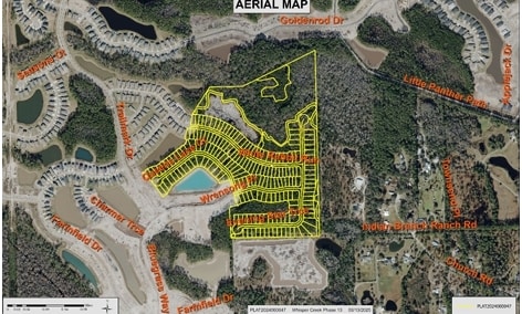
Property Detail
360 Indian Branch Ranch Rd
029400-0040
2-5 S60FT OF LOTS 1 & 2 & S60 FT OF N1/2 OF SW1/4 (EX E 1560.46FT OR391/489)PRIVATE RD (EX PT IN MB129/1-14) (EX PT IN OR6158/1183 & 1188 & 1193) OR3781/1556
Agriculturalland
ST. JOHNS
OR
Florida
B and X Area of moderate flood hazard, usually the area between the limits of the 100-year and 500-year floods.
1,2
2025
51.78 AC
2026
St Johns County
020905
Jacksonville (Florida)
1,134 SF
Jacksonville, FL
NEARBY LISTINGS FOR SALE OR LEASE
DEMOGRAPHICS near 360 Indian Branch Ranch Rd
1 mile
3 mile
5 mile
2025 Total Population
3,651
17,432
33,402
2030 Population
4,341
20,279
39,038
Pop Growth 2025-2030
+ 18.90%
+ 16.33%
+ 16.87%
Average Age
40
39
42
2025 Total Households
1,248
5,771
11,888
HH Growth 2025-2030
+ 19.07%
+ 16.79%
+ 17.62%
Median Household Inc
$109,532
$113,620
$112,784
Avg Household Size
2.90
3.00
2.70
2025 Avg HH Vehicles
2.00
2.00
2.00
Median Home Value
$593,654
$556,685
$515,654
Median Year Built
2009
2009
2010
Nearby Places
Map Layers
Map Styles
 Street
 Aerial
Layers
 Traffic
 Biking
Places
Listings with unknown addresses are not visible on the map
- Restaurants
- Banks
- Shops
- Fitness
- Groceries
Nearby Properties
Address
Land Use
TOTAL SIZE
Lot Size
Zoning
Address
Land Use
TOTAL SIZE
Lot Size
Zoning
159,791 SF
40 AC
PUD
Address
Land Use
TOTAL SIZE
Lot Size
Zoning
106,741 SF
18.50 AC
PUD
Address
Land Use
TOTAL SIZE
Lot Size
Zoning
42,168 SF
11.07 AC
PUD
Address
Land Use
TOTAL SIZE
Lot Size
Zoning
11,640 SF
2.90 AC
OR
Address
Land Use
TOTAL SIZE
Lot Size
Zoning
20,374 SF
189.83 AC
DRI
Address
Land Use
TOTAL SIZE
Lot Size
Zoning
10,753 SF
1.94 AC
Address
Land Use
TOTAL SIZE
Lot Size
Zoning
10,004 SF
1.14 AC
Address
Land Use
TOTAL SIZE
Lot Size
Zoning
9,624 SF
60.57 AC
OR
Address
Land Use
TOTAL SIZE
Lot Size
Zoning
6,591 SF
36.06 AC
Address
Land Use
TOTAL SIZE
Lot Size
Zoning
10,161 SF
49.57 AC
OR
Address
Land Use
TOTAL SIZE
Lot Size
Zoning
4,990 SF
0.75 AC
Address
Land Use
TOTAL SIZE
Lot Size
Zoning
7,365 SF
5 AC
Address
Land Use
TOTAL SIZE
Lot Size
Zoning
9,920 SF
2.54 AC
OR
Address
Land Use
TOTAL SIZE
Lot Size
Zoning
7,616 SF
15.96 AC
OR
Address
Land Use
TOTAL SIZE
Lot Size
Zoning
8,051 SF
65.08 AC
OR
Address
Land Use
TOTAL SIZE
Lot Size
Zoning
15,629 SF
87.78 AC
OR
Address
Land Use
TOTAL SIZE
Lot Size
Zoning
Address
Land Use
TOTAL SIZE
Lot Size
Zoning
6,937 SF
4.54 AC
PRD
Address
Land Use
TOTAL SIZE
Lot Size
Zoning
91.59 AC
Address
Land Use
TOTAL SIZE
Lot Size
Zoning
61.50 AC
OR
Address
Land Use
TOTAL SIZE
Lot Size
Zoning
6,081 SF
3.78 AC
PRD
Address
Land Use
TOTAL SIZE
Lot Size
Zoning
22.19 AC
OR
Address
Land Use
TOTAL SIZE
Lot Size
Zoning
3,899 SF
4.60 AC
OR
Address
Land Use
TOTAL SIZE
Lot Size
Zoning
8,988 SF
18.90 AC
OR
Address
Land Use
TOTAL SIZE
Lot Size
Zoning
10,234 SF
72.30 AC
OR
Address
Land Use
TOTAL SIZE
Lot Size
Zoning
2,993 SF
0.50 AC
Address
Land Use
TOTAL SIZE
Lot Size
Zoning
6,464 SF
15.14 AC
PRD
Address
Land Use
TOTAL SIZE
Lot Size
Zoning
5,423 SF
6.47 AC
OR
Address
Land Use
TOTAL SIZE
Lot Size
Zoning
161.76 AC
PUD
The World's #1 Commercial Real Estate Marketplace
Connect with us
© 2026 CoStar Group
The information above has been obtained from sources believed reliable. While we do not doubt its accuracy we have not verified it and make no guarantee, warranty or representation about it. It is your responsibility to independently confirm its accuracy and completeness. Any projections, opinions, assumptions, or estimates used are for example only and do not represent the current or future performance of the property. The value of this transaction to you depends on tax and other factors which should be evaluated by your tax, financial, and legal advisors. You and your advisors should conduct a careful, independent investigation of the property to determine to your satisfaction the suitability of the property for your needs.