Property Record
1017 Forest St E, Nokomis, FL 34275


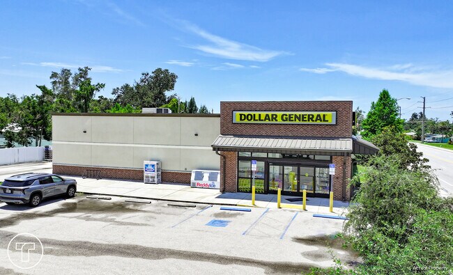

Property Detail
1017 Forest St E
North Port-Bradenton-Sarasota, FL
Mount Pleasant
0170-01-0072
S 64 FT OF LOTS 1 & 2, TOGETHER WITH N 11 FT OF LOTS 23 & 24, TOGETHER WITH N 97.7 FT OF LOTS 3, 4, 5 & 6, BLK A, LESS LAUREL RD E R/W AS DESC IN OR 2041/849, MOUNT PLEASANT, SUBJ TO 310 SF
Storebuilding
Sarasota
X
Florida
12115C0239G
1-6,2
2024
1.07 AC
2025
Sarasota
002714
Tampa/St Petersburg
7,513 SF
NEARBY LISTINGS FOR SALE OR LEASE
DEMOGRAPHICS near 1017 Forest St E
1 mile
3 mile
5 mile
2024 Total Population
5,654
34,635
68,943
2029 Population
6,523
40,637
80,799
Pop Growth 2024-2029
+ 15.37%
+ 17.33%
+ 17.20%
Average Age
57
59
60
2024 Total Households
2,920
17,906
35,606
HH Growth 2024-2029
+ 15.38%
+ 17.39%
+ 17.24%
Median Household Inc
$61,292
$66,261
$72,098
Avg Household Size
1.90
1.90
1.90
2024 Avg HH Vehicles
2.00
2.00
2.00
Median Home Value
$319,887
$336,342
$363,654
Median Year Built
1978
1981
1987
Nearby Places
Map Layers
Map Styles
 Street
 Aerial
Transit
 Traffic
 Biking
Places
Listings with unknown addresses are not visible on the map
- Restaurants
- Banks
- Shops
- Fitness
- Groceries
PUBLIC TRANSPORTATION
AIRPORT
Sarasota/Bradenton International
Drive
Walk
Distance
Sarasota/Bradenton International
37 min
20.8 mi
Freight Ports
Port Manatee
Drive
Walk
Distance
Port Manatee
49 min
39.0 mi
SALE & LEASE HISTORY
LISTING DATE
SALE/LEASE

Jul 28, 2025
For Sale
Aug 01, 2022
For Sale
Nearby Properties
Address
Land Use
TOTAL SIZE
Lot Size
Zoning
Address
Land Use
TOTAL SIZE
Lot Size
Zoning
738,835 SF
65.43 AC
LW
Address
Land Use
TOTAL SIZE
Lot Size
Zoning
26,265 SF
210.50 AC
RMH
Address
Land Use
TOTAL SIZE
Lot Size
Zoning
308,834 SF
16 AC
PUD
Address
Land Use
TOTAL SIZE
Lot Size
Zoning
273,036 SF
28.76 AC
RMF3
Address
Land Use
TOTAL SIZE
Lot Size
Zoning
263,056 SF
25.54 AC
LW
Address
Land Use
TOTAL SIZE
Lot Size
Zoning
8,017 SF
56 AC
RMH
Address
Land Use
TOTAL SIZE
Lot Size
Zoning
181,657 SF
56.90 AC
GU
Address
Land Use
TOTAL SIZE
Lot Size
Zoning
8,562 SF
58.92 AC
RMH
Address
Land Use
TOTAL SIZE
Lot Size
Zoning
23,348 SF
77.03 AC
RMH
Address
Land Use
TOTAL SIZE
Lot Size
Zoning
190,485 SF
5.81 AC
NTG
Address
Land Use
TOTAL SIZE
Lot Size
Zoning
48,681 SF
5 AC
OPI
Address
Land Use
TOTAL SIZE
Lot Size
Zoning
362,000 SF
41.51 AC
PID
Address
Land Use
TOTAL SIZE
Lot Size
Zoning
1,184 SF
90 AC
PUD
Address
Land Use
TOTAL SIZE
Lot Size
Zoning
133,773 SF
6.29 AC
OPI
Address
Land Use
TOTAL SIZE
Lot Size
Zoning
425,768 SF
18.41 AC
RMF2
Address
Land Use
TOTAL SIZE
Lot Size
Zoning
5,396 SF
33.59 AC
RMH
Address
Land Use
TOTAL SIZE
Lot Size
Zoning
5,208 SF
38.03 AC
CG
Address
Land Use
TOTAL SIZE
Lot Size
Zoning
48.01 AC
RSF1
Address
Land Use
TOTAL SIZE
Lot Size
Zoning
17,028 SF
3.57 AC
RE2
Address
Land Use
TOTAL SIZE
Lot Size
Zoning
12,263 SF
3.38 AC
RE2
Address
Land Use
TOTAL SIZE
Lot Size
Zoning
27,099 SF
2.27 AC
RE2
Address
Land Use
TOTAL SIZE
Lot Size
Zoning
127,135 SF
12.37 AC
CG
Address
Land Use
TOTAL SIZE
Lot Size
Zoning
110,209 SF
12.55 AC
PID
Address
Land Use
TOTAL SIZE
Lot Size
Zoning
70,220 SF
9.31 AC
LW
Address
Land Use
TOTAL SIZE
Lot Size
Zoning
49,400 SF
4.51 AC
OPI
Address
Land Use
TOTAL SIZE
Lot Size
Zoning
45,837 SF
3.06 AC
G
Address
Land Use
TOTAL SIZE
Lot Size
Zoning
139,551 SF
14.60 AC
CSC
Address
Land Use
TOTAL SIZE
Lot Size
Zoning
68,641 SF
6.40 AC
RTR
Address
Land Use
TOTAL SIZE
Lot Size
Zoning
120,522 SF
5.25 AC
PID
Address
Land Use
TOTAL SIZE
Lot Size
Zoning
112,788 SF
3.06 AC
CG
The World's #1 Commercial Real Estate Marketplace
Connect with us
© 2026 CoStar Group
The information above has been obtained from sources believed reliable. While we do not doubt its accuracy we have not verified it and make no guarantee, warranty or representation about it. It is your responsibility to independently confirm its accuracy and completeness. Any projections, opinions, assumptions, or estimates used are for example only and do not represent the current or future performance of the property. The value of this transaction to you depends on tax and other factors which should be evaluated by your tax, financial, and legal advisors. You and your advisors should conduct a careful, independent investigation of the property to determine to your satisfaction the suitability of the property for your needs.