Property Record
360 Portion Rd, Ronkonkoma, NY 11779
NEARBY LISTINGS FOR SALE OR LEASE
Property Detail
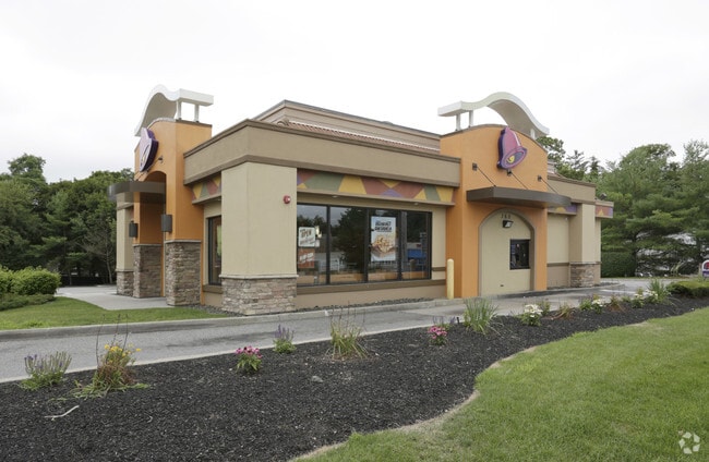
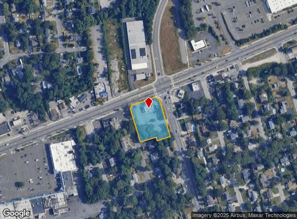
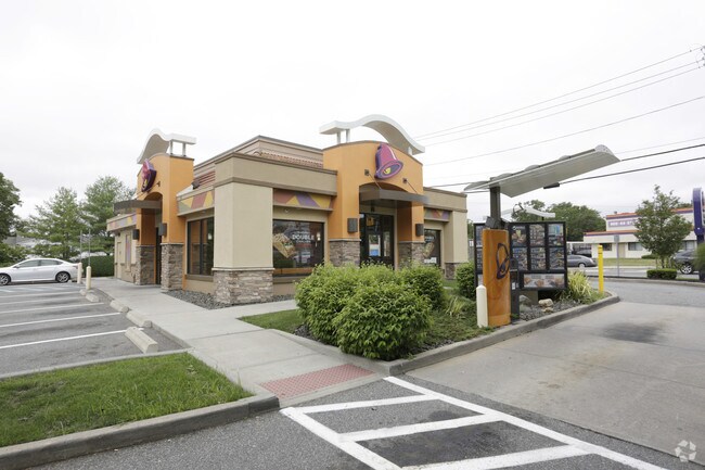
360 Portion Rd
Nassau County-Suffolk County, NY
Estates Of Ronkonkoma
0200-648-00-05-00-035-001
EAST OF RONKONKOMA 301 B21 3-13 INC
Restaurantdrivein
Suffolk
X
New York
36103C0680H
35
2024
1.05 AC
2024
Central Suffolk
158609
Long Island (New York)
DEMOGRAPHICS near 360 Portion Rd
1 mile
3 mile
5 mile
2024 Total Population
12,287
91,469
230,147
2029 Population
12,025
90,017
226,667
Pop Growth 2024-2029
(2.13%)
(1.59%)
(1.51%)
Average Age
43
41
42
2024 Total Households
4,325
30,476
77,922
HH Growth 2024-2029
(2.36%)
(1.74%)
(1.69%)
Median Household Inc
$87,657
$118,796
$119,482
Avg Household Size
2.70
2.90
2.80
2024 Avg HH Vehicles
2.00
2.00
2.00
Median Home Value
$403,089
$452,039
$459,951
Median Year Built
1966
1970
1971
Nearby Places
Map Layers
Map Styles
 Street
 Aerial
Transit
 Traffic
 Biking
Places
Listings with unknown addresses are not visible on the map
- Restaurants
- Banks
- Shops
- Fitness
- Groceries
PUBLIC TRANSPORTATION
COMMUTER RAIL
Ronkonkoma Station (Greenport Branch - Long Island Rail Road, Ronkonkoma Branch - Long Island Rail Road)
Drive
Walk
Distance
Ronkonkoma Station (Greenport Branch - Long Island Rail Road, Ronkonkoma Branch - Long Island Rail Road)
8 min
2.9 mi
St James Station (Port Jefferson Branch - Long Island Rail Road)
Drive
Walk
Distance
St James Station (Port Jefferson Branch - Long Island Rail Road)
15 min
5.9 mi
AIRPORT
Long Island MacArthur
Drive
Walk
Distance
Long Island MacArthur
11 min
4.6 mi
Freight Ports
Port of New Haven
Drive
Walk
Distance
Port of New Haven
129 min
48.6 mi
Nearby Properties
Address
Land Use
TOTAL SIZE
Lot Size
Zoning
Address
Land Use
TOTAL SIZE
Lot Size
Zoning
1,207.60 AC
Address
Land Use
TOTAL SIZE
Lot Size
Zoning
5,746 SF
1.16 AC
VILLA
Address
Land Use
TOTAL SIZE
Lot Size
Zoning
5,881 SF
1.60 AC
VILLA
Address
Land Use
TOTAL SIZE
Lot Size
Zoning
49.54 AC
CA
Address
Land Use
TOTAL SIZE
Lot Size
Zoning
3,610 SF
1.32 AC
VILLA
Address
Land Use
TOTAL SIZE
Lot Size
Zoning
4,692 SF
1.50 AC
VILLA
Address
Land Use
TOTAL SIZE
Lot Size
Zoning
1,809 SF
0.88 AC
VILLA
Address
Land Use
TOTAL SIZE
Lot Size
Zoning
95.19 AC
Address
Land Use
TOTAL SIZE
Lot Size
Zoning
51.59 AC
AA
Address
Land Use
TOTAL SIZE
Lot Size
Zoning
23.50 AC
AA
Address
Land Use
TOTAL SIZE
Lot Size
Zoning
5,773 SF
1.04 AC
CR80
Address
Land Use
TOTAL SIZE
Lot Size
Zoning
2,036 SF
0.33 AC
VILLA
Address
Land Use
TOTAL SIZE
Lot Size
Zoning
23.08 AC
AA
Address
Land Use
TOTAL SIZE
Lot Size
Zoning
25.90 AC
Address
Land Use
TOTAL SIZE
Lot Size
Zoning
140.10 AC
Address
Land Use
TOTAL SIZE
Lot Size
Zoning
1,694 SF
0.11 AC
VILLA
Address
Land Use
TOTAL SIZE
Lot Size
Zoning
3,490 SF
1 AC
VILLA
Address
Land Use
TOTAL SIZE
Lot Size
Zoning
4,500 SF
1.52 AC
VILLA
Address
Land Use
TOTAL SIZE
Lot Size
Zoning
7,476 SF
0.75 AC
VILLA
Address
Land Use
TOTAL SIZE
Lot Size
Zoning
Address
Land Use
TOTAL SIZE
Lot Size
Zoning
1,186 SF
0.55 AC
R15
Address
Land Use
TOTAL SIZE
Lot Size
Zoning
10.99 AC
Address
Land Use
TOTAL SIZE
Lot Size
Zoning
2,429 SF
1.10 AC
VILLA
Address
Land Use
TOTAL SIZE
Lot Size
Zoning
6,486 SF
0.55 AC
VILLA
Address
Land Use
TOTAL SIZE
Lot Size
Zoning
2,086 SF
0.55 AC
VILLA
Address
Land Use
TOTAL SIZE
Lot Size
Zoning
3,007 SF
1.86 AC
CR80
Address
Land Use
TOTAL SIZE
Lot Size
Zoning
2,390 SF
0.71 AC
VILLA
Address
Land Use
TOTAL SIZE
Lot Size
Zoning
2,053 SF
0.25 AC
VILLA
Address
Land Use
TOTAL SIZE
Lot Size
Zoning
8.60 AC
IND1
Address
Land Use
TOTAL SIZE
Lot Size
Zoning
2,452 SF
0.28 AC
VILLA
The World's #1 Commercial Real Estate Marketplace
Connect with us
© 2026 CoStar Group
The information above has been obtained from sources believed reliable. While we do not doubt its accuracy we have not verified it and make no guarantee, warranty or representation about it. It is your responsibility to independently confirm its accuracy and completeness. Any projections, opinions, assumptions, or estimates used are for example only and do not represent the current or future performance of the property. The value of this transaction to you depends on tax and other factors which should be evaluated by your tax, financial, and legal advisors. You and your advisors should conduct a careful, independent investigation of the property to determine to your satisfaction the suitability of the property for your needs.