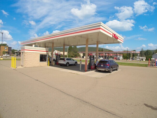
Property Record
360 Pulteney St, Corning, NY 14830


NEARBY LISTINGS FOR SALE OR LEASE
Property Detail
360 Pulteney St
Corning, NY
Steuben
463801-299-018-0001-049-000
New York
Stripcommercialcenter
49.100
0
7.58 AC
2024
Ithaca/Elmira
962800
Other Market Areas
59,861 SF
DEMOGRAPHICS near 360 Pulteney St
1 Mile
3 Mile
5 Mile
2024 Total Population
6,063
19,186
23,527
2029 Population
5,893
18,727
22,958
Pop Growth 2024-2029
(2.80%)
(2.39%)
(2.42%)
Average Age
41
41
41
2024 Total Households
2,852
8,617
10,402
HH Growth 2024-2029
(2.84%)
(2.47%)
(2.49%)
Median Household Inc
$52,745
$65,997
$70,419
Avg Household Size
2.10
2.10
2.20
2024 Avg HH Vehicles
1.00
2.00
2.00
Median Home Value
$125,740
$154,187
$156,340
Median Year Built
1948
1955
1958
Nearby Places
Map Layers
Map Styles
 Street
 Aerial
- Restaurants
- Banks
- Shops
- Fitness
- Groceries
PUBLIC TRANSPORTATION
AIRPORT
Elmira/Corning Regional
DRIVE
WALK
Distance
Elmira/Corning Regional
18 min
12.2 mi
Freight Ports
Albany, NY Port
DRIVE
WALK
Distance
Albany, NY Port
255 min
213.9 mi
SALE & LEASE HISTORY
LISTING DATE
SALE/LEASE

Sep 27, 2024
For Sale
Mar 22, 2017
For Lease
Apr 24, 2017
For Lease
Nearby Properties
Address
Land Use
TOTAL SIZE
Lot Size
Zoning
Address
Land Use
TOTAL SIZE
Lot Size
Zoning
52,288 SF
9.50 AC
BD
Address
Land Use
TOTAL SIZE
Lot Size
Zoning
302,250 SF
19.74 AC
BD
Address
Land Use
TOTAL SIZE
Lot Size
Zoning
Address
Land Use
TOTAL SIZE
Lot Size
Zoning
Address
Land Use
TOTAL SIZE
Lot Size
Zoning
406.35 AC
Address
Land Use
TOTAL SIZE
Lot Size
Zoning
192,620 SF
31.50 AC
05 - COMME
Address
Land Use
TOTAL SIZE
Lot Size
Zoning
27,603 SF
90.91 AC
CONF
Address
Land Use
TOTAL SIZE
Lot Size
Zoning
Address
Land Use
TOTAL SIZE
Lot Size
Zoning
17,717 SF
205.78 AC
CONF
Address
Land Use
TOTAL SIZE
Lot Size
Zoning
279,299 SF
6.72 AC
PC
Address
Land Use
TOTAL SIZE
Lot Size
Zoning
78,653 SF
4.06 AC
BD
Address
Land Use
TOTAL SIZE
Lot Size
Zoning
103,000 SF
14.16 AC
07
Address
Land Use
TOTAL SIZE
Lot Size
Zoning
150,000 SF
17.94 AC
05
Address
Land Use
TOTAL SIZE
Lot Size
Zoning
3.32 AC
C
Address
Land Use
TOTAL SIZE
Lot Size
Zoning
81,728 SF
4.03 AC
BD
Address
Land Use
TOTAL SIZE
Lot Size
Zoning
69.90 AC
Address
Land Use
TOTAL SIZE
Lot Size
Zoning
55,000 SF
4.86 AC
07 - MIXED
Address
Land Use
TOTAL SIZE
Lot Size
Zoning
97,110 SF
13.31 AC
C
Address
Land Use
TOTAL SIZE
Lot Size
Zoning
82,123 SF
1.35 AC
C
Address
Land Use
TOTAL SIZE
Lot Size
Zoning
90,947 SF
2.79 AC
C
Address
Land Use
TOTAL SIZE
Lot Size
Zoning
43,869 SF
5.02 AC
BD
Address
Land Use
TOTAL SIZE
Lot Size
Zoning
Address
Land Use
TOTAL SIZE
Lot Size
Zoning
Address
Land Use
TOTAL SIZE
Lot Size
Zoning
8,546 SF
31.88 AC
07 - MIXED
Address
Land Use
TOTAL SIZE
Lot Size
Zoning
48,040 SF
12.11 AC
BD
Address
Land Use
TOTAL SIZE
Lot Size
Zoning
20.37 AC
07 - MIXED
Address
Land Use
TOTAL SIZE
Lot Size
Zoning
82,146 SF
2.60 AC
R2
Address
Land Use
TOTAL SIZE
Lot Size
Zoning
46,800 SF
6.39 AC
07 - MIXED
Address
Land Use
TOTAL SIZE
Lot Size
Zoning
18,524 SF
2.86 AC
C
Address
Land Use
TOTAL SIZE
Lot Size
Zoning
2.35 AC
The World's #1 Commercial Real Estate Marketplace
Connect with us
© 2025 CoStar Group
The information above has been obtained from sources believed reliable. While we do not doubt its accuracy we have not verified it and make no guarantee, warranty or representation about it. It is your responsibility to independently confirm its accuracy and completeness. Any projections, opinions, assumptions, or estimates used are for example only and do not represent the current or future performance of the property. The value of this transaction to you depends on tax and other factors which should be evaluated by your tax, financial, and legal advisors. You and your advisors should conduct a careful, independent investigation of the property to determine to your satisfaction the suitability of the property for your needs.