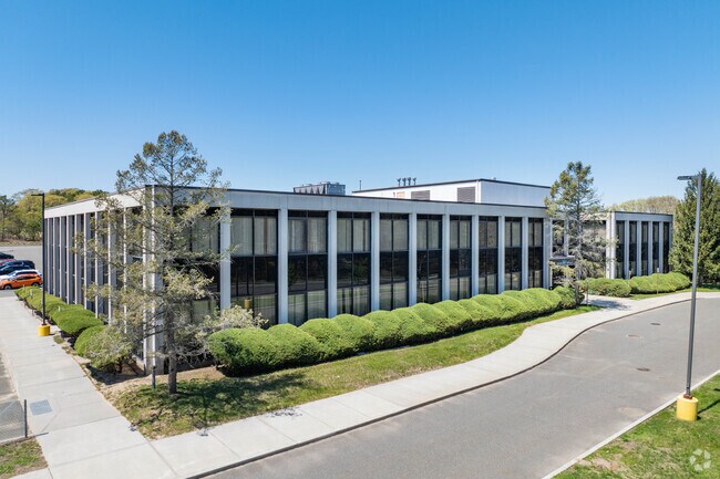
Property Record
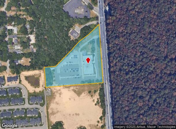
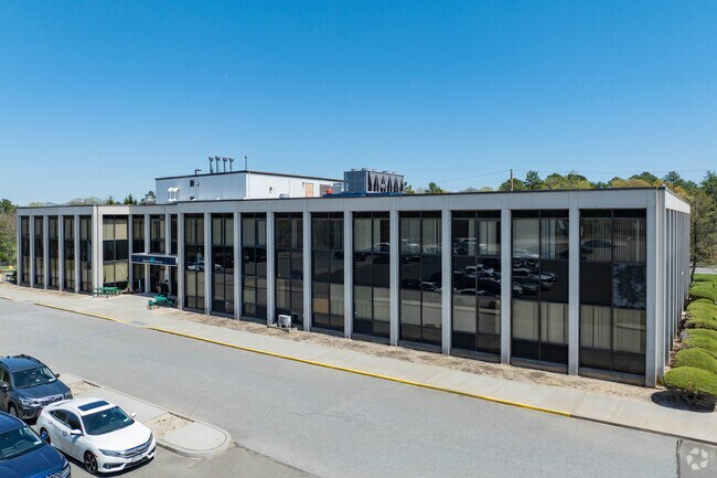
3600 Route 112, Coram, NY 11727
NEARBY LISTINGS FOR SALE OR LEASE
Property Detail
3600 Route 112
Nassau County-Suffolk County, NY
Coram
0200-494-00-01-00-039-000
N SUFF CNTY WATER E PAT PT JEFF RD
Commercialbuilding
Suffolk
X
New York
36103C0705H
39
0
5 AC
2024
Central Suffolk
158715
Long Island (New York)
DEMOGRAPHICS near 3600 Route 112
1 Mile
3 Mile
5 Mile
2024 Total Population
5,688
75,368
186,651
2029 Population
5,638
74,088
183,793
Pop Growth 2024-2029
(0.88%)
(1.70%)
(1.53%)
Average Age
44
41
41
2024 Total Households
2,628
26,026
63,520
HH Growth 2024-2029
(1.07%)
(1.98%)
(1.76%)
Median Household Inc
$80,962
$95,674
$105,293
Avg Household Size
2.10
2.70
2.80
2024 Avg HH Vehicles
2.00
2.00
2.00
Median Home Value
$242,988
$382,687
$412,656
Median Year Built
1985
1976
1975
Nearby Places
- Restaurants
- Banks
- Shops
- Fitness
- Groceries
PUBLIC TRANSPORTATION
COMMUTER RAIL
Medford Station (Greenport Branch - Long Island Rail Road)
DRIVE
WALK
Distance
Medford Station (Greenport Branch - Long Island Rail Road)
7 min
3.1 mi
Port Jefferson Station (Port Jefferson Branch - Long Island Rail Road)
DRIVE
WALK
Distance
Port Jefferson Station (Port Jefferson Branch - Long Island Rail Road)
13 min
6.4 mi
AIRPORT
Long Island MacArthur
DRIVE
WALK
Distance
Long Island MacArthur
22 min
12.8 mi
Tweed/New Haven
DRIVE
WALK
Distance
Tweed/New Haven
128 min
47.5 mi
Freight Ports
Port of New Haven
DRIVE
WALK
Distance
Port of New Haven
123 min
44.7 mi
Nearby Properties
Address
Land Use
TOTAL SIZE
Lot Size
Zoning
Address
Land Use
TOTAL SIZE
Lot Size
Zoning
26,576 SF
2.30 AC
LI40
Address
Land Use
TOTAL SIZE
Lot Size
Zoning
25.90 AC
Address
Land Use
TOTAL SIZE
Lot Size
Zoning
21,554 SF
1.03 AC
HC
Address
Land Use
TOTAL SIZE
Lot Size
Zoning
3,879 SF
0.57 AC
R1
Address
Land Use
TOTAL SIZE
Lot Size
Zoning
5,530 SF
0.44 AC
R1
Address
Land Use
TOTAL SIZE
Lot Size
Zoning
Address
Land Use
TOTAL SIZE
Lot Size
Zoning
31.33 AC
Address
Land Use
TOTAL SIZE
Lot Size
Zoning
21.04 AC
Address
Land Use
TOTAL SIZE
Lot Size
Zoning
Address
Land Use
TOTAL SIZE
Lot Size
Zoning
47.20 AC
Address
Land Use
TOTAL SIZE
Lot Size
Zoning
12.47 AC
Address
Land Use
TOTAL SIZE
Lot Size
Zoning
0.53 AC
R20
Address
Land Use
TOTAL SIZE
Lot Size
Zoning
Address
Land Use
TOTAL SIZE
Lot Size
Zoning
34.53 AC
Address
Land Use
TOTAL SIZE
Lot Size
Zoning
38.42 AC
Address
Land Use
TOTAL SIZE
Lot Size
Zoning
27.75 AC
Address
Land Use
TOTAL SIZE
Lot Size
Zoning
Address
Land Use
TOTAL SIZE
Lot Size
Zoning
18.50 AC
Address
Land Use
TOTAL SIZE
Lot Size
Zoning
1,362 SF
0.39 AC
HC
Address
Land Use
TOTAL SIZE
Lot Size
Zoning
22.45 AC
Address
Land Use
TOTAL SIZE
Lot Size
Zoning
23.35 AC
Address
Land Use
TOTAL SIZE
Lot Size
Zoning
Address
Land Use
TOTAL SIZE
Lot Size
Zoning
23.85 AC
Address
Land Use
TOTAL SIZE
Lot Size
Zoning
27.55 AC
Address
Land Use
TOTAL SIZE
Lot Size
Zoning
16.50 AC
Address
Land Use
TOTAL SIZE
Lot Size
Zoning
Address
Land Use
TOTAL SIZE
Lot Size
Zoning
14.11 AC
Address
Land Use
TOTAL SIZE
Lot Size
Zoning
23.91 AC
Address
Land Use
TOTAL SIZE
Lot Size
Zoning
Address
Land Use
TOTAL SIZE
Lot Size
Zoning
25.30 AC
The World's #1 Commercial Real Estate Marketplace
Connect with us
© 2025 CoStar Group
The information above has been obtained from sources believed reliable. While we do not doubt its accuracy we have not verified it and make no guarantee, warranty or representation about it. It is your responsibility to independently confirm its accuracy and completeness. Any projections, opinions, assumptions, or estimates used are for example only and do not represent the current or future performance of the property. The value of this transaction to you depends on tax and other factors which should be evaluated by your tax, financial, and legal advisors. You and your advisors should conduct a careful, independent investigation of the property to determine to your satisfaction the suitability of the property for your needs.