Property Record
3601 Danbury Rd, Brewster, NY 10509


Property Detail
3601 Danbury Rd
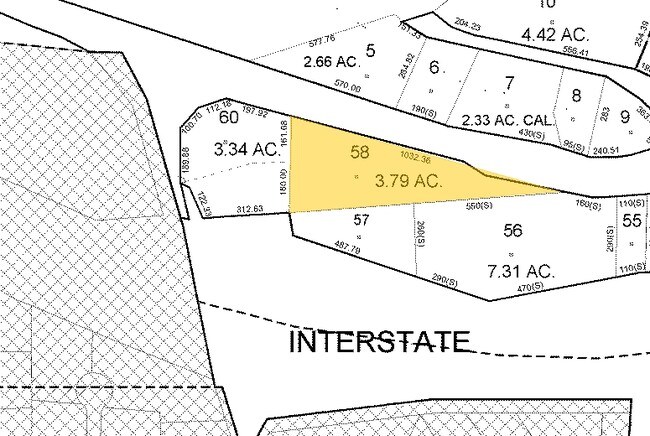
373089-068-000-0002-058-000-0000
PUTNAM
Commercialacreage
New York
SR 6
58.00
B and X Area of moderate flood hazard, usually the area between the limits of the 100-year and 500-year floods.
3.79 AC
2024
Brewster
2025
Westchester/So Connecticut
011700
New York-Jersey City-White Plains, NY-NJ
NEARBY LISTINGS FOR SALE OR LEASE
DEMOGRAPHICS near 3601 Danbury Rd
1 mile
3 mile
5 mile
2025 Total Population
780
16,769
40,112
2030 Population
769
16,972
40,645
Pop Growth 2025-2030
(1.41%)
+ 1.21%
+ 1.33%
Average Age
44
43
44
2025 Total Households
284
6,673
15,333
HH Growth 2025-2030
(1.41%)
+ 1.60%
+ 1.53%
Median Household Inc
$149,999
$116,002
$122,297
Avg Household Size
2.70
2.50
2.50
2025 Avg HH Vehicles
3.00
2.00
2.00
Median Home Value
$635,135
$492,432
$510,636
Median Year Built
1966
1980
1979
Nearby Places
Map Layers
Map Styles
 Street
 Aerial
Layers
 Traffic
 Biking
Places
Listings with unknown addresses are not visible on the map
- Restaurants
- Banks
- Shops
- Fitness
- Groceries
PUBLIC TRANSPORTATION
COMMUTER RAIL
Brewster Station (Harlem Line - Metro-North Commuter Railroad Company (Metro-North))
Drive
Walk
Distance
Brewster Station (Harlem Line - Metro-North Commuter Railroad Company (Metro-North))
5 min
3.2 mi
Southeast Station (Harlem Line - Metro-North Commuter Railroad Company (Metro-North))
Drive
Walk
Distance
Southeast Station (Harlem Line - Metro-North Commuter Railroad Company (Metro-North))
15 min
7.0 mi
AIRPORT
Westchester County
Drive
Walk
Distance
Westchester County
35 min
27.7 mi
New York Stewart International
Drive
Walk
Distance
New York Stewart International
52 min
38.8 mi
Freight Ports
Port of New Haven
Drive
Walk
Distance
Port of New Haven
64 min
43.8 mi
SALE & LEASE HISTORY
LISTING DATE
SALE/LEASE

Sep 24, 2016
For Sale
Mar 04, 2019
For Lease
Jan 17, 2018
For Sale
Aug 09, 2022
For Sale
Nearby Properties
Address
Land Use
TOTAL SIZE
Lot Size
Zoning
Address
Land Use
TOTAL SIZE
Lot Size
Zoning
23,091 SF
84.73 AC
R160
Address
Land Use
TOTAL SIZE
Lot Size
Zoning
1,078.50 AC
SR 6
Address
Land Use
TOTAL SIZE
Lot Size
Zoning
505.03 AC
PND
Address
Land Use
TOTAL SIZE
Lot Size
Zoning
670.72 AC
SP Z
Address
Land Use
TOTAL SIZE
Lot Size
Zoning
47.39 AC
PND
Address
Land Use
TOTAL SIZE
Lot Size
Zoning
32.98 AC
PND
Address
Land Use
TOTAL SIZE
Lot Size
Zoning
146,484 SF
23.06 AC
SR 22
Address
Land Use
TOTAL SIZE
Lot Size
Zoning
196,513 SF
PND
Address
Land Use
TOTAL SIZE
Lot Size
Zoning
196,544 SF
PND
Address
Land Use
TOTAL SIZE
Lot Size
Zoning
13.39 AC
RMF-6
Address
Land Use
TOTAL SIZE
Lot Size
Zoning
99,900 SF
21.48 AC
OP1
Address
Land Use
TOTAL SIZE
Lot Size
Zoning
Address
Land Use
TOTAL SIZE
Lot Size
Zoning
67.30 AC
Address
Land Use
TOTAL SIZE
Lot Size
Zoning
1.16 AC
SR 6
Address
Land Use
TOTAL SIZE
Lot Size
Zoning
136,073 SF
PND
Address
Land Use
TOTAL SIZE
Lot Size
Zoning
135,929 SF
PND
Address
Land Use
TOTAL SIZE
Lot Size
Zoning
134,407 SF
PND
Address
Land Use
TOTAL SIZE
Lot Size
Zoning
134,436 SF
99.53 AC
PND
Address
Land Use
TOTAL SIZE
Lot Size
Zoning
42.30 AC
Address
Land Use
TOTAL SIZE
Lot Size
Zoning
22,338 SF
2.37 AC
C
Address
Land Use
TOTAL SIZE
Lot Size
Zoning
Address
Land Use
TOTAL SIZE
Lot Size
Zoning
2.03 AC
C
Address
Land Use
TOTAL SIZE
Lot Size
Zoning
59,257 SF
21 AC
SR 6
Address
Land Use
TOTAL SIZE
Lot Size
Zoning
3,060 SF
2.47 AC
R40
Address
Land Use
TOTAL SIZE
Lot Size
Zoning
2,168 SF
51.21 AC
RAAA
Address
Land Use
TOTAL SIZE
Lot Size
Zoning
66,037 SF
1.61 AC
R
Address
Land Use
TOTAL SIZE
Lot Size
Zoning
20,083 SF
33.92 AC
CDD
Address
Land Use
TOTAL SIZE
Lot Size
Zoning
69.71 AC
Address
Land Use
TOTAL SIZE
Lot Size
Zoning
57,505 SF
11.75 AC
SR 6
Address
Land Use
TOTAL SIZE
Lot Size
Zoning
84,714 SF
9.83 AC
RA80
The World's #1 Commercial Real Estate Marketplace
Connect with us
© 2026 CoStar Group
The information above has been obtained from sources believed reliable. While we do not doubt its accuracy we have not verified it and make no guarantee, warranty or representation about it. It is your responsibility to independently confirm its accuracy and completeness. Any projections, opinions, assumptions, or estimates used are for example only and do not represent the current or future performance of the property. The value of this transaction to you depends on tax and other factors which should be evaluated by your tax, financial, and legal advisors. You and your advisors should conduct a careful, independent investigation of the property to determine to your satisfaction the suitability of the property for your needs.