Property Record
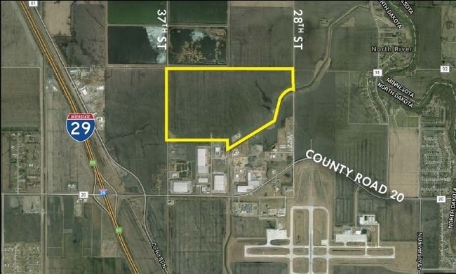
3336 52Nd Ave N, Fargo, ND 58102
NEARBY LISTINGS FOR SALE OR LEASE
Property Detail
3336 52Nd Ave N
Fargo, ND-MN
Unplatted
01-3503-00050-000
LOT: 0 BLOCK: 14 ADDITION: UNPLATTED ADDITIONAL: UNPLATTED 14-140-49 E 16 ACRES OF NW1/4; 2004 NORTH SIDE ANNEX **3-17-05 ANNEXED FRM 60-0000-01021-000
Agriculturalland
Cass
AE
North Dakota
38017C0579G
97.29 AC
2024
Fargo
2024
Other Market Areas
000300
DEMOGRAPHICS near 3336 52Nd Ave N
1 Mile
3 Mile
5 Mile
2024 Total Population
14
7,180
40,169
2029 Population
14
7,668
42,588
Pop Growth 2024-2029
0.00%
+ 6.80%
+ 6.02%
Average Age
40
41
36
2024 Total Households
5
3,527
16,082
HH Growth 2024-2029
0.00%
+ 7.51%
+ 7.61%
Median Household Inc
$149,999
$55,717
$53,135
Avg Household Size
2.40
2.00
2.10
2024 Avg HH Vehicles
2.00
2.00
2.00
Median Home Value
$399,999
$264,024
$239,317
Median Year Built
1994
1980
1973
Nearby Places
- Restaurants
- Banks
- Shops
- Fitness
- Groceries
PUBLIC TRANSPORTATION
COMMUTER RAIL
Fargo Amtrak Station (Empire Builder - Amtrak)
DRIVE
WALK
Distance
Fargo Amtrak Station (Empire Builder - Amtrak)
16 min
6.8 mi
AIRPORT
Hector International
DRIVE
WALK
Distance
Hector International
11 min
4.2 mi
Freight Ports
Port Milwaukee
DRIVE
WALK
Distance
Port Milwaukee
642 min
581.3 mi
SALE & LEASE HISTORY
LISTING DATE
SALE/LEASE

Sep 24, 2016
For Sale
Nearby Properties
Address
Land Use
TOTAL SIZE
Lot Size
Zoning
Address
Land Use
TOTAL SIZE
Lot Size
Zoning
Address
Land Use
TOTAL SIZE
Lot Size
Zoning
12.07 AC
Address
Land Use
TOTAL SIZE
Lot Size
Zoning
242,032 SF
14.23 AC
GI
Address
Land Use
TOTAL SIZE
Lot Size
Zoning
Address
Land Use
TOTAL SIZE
Lot Size
Zoning
60,125 SF
25.37 AC
LI
Address
Land Use
TOTAL SIZE
Lot Size
Zoning
Address
Land Use
TOTAL SIZE
Lot Size
Zoning
Address
Land Use
TOTAL SIZE
Lot Size
Zoning
247,888 SF
15.13 AC
GI
Address
Land Use
TOTAL SIZE
Lot Size
Zoning
Address
Land Use
TOTAL SIZE
Lot Size
Zoning
3.59 AC
GI
Address
Land Use
TOTAL SIZE
Lot Size
Zoning
286,296 SF
18.30 AC
LI
Address
Land Use
TOTAL SIZE
Lot Size
Zoning
219,000 SF
11.79 AC
GI
Address
Land Use
TOTAL SIZE
Lot Size
Zoning
10.10 AC
GI
Address
Land Use
TOTAL SIZE
Lot Size
Zoning
Address
Land Use
TOTAL SIZE
Lot Size
Zoning
33,030 SF
1.29 AC
MR3
Address
Land Use
TOTAL SIZE
Lot Size
Zoning
Address
Land Use
TOTAL SIZE
Lot Size
Zoning
37.05 AC
MHP
Address
Land Use
TOTAL SIZE
Lot Size
Zoning
100,800 SF
5.32 AC
GI
Address
Land Use
TOTAL SIZE
Lot Size
Zoning
Address
Land Use
TOTAL SIZE
Lot Size
Zoning
25.66 AC
Address
Land Use
TOTAL SIZE
Lot Size
Zoning
9.92 AC
AG
Address
Land Use
TOTAL SIZE
Lot Size
Zoning
94,889 SF
2.29 AC
MR3
Address
Land Use
TOTAL SIZE
Lot Size
Zoning
Address
Land Use
TOTAL SIZE
Lot Size
Zoning
5,800 SF
5.88 AC
GI
Address
Land Use
TOTAL SIZE
Lot Size
Zoning
80,000 SF
5.88 AC
GI
Address
Land Use
TOTAL SIZE
Lot Size
Zoning
1.86 AC
Address
Land Use
TOTAL SIZE
Lot Size
Zoning
109,766 SF
4.30 AC
LC
Address
Land Use
TOTAL SIZE
Lot Size
Zoning
38,340 SF
1.36 AC
LC
Address
Land Use
TOTAL SIZE
Lot Size
Zoning
54,000 SF
4.91 AC
GI
Address
Land Use
TOTAL SIZE
Lot Size
Zoning
The World's #1 Commercial Real Estate Marketplace
Connect with us
© 2025 CoStar Group
The information above has been obtained from sources believed reliable. While we do not doubt its accuracy we have not verified it and make no guarantee, warranty or representation about it. It is your responsibility to independently confirm its accuracy and completeness. Any projections, opinions, assumptions, or estimates used are for example only and do not represent the current or future performance of the property. The value of this transaction to you depends on tax and other factors which should be evaluated by your tax, financial, and legal advisors. You and your advisors should conduct a careful, independent investigation of the property to determine to your satisfaction the suitability of the property for your needs.