Property Record
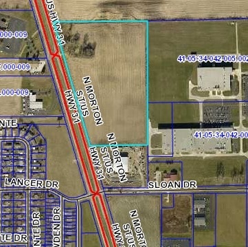
3601 N Morton St, Franklin, IN 46131

NEARBY LISTINGS FOR SALE OR LEASE
Property Detail
3601 N Morton St
Indianapolis-Carmel-Anderson, IN
Thompson Commercial Subdivision Secondar
41-05-34-031-005.000-009
THOMPSON COMMERCIAL SUB BLK A MP FRANKLIN COMMUNI
Agriculturalland
Johnson
X
Indiana
18081C0139E
21.17 AC
2024
Far South Johnson Cty
2025
Indianapolis
610802
DEMOGRAPHICS near 3601 N Morton St
1 Mile
3 Mile
5 Mile
2024 Total Population
3,086
25,307
61,021
2029 Population
3,310
27,055
65,265
Pop Growth 2024-2029
+ 7.26%
+ 6.91%
+ 6.95%
Average Age
39
39
38
2024 Total Households
1,143
9,384
21,882
HH Growth 2024-2029
+ 7.44%
+ 7.00%
+ 7.12%
Median Household Inc
$72,742
$74,460
$77,259
Avg Household Size
2.70
2.60
2.70
2024 Avg HH Vehicles
2.00
2.00
2.00
Median Home Value
$147,342
$167,328
$190,981
Median Year Built
1996
1991
1995
Nearby Places
Map Layers
Map Styles
 Street
 Aerial
- Restaurants
- Banks
- Shops
- Fitness
- Groceries
PUBLIC TRANSPORTATION
AIRPORT
Indianapolis International
DRIVE
WALK
Distance
Indianapolis International
45 min
27.1 mi
Freight Ports
Port of Toledo
DRIVE
WALK
Distance
Port of Toledo
293 min
242.3 mi
SALE & LEASE HISTORY
LISTING DATE
SALE/LEASE

Nov 10, 2021
For Sale
Nearby Properties
Address
Land Use
TOTAL SIZE
Lot Size
Zoning
Address
Land Use
TOTAL SIZE
Lot Size
Zoning
1,057,350 SF
60.62 AC
Address
Land Use
TOTAL SIZE
Lot Size
Zoning
984,410 SF
73.31 AC
Address
Land Use
TOTAL SIZE
Lot Size
Zoning
845,880 SF
45.31 AC
Address
Land Use
TOTAL SIZE
Lot Size
Zoning
1,103,760 SF
84.07 AC
Address
Land Use
TOTAL SIZE
Lot Size
Zoning
997,650 SF
67.25 AC
Address
Land Use
TOTAL SIZE
Lot Size
Zoning
826,800 SF
62.89 AC
Address
Land Use
TOTAL SIZE
Lot Size
Zoning
34.59 AC
Address
Land Use
TOTAL SIZE
Lot Size
Zoning
588,200 SF
44.31 AC
Address
Land Use
TOTAL SIZE
Lot Size
Zoning
530,400 SF
29.63 AC
Address
Land Use
TOTAL SIZE
Lot Size
Zoning
32.60 AC
Address
Land Use
TOTAL SIZE
Lot Size
Zoning
1,792 SF
66.50 AC
Address
Land Use
TOTAL SIZE
Lot Size
Zoning
232,709 SF
51.30 AC
Address
Land Use
TOTAL SIZE
Lot Size
Zoning
193,378 SF
20.55 AC
Address
Land Use
TOTAL SIZE
Lot Size
Zoning
136,760 SF
31.47 AC
Address
Land Use
TOTAL SIZE
Lot Size
Zoning
119,499 SF
11.54 AC
Address
Land Use
TOTAL SIZE
Lot Size
Zoning
178,880 SF
9.03 AC
Address
Land Use
TOTAL SIZE
Lot Size
Zoning
168,480 SF
8.42 AC
Address
Land Use
TOTAL SIZE
Lot Size
Zoning
54,436 SF
18.83 AC
Address
Land Use
TOTAL SIZE
Lot Size
Zoning
130,440 SF
10.05 AC
Address
Land Use
TOTAL SIZE
Lot Size
Zoning
114,852 SF
8.50 AC
Address
Land Use
TOTAL SIZE
Lot Size
Zoning
207,310 SF
17.20 AC
Address
Land Use
TOTAL SIZE
Lot Size
Zoning
20.19 AC
Address
Land Use
TOTAL SIZE
Lot Size
Zoning
7.19 AC
Address
Land Use
TOTAL SIZE
Lot Size
Zoning
86,082 SF
8.14 AC
Address
Land Use
TOTAL SIZE
Lot Size
Zoning
2,516 SF
7.87 AC
Address
Land Use
TOTAL SIZE
Lot Size
Zoning
2,304 SF
14.05 AC
Address
Land Use
TOTAL SIZE
Lot Size
Zoning
119,416 SF
11.51 AC
Address
Land Use
TOTAL SIZE
Lot Size
Zoning
539,190 SF
33.27 AC
Address
Land Use
TOTAL SIZE
Lot Size
Zoning
160,700 SF
25.56 AC
Address
Land Use
TOTAL SIZE
Lot Size
Zoning
140,328 SF
20 AC
The World's #1 Commercial Real Estate Marketplace
Connect with us
© 2025 CoStar Group
The information above has been obtained from sources believed reliable. While we do not doubt its accuracy we have not verified it and make no guarantee, warranty or representation about it. It is your responsibility to independently confirm its accuracy and completeness. Any projections, opinions, assumptions, or estimates used are for example only and do not represent the current or future performance of the property. The value of this transaction to you depends on tax and other factors which should be evaluated by your tax, financial, and legal advisors. You and your advisors should conduct a careful, independent investigation of the property to determine to your satisfaction the suitability of the property for your needs.