Property Record
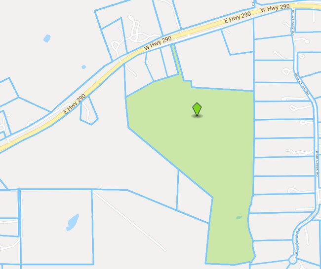
3601 W Highway 290, Dripping Springs, TX 78620


NEARBY LISTINGS FOR SALE OR LEASE
Property Detail
3601 W Highway 290
R15852
L W Kingsley Survey
Vacantlandnec
ABS 280 L W KINGSLEY SURVEY 1.00 AC GEO#90400832
X
Hays
48209C0085F
Texas
2024
5 AC
2025
Hays County
010817
Austin
2,191 SF
Austin-Round Rock-San Marcos, TX
DEMOGRAPHICS near 3601 W Highway 290
1 Mile
3 Mile
5 Mile
2024 Total Population
206
5,036
13,407
2029 Population
276
6,717
17,823
Pop Growth 2024-2029
+ 33.98%
+ 33.38%
+ 32.94%
Average Age
41
42
42
2024 Total Households
73
1,806
4,830
HH Growth 2024-2029
+ 35.62%
+ 34.27%
+ 33.89%
Median Household Inc
$130,555
$126,239
$123,152
Avg Household Size
2.80
2.70
2.70
2024 Avg HH Vehicles
3.00
2.00
2.00
Median Home Value
$742,424
$702,792
$659,579
Median Year Built
2010
2006
2005
Nearby Places
Map Layers
Map Styles
 Street
 Aerial
- Restaurants
- Banks
- Shops
- Fitness
- Groceries
PUBLIC TRANSPORTATION
AIRPORT
Austin-Bergstrom International
DRIVE
WALK
Distance
Austin-Bergstrom International
51 min
33.5 mi
Freight Ports
Calhoun Port
DRIVE
WALK
Distance
Calhoun Port
212 min
171.7 mi
SALE & LEASE HISTORY
LISTING DATE
SALE/LEASE

Nov 14, 2018
For Sale
Nearby Properties
Address
Land Use
TOTAL SIZE
Lot Size
Zoning
Address
Land Use
TOTAL SIZE
Lot Size
Zoning
474.73 AC
Address
Land Use
TOTAL SIZE
Lot Size
Zoning
16,274 SF
22.16 AC
Address
Land Use
TOTAL SIZE
Lot Size
Zoning
79,769 SF
35.70 AC
Address
Land Use
TOTAL SIZE
Lot Size
Zoning
38.01 AC
Address
Land Use
TOTAL SIZE
Lot Size
Zoning
16,500 SF
10 AC
Address
Land Use
TOTAL SIZE
Lot Size
Zoning
888 SF
5.93 AC
Address
Land Use
TOTAL SIZE
Lot Size
Zoning
106,783 SF
5.79 AC
Address
Land Use
TOTAL SIZE
Lot Size
Zoning
24,336 SF
2.72 AC
Address
Land Use
TOTAL SIZE
Lot Size
Zoning
Address
Land Use
TOTAL SIZE
Lot Size
Zoning
9,913 SF
15.01 AC
Address
Land Use
TOTAL SIZE
Lot Size
Zoning
6,298 SF
4.16 AC
Address
Land Use
TOTAL SIZE
Lot Size
Zoning
10,824 SF
3.24 AC
Address
Land Use
TOTAL SIZE
Lot Size
Zoning
60,980 SF
36.80 AC
Address
Land Use
TOTAL SIZE
Lot Size
Zoning
18,900 SF
3.93 AC
Address
Land Use
TOTAL SIZE
Lot Size
Zoning
Address
Land Use
TOTAL SIZE
Lot Size
Zoning
196.48 AC
Address
Land Use
TOTAL SIZE
Lot Size
Zoning
Address
Land Use
TOTAL SIZE
Lot Size
Zoning
5.72 AC
Address
Land Use
TOTAL SIZE
Lot Size
Zoning
7,334 SF
2.94 AC
Address
Land Use
TOTAL SIZE
Lot Size
Zoning
24,328 SF
5 AC
Address
Land Use
TOTAL SIZE
Lot Size
Zoning
4,680 SF
2.12 AC
Address
Land Use
TOTAL SIZE
Lot Size
Zoning
18,821 SF
7.99 AC
Address
Land Use
TOTAL SIZE
Lot Size
Zoning
9,077 SF
94.33 AC
Address
Land Use
TOTAL SIZE
Lot Size
Zoning
10,740 SF
1.94 AC
Address
Land Use
TOTAL SIZE
Lot Size
Zoning
4,624 SF
2 AC
Address
Land Use
TOTAL SIZE
Lot Size
Zoning
8,018 SF
112.96 AC
Address
Land Use
TOTAL SIZE
Lot Size
Zoning
4,515 SF
10.19 AC
Address
Land Use
TOTAL SIZE
Lot Size
Zoning
7,580 SF
6.67 AC
Address
Land Use
TOTAL SIZE
Lot Size
Zoning
8,960 SF
2.19 AC
Address
Land Use
TOTAL SIZE
Lot Size
Zoning
5,784 SF
100.19 AC
The World's #1 Commercial Real Estate Marketplace
Connect with us
© 2026 CoStar Group
The information above has been obtained from sources believed reliable. While we do not doubt its accuracy we have not verified it and make no guarantee, warranty or representation about it. It is your responsibility to independently confirm its accuracy and completeness. Any projections, opinions, assumptions, or estimates used are for example only and do not represent the current or future performance of the property. The value of this transaction to you depends on tax and other factors which should be evaluated by your tax, financial, and legal advisors. You and your advisors should conduct a careful, independent investigation of the property to determine to your satisfaction the suitability of the property for your needs.