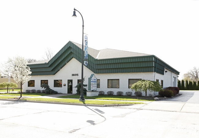
Property Record
36015 Goddard Rd, Romulus, MI 48174

Property Detail
36015 Goddard Rd
80-077-02-0063-301
20A63 TO 67 BL2 LOTS 63 TO 67 INCL BLOCK 2 ALSO E 1/2 ADJ VAC ALLEY THE JUNCTION SUB BLOCK 2 T3SR9E L17 P34 WCR SPLIT ON 04/23/2012 WITH 80 077 02 0063 300, 80 077 02 0064 300 INTO 80 077 02 0063 301;
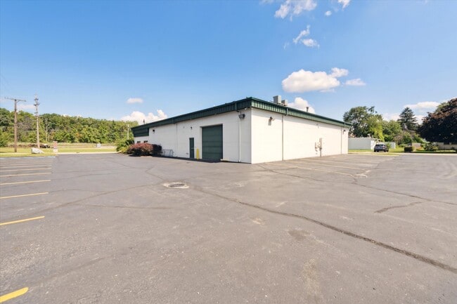
Warehouse
Wayne
CBD-1
Michigan
B and X Area of moderate flood hazard, usually the area between the limits of the 100-year and 500-year floods.
63-67
2025
0.56 AC
2025
Airport District
585900
Detroit
7,533 SF
Detroit-Warren-Dearborn, MI
NEARBY LISTINGS FOR SALE OR LEASE
DEMOGRAPHICS near 36015 Goddard Rd
1 mile
3 mile
5 mile
2025 Total Population
3,534
16,507
79,418
2030 Population
3,506
16,318
78,387
Pop Growth 2025-2030
(0.79%)
(1.14%)
(1.30%)
Average Age
42
40
40
2025 Total Households
1,554
6,645
32,003
HH Growth 2025-2030
(0.77%)
(1.23%)
(1.39%)
Median Household Inc
$52,187
$69,056
$68,781
Avg Household Size
2.20
2.40
2.40
2025 Avg HH Vehicles
2.00
2.00
2.00
Median Home Value
$181,559
$198,075
$191,808
Median Year Built
1964
1971
1972
Nearby Places
Map Layers
Map Styles
 Street
 Aerial
Transit
 Traffic
 Biking
Places
Listings with unknown addresses are not visible on the map
- Restaurants
- Banks
- Shops
- Fitness
- Groceries
PUBLIC TRANSPORTATION
AIRPORT
Detroit Metro Wayne County
Drive
Walk
Distance
Detroit Metro Wayne County
9 min
5.3 mi
Windsor International
Drive
Walk
Distance
Windsor International
50 min
32.2 mi
Freight Ports
Port of Toledo
Drive
Walk
Distance
Port of Toledo
61 min
48.3 mi
SALE & LEASE HISTORY
LISTING DATE
SALE/LEASE

Oct 23, 2023
For Sale
Mar 18, 2022
For Lease
Mar 18, 2022
For Sale
Nearby Properties
Address
Land Use
TOTAL SIZE
Lot Size
Zoning
Address
Land Use
TOTAL SIZE
Lot Size
Zoning
857,173 SF
84.70 AC
M-1/COND
Address
Land Use
TOTAL SIZE
Lot Size
Zoning
739,289 SF
238.69 AC
AG
Address
Land Use
TOTAL SIZE
Lot Size
Zoning
307,524 SF
63.94 AC
AP-AIRPORT
Address
Land Use
TOTAL SIZE
Lot Size
Zoning
500,240 SF
M1-LIG
Address
Land Use
TOTAL SIZE
Lot Size
Zoning
108,809 SF
AP-AIRPORT
Address
Land Use
TOTAL SIZE
Lot Size
Zoning
146,562 SF
M2-GEN
Address
Land Use
TOTAL SIZE
Lot Size
Zoning
500,240 SF
55.95 AC
M2-GEN
Address
Land Use
TOTAL SIZE
Lot Size
Zoning
1,141,765 SF
154.21 AC
M2-GEN
Address
Land Use
TOTAL SIZE
Lot Size
Zoning
600,000 SF
M1-LIG
Address
Land Use
TOTAL SIZE
Lot Size
Zoning
393,948 SF
43.43 AC
M2-GEN
Address
Land Use
TOTAL SIZE
Lot Size
Zoning
354,968 SF
25.72 AC
RC/M-1
Address
Land Use
TOTAL SIZE
Lot Size
Zoning
435,648 SF
27.84 AC
M2-GEN
Address
Land Use
TOTAL SIZE
Lot Size
Zoning
366,820 SF
20.83 AC
RC/M-1
Address
Land Use
TOTAL SIZE
Lot Size
Zoning
366,820 SF
20.72 AC
RC/M-1
Address
Land Use
TOTAL SIZE
Lot Size
Zoning
268,272 SF
22.70 AC
M-1/COND
Address
Land Use
TOTAL SIZE
Lot Size
Zoning
199,922 SF
30.86 AC
M2-GEN
Address
Land Use
TOTAL SIZE
Lot Size
Zoning
920,139 SF
56.56 AC
M2-GEN
Address
Land Use
TOTAL SIZE
Lot Size
Zoning
250,263 SF
18.81 AC
RM-MLTI
Address
Land Use
TOTAL SIZE
Lot Size
Zoning
285,080 SF
21.89 AC
M2-GEN
Address
Land Use
TOTAL SIZE
Lot Size
Zoning
244,760 SF
22.63 AC
M-1/COND
Address
Land Use
TOTAL SIZE
Lot Size
Zoning
489,500 SF
58.51 AC
M2-GEN
Address
Land Use
TOTAL SIZE
Lot Size
Zoning
240,355 SF
26.05 AC
M2-GEN
Address
Land Use
TOTAL SIZE
Lot Size
Zoning
462,840 SF
45.66 AC
PDA
Address
Land Use
TOTAL SIZE
Lot Size
Zoning
6,128 SF
50.14 AC
RC-REG
Address
Land Use
TOTAL SIZE
Lot Size
Zoning
5,382 SF
109.33 AC
RMH-MOB
Address
Land Use
TOTAL SIZE
Lot Size
Zoning
1,619,168 SF
150.49 AC
M2-GEN
Address
Land Use
TOTAL SIZE
Lot Size
Zoning
165,200 SF
14.85 AC
M-1/COND
Address
Land Use
TOTAL SIZE
Lot Size
Zoning
249,090 SF
27.15 AC
M1-LIG
Address
Land Use
TOTAL SIZE
Lot Size
Zoning
161,794 SF
17.73 AC
RM MULT
Address
Land Use
TOTAL SIZE
Lot Size
Zoning
960 SF
62.42 AC
RC-REG
The World's #1 Commercial Real Estate Marketplace
Connect with us
© 2026 CoStar Group
The information above has been obtained from sources believed reliable. While we do not doubt its accuracy we have not verified it and make no guarantee, warranty or representation about it. It is your responsibility to independently confirm its accuracy and completeness. Any projections, opinions, assumptions, or estimates used are for example only and do not represent the current or future performance of the property. The value of this transaction to you depends on tax and other factors which should be evaluated by your tax, financial, and legal advisors. You and your advisors should conduct a careful, independent investigation of the property to determine to your satisfaction the suitability of the property for your needs.