Property Record
36031 E Us Highway 50, Pueblo, CO 81006
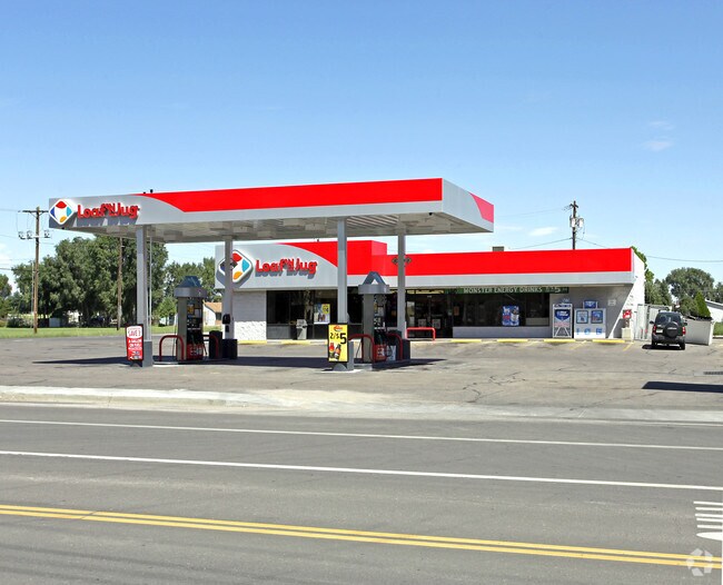


Property Detail
36031 E Us Highway 50
1-3-04-0-06-002
NW4 SW4 4-21-63 0.70A SUB. VARIANCE #337 PARCEL B,A/K/A A POR OF NW4 SW4 4-21-63 DESC AS: BEG AT PT ON,ELY R/W LINE OF 36TH LANE (STATE HWY #231) FR WH SW COR,SD SEC 4 BEARS S 01 DEG 49 MIN 17 SEC W, 1584.06 FT TH,S 89 DEG 09 MIN 47 SEC E, 150.06 FT
Commercialacreage
Pueblo
B4:COMM/RE
Colorado
B and X Area of moderate flood hazard, usually the area between the limits of the 100-year and 500-year floods.
0.70 AC
2024
Colorado East Area
2024
Other Market Areas
003200
Pueblo, CO
3,612 SF
NEARBY LISTINGS FOR SALE OR LEASE
-
-
View all Pueblo listings for sale on LoopNet.com
DEMOGRAPHICS near 36031 E Us Highway 50
1 mile
3 mile
5 mile
2025 Total Population
2,044
5,320
9,361
2030 Population
2,246
5,604
9,626
Pop Growth 2025-2030
+ 9.88%
+ 5.34%
+ 2.83%
Average Age
44
42
43
2025 Total Households
797
2,010
3,584
HH Growth 2025-2030
+ 9.91%
+ 5.42%
+ 2.79%
Median Household Inc
$91,116
$79,808
$83,353
Avg Household Size
2.60
2.70
2.60
2025 Avg HH Vehicles
3.00
2.00
3.00
Median Home Value
$451,282
$402,025
$388,234
Median Year Built
2010
1979
1976
Nearby Places
Map Layers
Map Styles
 Street
 Aerial
Layers
 Traffic
 Biking
Places
Listings with unknown addresses are not visible on the map
- Restaurants
- Banks
- Shops
- Fitness
- Groceries
Nearby Properties
Address
Land Use
TOTAL SIZE
Lot Size
Zoning
Address
Land Use
TOTAL SIZE
Lot Size
Zoning
1,158,183 SF
84.46 AC
I2:IND/MAN
Address
Land Use
TOTAL SIZE
Lot Size
Zoning
196,492 SF
11.41 AC
I3:IND/HEA
Address
Land Use
TOTAL SIZE
Lot Size
Zoning
191,905 SF
11.20 AC
I1:IND/PAR
Address
Land Use
TOTAL SIZE
Lot Size
Zoning
128,100 SF
17.28 AC
I2:IND/MAN
Address
Land Use
TOTAL SIZE
Lot Size
Zoning
63,500 SF
3.80 AC
I2:IND/MAN
Address
Land Use
TOTAL SIZE
Lot Size
Zoning
16,933 SF
25.26 AC
I3:IND/HEA
Address
Land Use
TOTAL SIZE
Lot Size
Zoning
26,400 SF
4.87 AC
I2:IND/MAN
Address
Land Use
TOTAL SIZE
Lot Size
Zoning
76.72 AC
I-2
Address
Land Use
TOTAL SIZE
Lot Size
Zoning
7,706 SF
1.80 AC
I2:IND/MAN
Address
Land Use
TOTAL SIZE
Lot Size
Zoning
31,328 SF
5.22 AC
I1:IND/PAR
Address
Land Use
TOTAL SIZE
Lot Size
Zoning
4,970 SF
1 AC
A-3
Address
Land Use
TOTAL SIZE
Lot Size
Zoning
3,805 SF
1.77 AC
A-4
Address
Land Use
TOTAL SIZE
Lot Size
Zoning
146,480 SF
20 AC
I3:IND/HEA
Address
Land Use
TOTAL SIZE
Lot Size
Zoning
3,038 SF
1.04 AC
A-3
Address
Land Use
TOTAL SIZE
Lot Size
Zoning
50,000 SF
10.12 AC
I2:IND/MAN
Address
Land Use
TOTAL SIZE
Lot Size
Zoning
4,576 SF
Address
Land Use
TOTAL SIZE
Lot Size
Zoning
2,969 SF
1.34 AC
A-3
Address
Land Use
TOTAL SIZE
Lot Size
Zoning
5,412 SF
9.30 AC
A-2
Address
Land Use
TOTAL SIZE
Lot Size
Zoning
26,950 SF
3.92 AC
I2:IND/MAN
Address
Land Use
TOTAL SIZE
Lot Size
Zoning
2,491 SF
38.64 AC
A-1
Address
Land Use
TOTAL SIZE
Lot Size
Zoning
48,087 SF
5.57 AC
I2:IND/MAN
Address
Land Use
TOTAL SIZE
Lot Size
Zoning
22,065 SF
10.12 AC
I2:IND/MAN
Address
Land Use
TOTAL SIZE
Lot Size
Zoning
2,081 SF
1.48 AC
A-3
Address
Land Use
TOTAL SIZE
Lot Size
Zoning
35,697 SF
3.37 AC
I2:IND/MAN
Address
Land Use
TOTAL SIZE
Lot Size
Zoning
26,250 SF
4.71 AC
I2:IND/MAN
Address
Land Use
TOTAL SIZE
Lot Size
Zoning
33,900 SF
6.25 AC
I2:IND/MAN
Address
Land Use
TOTAL SIZE
Lot Size
Zoning
8,400 SF
0.80 AC
B-4
Address
Land Use
TOTAL SIZE
Lot Size
Zoning
8,835 SF
7.02 AC
B4:COMM/RE
Address
Land Use
TOTAL SIZE
Lot Size
Zoning
15,454 SF
0.95 AC
I3:IND/HEA
Address
Land Use
TOTAL SIZE
Lot Size
Zoning
61,272 SF
4.17 AC
I2:IND/MAN
The World's #1 Commercial Real Estate Marketplace
Connect with us
© 2026 CoStar Group
The information above has been obtained from sources believed reliable. While we do not doubt its accuracy we have not verified it and make no guarantee, warranty or representation about it. It is your responsibility to independently confirm its accuracy and completeness. Any projections, opinions, assumptions, or estimates used are for example only and do not represent the current or future performance of the property. The value of this transaction to you depends on tax and other factors which should be evaluated by your tax, financial, and legal advisors. You and your advisors should conduct a careful, independent investigation of the property to determine to your satisfaction the suitability of the property for your needs.